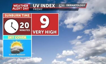
Friday’s UV index and pollen tracker
The UV index will be high through midday, between storm chances. Allergen levels remain high through the weekend. Grass, plantain, and nettle are the primary allergens.
Continue Reading The UV index will be high through midday, between storm chances. Allergen levels remain high through the weekend. Grass, plantain, and nettle are the primary allergens.
Continue Reading
This summer has been hard for agriculture, with intense drought lasting throughout these past couple of months. Last month alone, almost 99% of Missouri was in a drought, causing farmers to make tough decisions with their livestock and crops. This drought also damaged select crops, creating several problems for the agriculture business as a whole.
Continue Reading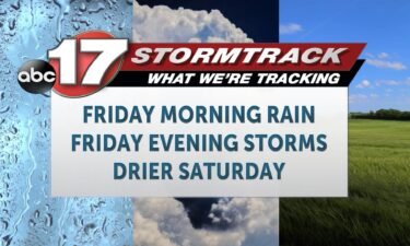
TONIGHT: Thursday night remains quiet, with partly cloudy skies. Temperatures fall into the low 70s/upper 60s by sunrise. TOMORROW: Friday is an ABC 17 Stormtrack Weather Alert Day. We will have a round of showers and storms early around sunrise, primarily north of I-70, but potentially bringing a few drops as far south as Jefferson
Continue Reading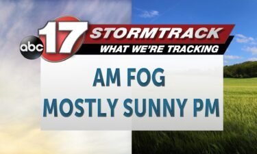
Today: Thursday morning starts off with widespread fog across the region before clearing into the second half of the morning giving way to mostly sunny skies. Highs warm into the mid-80s. Winds switch from the northwest back from the southwest late this afternoon at 5-10 MPH. Tonight: Overnight lows cool to the mid-60s with chances
Continue Reading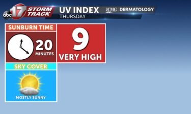
The UV index will be high under mostly sunny skies. Allergen levels climb to high on Thursday. Grass, plantain, and nettle are the primary allergens.
Continue Reading
TONIGHT: A few spotty showers remain possible areawide, as rain comes to an end. A few strong storms will be possible near and south of I-44, but most of the activity will remain south of mid-Missouri. Temperatures will fall into the mid-60s by Thursday morning. TOMORROW: Expect sunshine, and highs in the low-to-mid 80s on
Continue Reading
Much of Mid-Missouri is already well ahead of schedule for rainfall this month thanks to frequent heavy storms to kick off August. We actually ended July just under our monthly rainfall, but a quick pattern change to near-daily storm chances in the last weeks pushed numbers up quickly. Columbia and Jefferson City are both over
Continue Reading
This Afternoon: Isolated storms are possible through the late afternoon, possibly bringing high winds. Today’s severe risk has pushed mostly south, but strong storms are most likely near and south of I-44. All severe hazards are possible with storms this evening. Tonight: Showers and storms push southeast quickly overnight, with lows dropping to the lower
Continue Reading
Today: Showers and storms become widespread by mid morning with the potential for strong damaging winds up to 60 MPH. Flash flooding remains possible as heavy downpours are expected. A secondary round develops late this evening into the overnight hours causing potentially stronger storms south of the Lake of the Ozarks region near southern portions
Continue Reading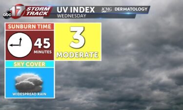
The UV index will be moderate with widespread rain and clouds. Rain may help pollen levels as they will fall to the low territory before returning to high on Thursday. Grass, plantain, and nettle are the primary allergens.
Continue Reading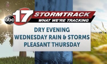
TONIGHT: Skies remain mostly clear into the evening, but high clouds move in ahead of Wednesday’s rain chances. Temperatures fall into the 60s. TOMORROW: Wednesday, a complex of showers and thunderstorms will arrive after sunrise. There will a limited potential for severe storms here. Primarily gusty winds are expected with this activity. Rain will be
Continue Reading
The numbers are in, and last month was officially the hottest month ever recorded globally. July saw global temperatures 1.3 degrees Fahrenheit above average, which is over half a degree warmer than the previous record set in July 2019. Mid-Missouri followed this trend over the past month and even outperformed global trends. For Columbia, temperatures
Continue Reading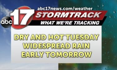
This Afternoon: Highs climb into the mid-80s with winds out of the northwest at 5-10 mph. Skies remain partly cloudy. Tonight: Overnight lows cool to the upper 60s as clouds fill in. Rain chances likely hold off until after sunrise. Extended: Wednesday sees widespread showers and storms through the morning with heavy downpours and high
Continue Reading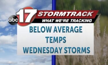
Today: Afternoon highs climb into the mid-80s with winds out of the northwest at 5-10 mph. Skies remain partly cloudy. Tonight: Overnight lows cool to the upper 60s as skies become mostly cloudy. Winds switch out of the southwest at 4-8 MPH. Extended: Wednesday sees widespread showers and storms with the possibility for a few
Continue Reading
TONIGHT: Conditions cool efficiently overnight to the lower 60s, which could produce fog in low-lying areas. TOMORROW: More sunshine is on the way Tuesday, while temperatures remain below average in the lower 80s. Spotty rain is possible to our north, but Mid-MO will likely stay entirely dry. EXTENDED: Rain returns quickly into Wednesday with strong
Continue Reading Over the past week, Mid-MO has seen substantial rainfall, with areas getting 7-9 inches. With these systems, plenty of flooding advisories and warnings took place, but we also saw drought conditions take a hit. With that, river levels are also looking a little more normal because of this much needed rainfall. But what does this
Continue Reading
TONIGHT: I’m tracking temperatures topping out in the high 70s this afternoon/evening, with skies clearing as the day goes on. I’m expecting temperatures cooling off into the low 60s overnight. TOMORROW: I’m tracking partly cloudy skies and a mostly dry day tomorrow, with temperatures getting into the low 80s. There is a slight chance for
Continue Reading
Today: Afternoon highs warm into the upper 70s nearly 80 degrees. Skies begin mostly cloudy but begin to clear heading towards the evening hours. Winds remain out of the northwest at 12-18 MPH and gusts up tp 25 MPH. Tonight: Overnight lows cool to the lower 60s with partly cloudy skies and winds out of
Continue Reading
TONIGHT: I’m tracking low chances of isolated storm activity, with the most widespread chances staying to the east of our viewing area. It’s staying gusty, with winds in the 10-15 mph range from the NW and gusts up to 20 mph. Temperatures will be dropping down into the high 60s. TOMORROW: I’m tracking isolated to
Continue Reading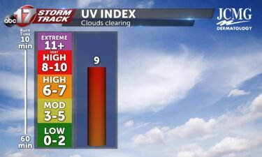
After isolated to scattered rain chances move out of mid-MO and clouds start to clear, our viewing area will be observing a UV index of 9 tomorrow. Without sunscreen that’s SPF 50 or higher, it only takes 15-25 minutes of exposure to receive a sunburn. With rainfall helping keep things slightly moisturized, mid-MO will observe
Continue Reading