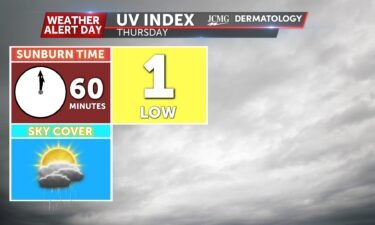
Thursday’s UV index and pollen tracker
The UV index will be much lower on Thursday due to rain and storms. Pollen levels briefly drop tomorrow with rain in the area, but ramp back up for the rest of the week.
Continue Reading The UV index will be much lower on Thursday due to rain and storms. Pollen levels briefly drop tomorrow with rain in the area, but ramp back up for the rest of the week.
Continue Reading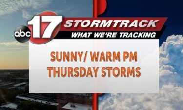
TODAY: Wednesday afternoon sees mostly sunny skies and highs into the upper 70s as winds continue out of the west gusting up to 30 mph. TONIGHT: Overnight, you can expect more of the same. Temperatures will drop into the upper 40s under clear skies and relatively calm conditions. Any breeze will be minor and from
Continue Reading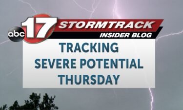
BLOG: SETUP: Another area of low pressure will drive southerly low level winds into the region early Thursday morning, which will in turn drive chances for storms before sunrise. Then, the area of low pressure will dive south through the day, effectively acting as a cold front by bringing a line of storms with it.
Continue Reading
TODAY: Wednesday is a bright and mild day, with sunny skies and highs in the mid-70s. Winds will be from the west and northwest, sustained around 20 mph, gusting as high as 30+ mph. Winds will relax slightly into the late afternoon. TONIGHT: Temperatures will fall into the 50s overnight, making for another mild evening.
Continue Reading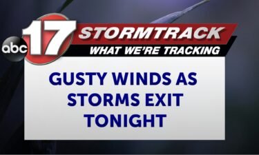
TONIGHT: Gradually decreasing clouds with lows in the upper 50s. Gusty winds topping out near 40 mph. TOMORROW: Mostly sunny and breezy with highs in the lower to mid-70s with gusty west winds. EXTENDED: Scattered storms have developed along a dry line moving eastward this afternoon, and they will continue racing east-northeast through mid-evening before
Continue Reading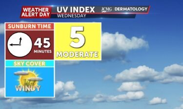
The UV index will be moderate tomorrow as clouds clear out. Pollen levels continue to be high tomorrow with tree pollens as the main allergen.
Continue Reading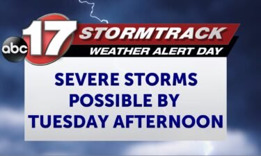
Slight changes have been made to the SPC outlook, which you may notice as a slight shift northward of the greatest risk for severe weather.
Continue Reading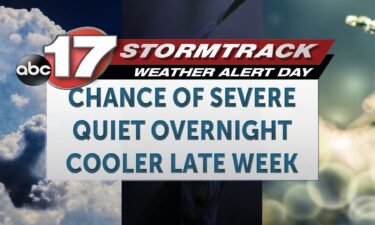
TODAY: Tuesday is an ABC 17 Stormtrack Weather Alert Day. It is another warm day, with temperatures climbing to near 80 by the afternoon. This will be slightly cooler than Monday, as we’ll be tracking showers and storms through the morning that will have somewhat of a cooling effect. Showers and storms will be very
Continue Reading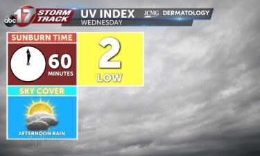
The UV index will be a bit lower Tuesday with clouds rolling in. Pollen levels will continue to be high the next several days with the primary allergens in the tree category.
Continue Reading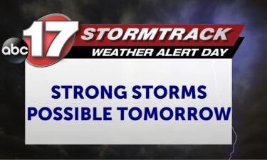
TONIGHT: Increasing clouds with an isolated storm or two possible. Lows in the mid-60s. TOMORROW: Partly cloudy with two rounds of rain and storms. Initial storms by late morning will have a low severe threat, but the risk increases by late afternoon, particularly along and north of I-70. A Weather Alert Day is in effect
Continue Reading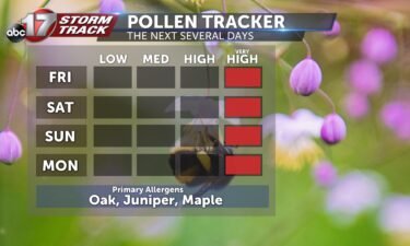
The trees are in bloom.
Continue Reading
TODAY: Monday will start mostly sunny, before becoming partly cloudy. Temperatures will reach into the mid-80s making for another warm day, much like Sunday. Storms may develop after 6 p.m. along a warm front that lifts into the region tonight. Storms will likely be isolated in nature, with some potential for hail and gusty winds.
Continue Reading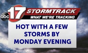
TONIGHT: Mostly clear and mild with lows in the upper 50s. TOMORROW: Mostly sunny with highs in the mid-80s. Isolated storms possible by early evening. EXTENDED: The streak of early summer like temperatures continues this week as upper southwest winds prevail. Monday starts off warm with temperatures in the upper 50s before rising into the
Continue Reading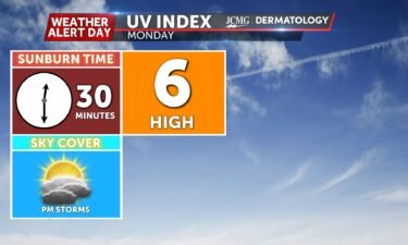
The UV index will be high on Monday as there will be limited cloud cover. Apply sunscreen with the sunburn time around 30 minutes. Tree pollens continue to be very high this week. Primary allergens are ash, alder, and birch.
Continue Reading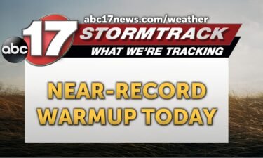
TODAY: More sunshine and breezy conditions are expected with gusts up to 20 mph. This combo could break high temperature records for Sunday; Columbia’s record high is 89 degrees while the forecast sits at 88. TOMORROW: Clouds fill back in Monday but temperatures will still make it into the mid-80s. Isolated storms fire up near
Continue Reading
TONIGHT: I’m tracking a warm evening with temperatures gradually dropping down into the high 50s. Winds will be breezy at 10-15 mph with gusts up to 20 mph from the southwest. TOMORROW: I’m tracking another breezy day with winds from the west at 10-15 mph and gusts up to 20 mph. Plenty of sunshine is
Continue Reading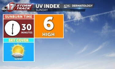
Sunday’s UV Index is expected to be a 6, which is high. This means that it only takes 30 minutes to receive a sunburn without proper protection. Pollen will be very high the next couple of days, with maple, oak, and juniper being the main allergens present.
Continue Reading
TODAY: Highs soar to the 80s as warm southerly winds gust up to 30 mph. Skies will be full of sunshine this afternoon. TOMORROW: Sunday is a near repeat in the 80s with gusty conditions. With low humidity in the area be sure to avoid burning. EXTENDED: Monday remains dry and partly cloudy until the
Continue Reading
TONIGHT: Overnight lows cool to the mid-40s as winds continue out of the northwest at 5-10 mph. Skies remain mostly clear. TOMORROW: Saturday welcomes plenty of sunshine with partly cloudy skies and highs surging into the lower 80s with winds out of the southwest gusting up to 30 mph. EXTENDED: Sunday sees similar wind conditions
Continue Reading
TODAY: Friday wraps up the work week on a mild note. We’ll be bright and sunny, with a northwest breeze sustained at 15-20 mph gusting to 30 mph. This rounds out to a high temperature back in the mid-to-upper 60s. TONIGHT: Overnight, temperatures fall into the 40s as high pressure inching through the region drives
Continue Reading