INSIDER BLOG: Tracking more thunderstorms Thursday
BLOG:
SETUP:
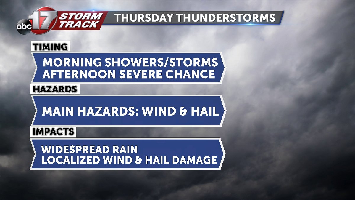
Another area of low pressure will drive southerly low level winds into the region early Thursday morning, which will in turn drive chances for storms before sunrise. Then, the area of low pressure will dive south through the day, effectively acting as a cold front by bringing a line of storms with it. Some storms may be severe, with wind and hail being the primary threat.
TIMING:
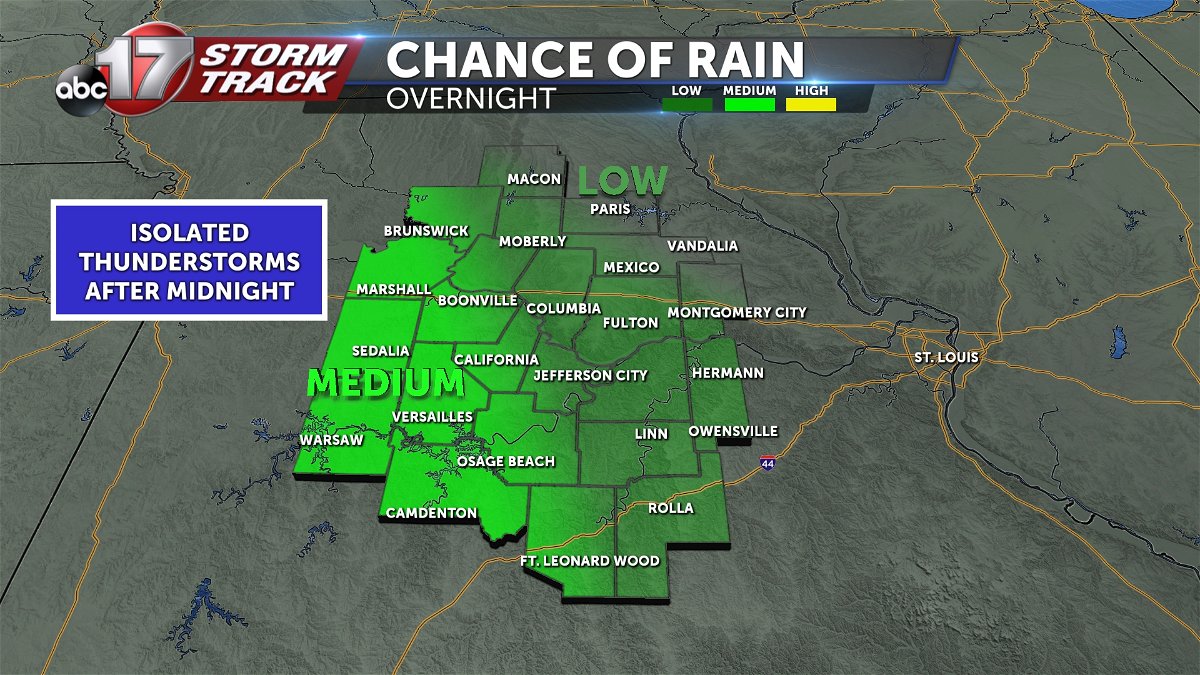
Just after midnight, the low level jet will trigger storms in southeast Kansas and Western Missouri.
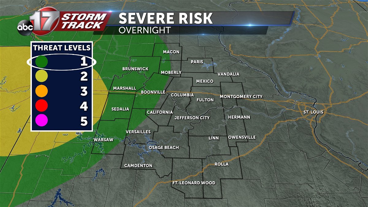
These may be strong until weakening towards the day break hour. Then, the cold front will push in from the north, bringing storms to the borders of Chariton, and Macon counties as soon as 7-8 a.m. These storms may also be strong early in their lifespan. As the morning progresses, though, we'll see these weaken.
So, weakening showers and storms are expected for most of the northern half of the region.
These will arrive by noon in places like Marshall, Booneville, Columbia, and Montgomery City. Into the afternoon, we expect these storms to generally restrengthen into severe capable storms. From Jefferson City to I-44 we expect these increase in strength, and potentially produce damaging wind and large hail.
IMPACTS:
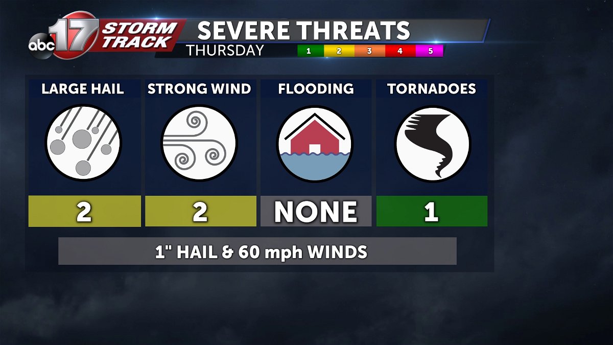
Our severe threats will be primarily wind and hail, but we can break this down in more detail.
The first round of storms, arriving shortly after 12 a.m. Thursday, will bring an isolated threat for large hail. Storms arriving in the northwest shortly after sunrise, may also carry a slight hail threat, before weakening shortly after they arrive. The line of showers and remnant storms will spread south, across mid-Missouri. In the afternoon, the warming ahead of this line, in our southeastern most counties, will prime the atmosphere for this line to strengthen.
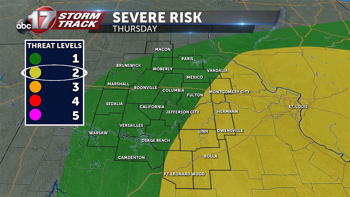
Hail and damaging winds will be increasingly likely as this line moves into areas near Camdenton, Linn, Hermann, Owensville, Rolla, and potentially Montgomery City.
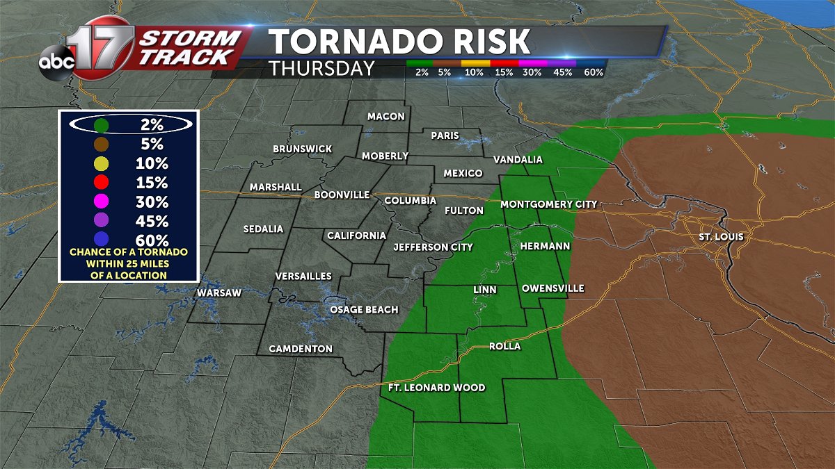
Our Tornado threat is quite low, but an isolated tornado cannot be ruled out in these southeastern most communities. The tornado threat is largely focused southeast near St. Louis on Thursday.


