Weather Alert Day: Severe storm threat continues into this evening
UPDATES:
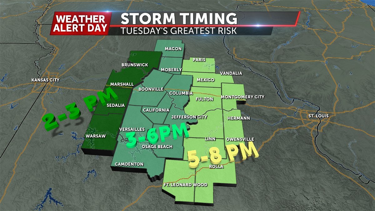
Tuesday Afternoon Update:
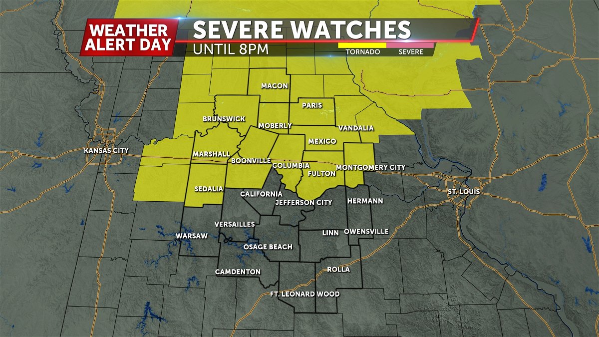
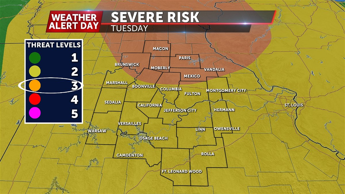
Slight changes have been made to the SPC outlook, which you may notice as a slight shift northward of the greatest risk for severe weather. This is where the greatest risk for strong updrafts will be to support large hail and strong tornadoes. However we all still have a chance for hail, damaging winds, and tornadoes.
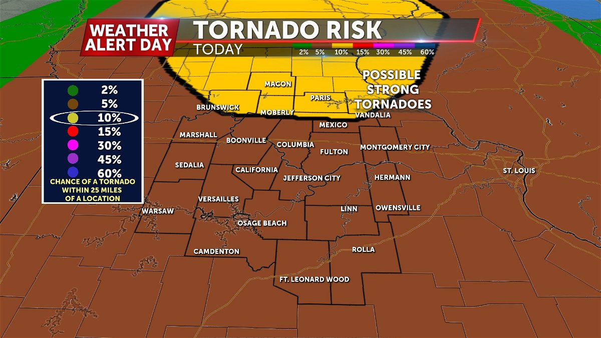
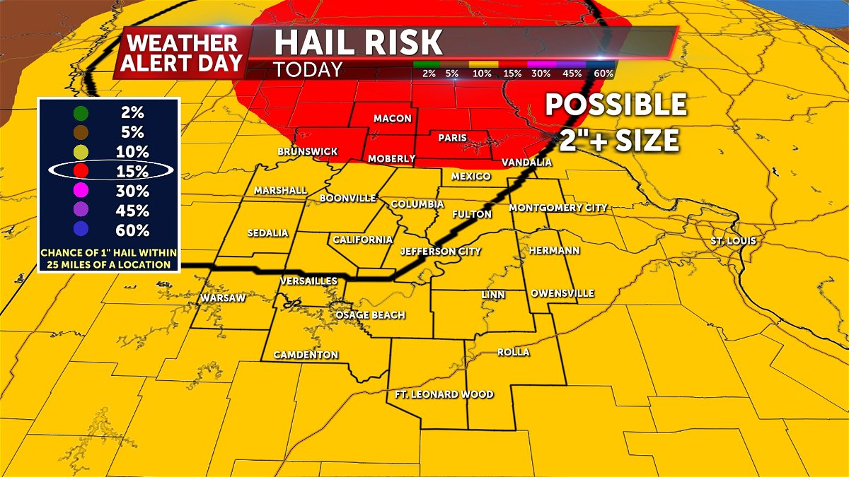
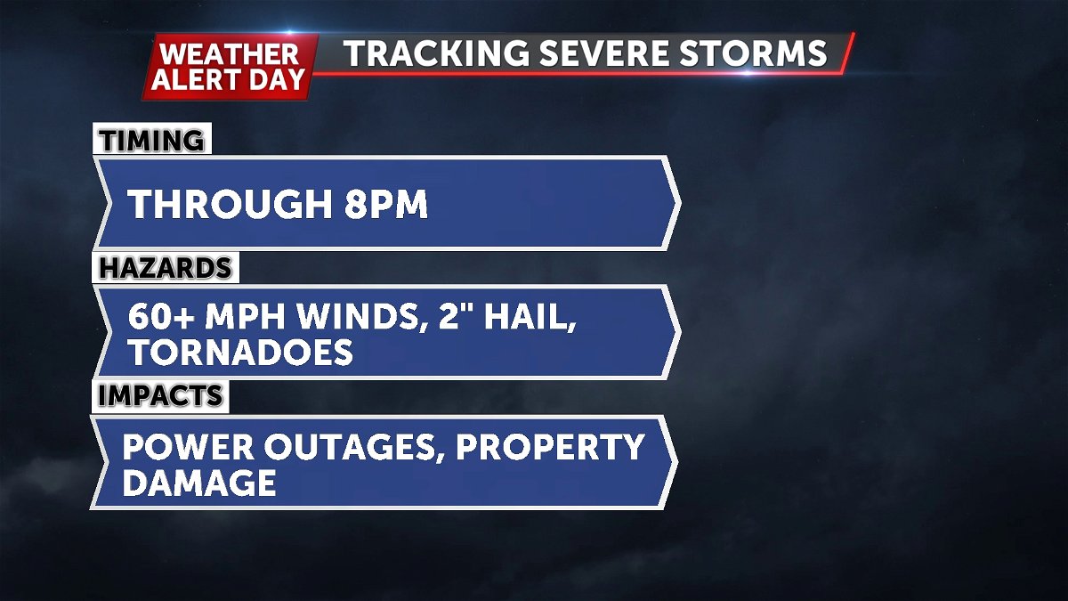
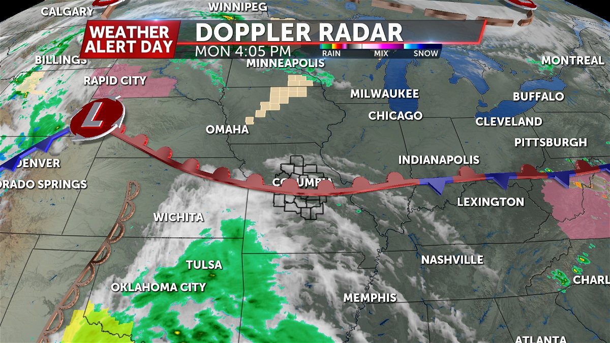
The initial line of strong storms has pressed east, with a second round of storms developing west. These will pose a severe threat this afternoon into tonight with the possibility of large hail, damaging winds, and tornadoes.
After 9 p.m., the risk for severe weather fades as the dry line clears the region.
Monday Afternoon Update:
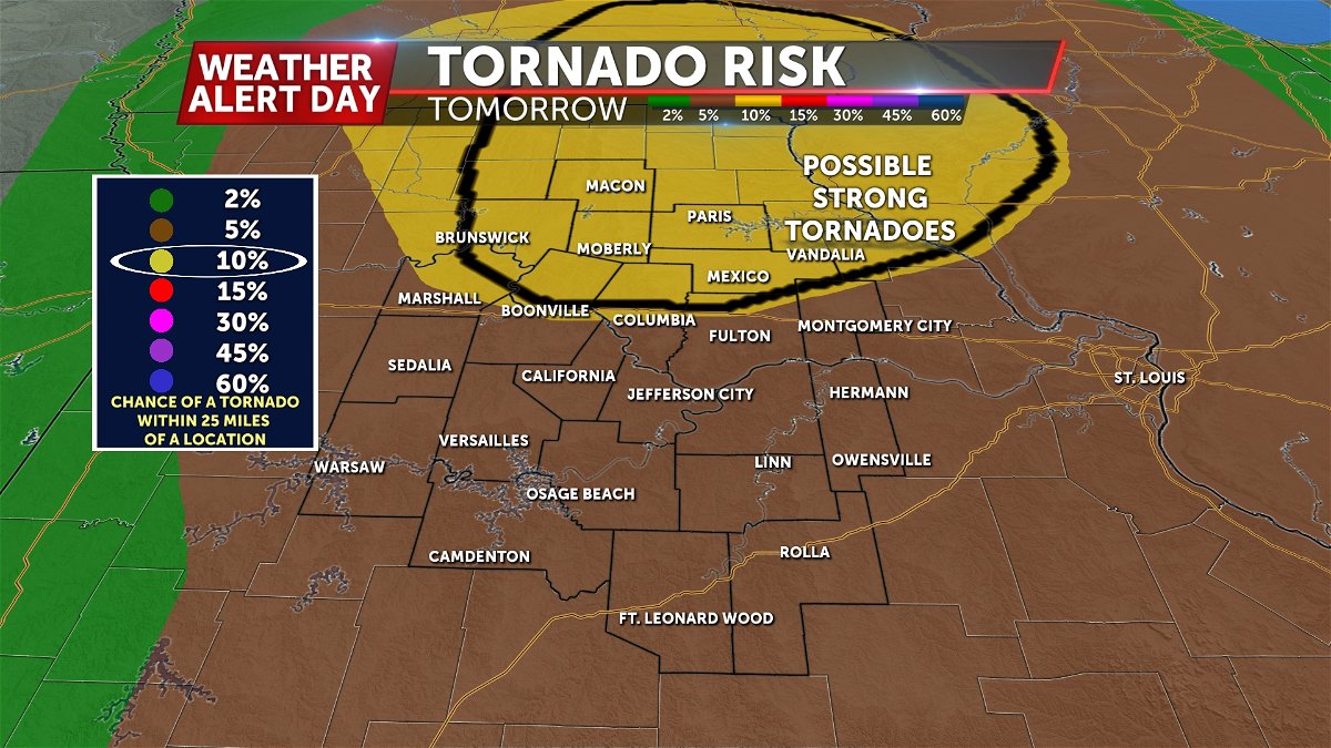
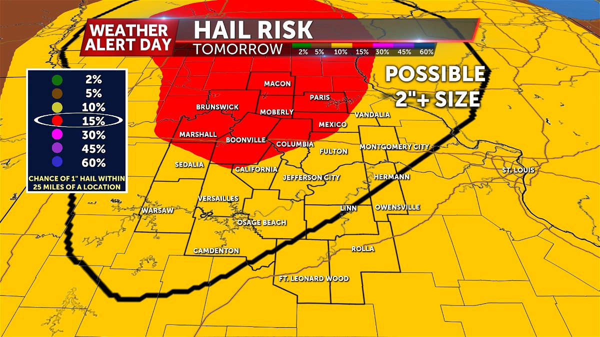
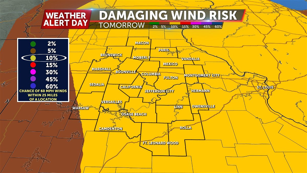
Not much has changed as of Monday afternoon regarding the threat for severe storms on Tuesday. We are still watching areas along and north of I-70 for the greatest risk of hail, damaging winds, and tornadoes. Still it's important to remember that all of us see a chance at severe storms.
We're still carefully watching the morning round of showers and storms and how it may impact the threat for severe storms later in the day. There remains the possibility that this round may impact instability and how potent storms could be, or their ability to develop at all. Still, given all other ingredients in place, the threat for severe storms is quite high if instability materializes late Tuesday. Have a plan in place to stay weather aware Tuesday afternoon and evening.
Here are the latest outlook maps.
BLOG:
The ABC 17 Stormtrack Weather Team has issued a Weather Alert Day for the threat of severe storms by Tuesday afternoon into the evening.
SETUP
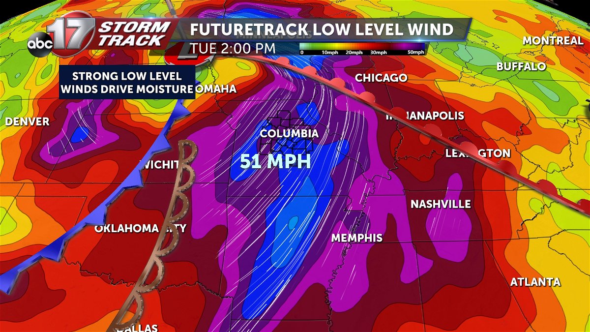
A ridge of high pressure brought near-record heat this weekend and could aid in producing strong storms as moisture surges north into the workweek. Strong low level winds ramp up each evening to increase the amount of moisture that could create unstable conditions both Monday and Tuesday nights.
A stalled front will move north on Monday, triggering a few storms by early Monday evening. A few of these could be on the stronger side, with quarter size hail possible. The higher threat will come on Tuesday ahead of a cold front that will sweep through by Tuesday night.
TIMING
A warm front will lift through the area on Monday, pushing out storms by the late evening. This round and overnight activity is expected to be marginally severe. The accompanying cold front with this system will be more worrying, with greater ingredients for severe storms, particularly with our wind setup. The cold front tracks through on Tuesday afternoon with all severe threats on the table.
IMPACTS
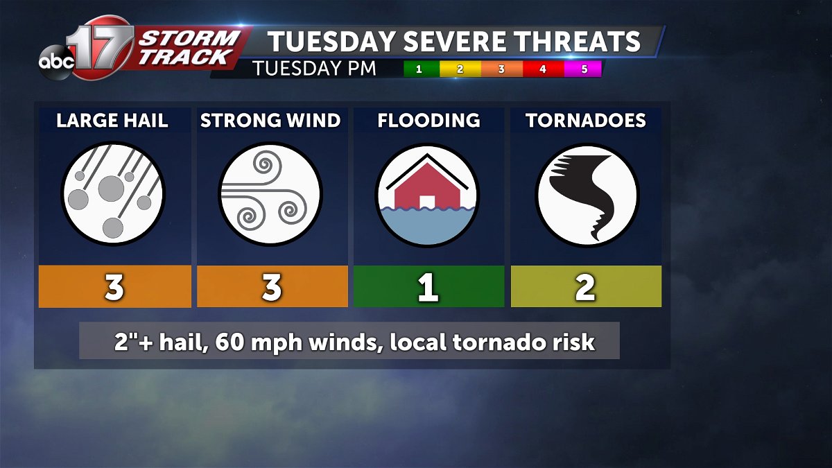
Monday bring isolated high winds and hail in the evening, though the best setup on that day is to our west. Tuesday poses a higher and more widespread risk for all severe hazards including tornadoes in northern Missouri.
Stay up to date with the forecast and have ways to receive weather information ahead of the storm. Download the free ABC 17 Stormtrack Weather App for alerts in your area.
