Tracking a cool week with snow in the Futuretrack
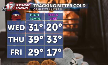
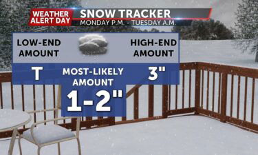
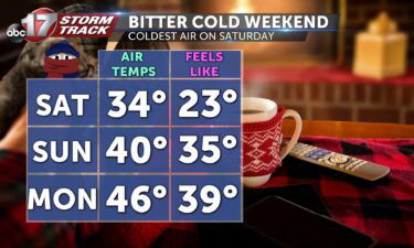
TONIGHT: Temperatures dropping back down into the low 20’s with skies clearing up. TOMORROW: Temperatures still only climbing up to around 40 degrees, with some patchy clouds throughout the day. EXTENDED: A Weather Alert Day has been issued for Monday night into Tuesday morning because of a system containing a wintery mix is moving over
Continue Reading