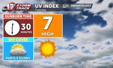
Tuesday’s UV index and pollen tracker
The UV index will be slightly lower tomorrow with morning rain and clouds exiting. Pollen levels will increase as rain moves out the rest of the week.
Continue Reading The UV index will be slightly lower tomorrow with morning rain and clouds exiting. Pollen levels will increase as rain moves out the rest of the week.
Continue Reading
Today: A slow moving cold front will continue to pass through Central Missouri leading to scattered showers and storms throughout the day. Storms will begin to become the focal point this afternoon after 5 PM. Isolated heavy downpours and lightning will be the main threats. Afternoon high’s top out at 90 degrees. Tonight: Scattered showers
Continue Reading
TODAY: Showers and storms will keep the forecast a little cooler today. While the chance for rain will be widespread, not all will see a soaker today. Showers have developed ahead of the a cold front approaching from the northwest this morning. As it enters our northern counties this morning, it will bring another chance
Continue Reading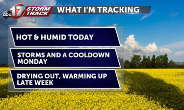
Today: Another hot and humid day with highs in the mid-90s and excessive moisture bringing the heat index up to triple digits. Widely scattered storms are possible across southeast Missouri again this afternoon. Tomorrow: A slow-moving cold front digs in early; don’t expect much relief for Monday though. Highs reach near 90 and moisture pooling
Continue Reading Tonight: Skies remain mostly clear throughout the overnight hours as temperatures fall slowly into the upper 70’s. Winds remain out of the southwest at 5-10 mph. Tomorrow: Temperatures soar to the mid-90’s once again with high dewpoints leading to the heat index creeping just over 100 degrees. Skies become partly cloudy with scattered storms by
Continue Reading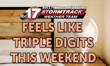
SATURDAY AM UPDATE: A Heat Advisory has been extended further into the weekend for Central Missouri. Less cloud cover expected the next few days will allow the heat index to breach triple digits on Saturday and Sunday afternoons. SETUP After a toasty end to the week, we’re gearing up for yet another hot weekend in
Continue Reading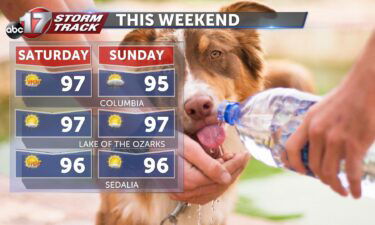
TODAY: Mostly sunny and muggy with highs in the upper 90s. Heat index from 103-106 with a pop-up storm possible in the afternoon. TOMORROW: Clouds filling in early; highs still reach the mid-90s. A slight drop in humidity brings the feels-like down a few degrees to 100-103. Widely scattered showers possible again in the afternoon.
Continue Reading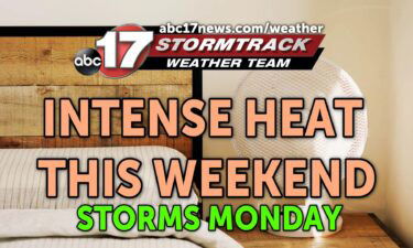
TONIGHT: Mostly clear and muggy, lows in the mid-70s. TOMORROW: Mostly sunny and hot with highs in the mid-upper 90s. Heat index between 103-105. Spot storm possible by late afternoon. EXTENDED: We remain mostly clear tonight as temperatures hold in the mid-70s. Tomorrow is the hotter day of the weekend with highs getting into the
Continue Reading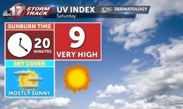
Saturday will be bright and hot with a UV index at a 9, with the sunburn time between 20-30 minutes. Pollen levels will be high all of next week with limited rain chances.
Continue Reading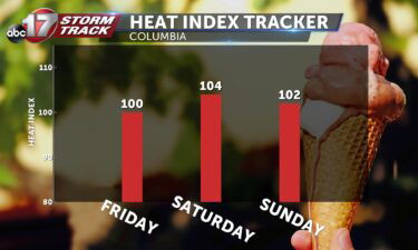
This Afternoon: Mostly sunny skies with highs in the mid-90s. Increased moisture today will bring the heat index up to 100 degrees. Tonight: Skies remain mostly clear and southerly winds keep conditions stifling overnight with lows in the mid-upper 70s. Extended: A stationary boundary to the southeast may be enough to fuel a pop-up storm
Continue Reading
TODAY: Friday starts sunny, with clear skies behind yesterday’s cold front, which currently sits as a stationary boundary just south of mid-MO. Despite being on the “cool” side of the boundary, temperatures this morning are warm, in the low 70s, and will stay warm this afternoon, as they climb into the low 90s. Winds start
Continue Reading
Governor Parson is set to address the first meeting of Missouri’s Drought Assessment Committee Thursday at 10:00 a.m., at the Lewis and Clark State Office Building.
Continue Reading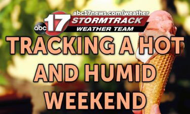
TONIGHT: Mostly clear and mild with lows near 70. TOMORROW: Mostly sunny and a bit warmer with highs in the upper 80s to lower 90s. Heat index in the upper 90s to around 100. EXTENDED: Mid-Missouri is dry for the next few days as high pressure begins to build back in tomorrow, bringing us back
Continue Reading
The UV index will be high with plenty of sunshine on Friday. Pollen levels will be high all weekend and drop slightly on Monday with rain in the forecast. in
Continue Reading This Afternoon: Partly cloudy skies with a pop-up storm possible near the I-44 corridor. Heat index in the mid-90s. Tonight: Temperatures falling to the low 70s. Patchy fog is possible early Friday again in the coolest areas. Extended: Southerly winds take over on Friday, and with clear skies, this will bump temperatures back into the
Continue Reading
DROUGHT MONITOR: The drought monitor is a product collaboratively produced by various government agencies and other organizations, to keep tabs on how dry (or not) communities are around the country. The product is updated every Thursday morning based on data collected through Tuesday morning of the same week. This means the drought monitor is updated
Continue Reading
TODAY: Rain ongoing this morning across the southern third of our counties will continue to push south during the pre-dawn hours. Most will find themselves dry by sunrise, but not before receiving copious amounts of rainfall. There may also be some patchy dense fog across the region with still and moist air sitting at the
Continue Reading
The Stormtrack Weather Team has issued a Weather Alert Day through late tonight for the threat of severe storms and potential flash flooding. A Severe Thunderstorm Watch is in effect for much of Mid-Missouri through 9:00 p.m., and a Flood Watch is in effect until 10:00 a.m. Thursday for areas along and south of I-70.
Continue Reading
The UV index will continue to be high Thursday as rain exits the area early. Pollen levels will be lower on Thursday, but rebound as winds and temperatures increase into the end of the week.
Continue Reading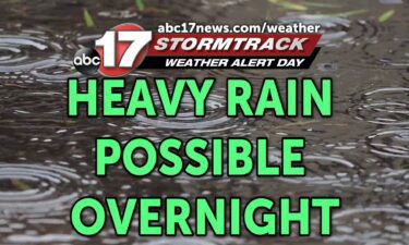
TONIGHT: Scattered storms with heavy rain and gusty winds. Rain amounts between 2-4″ possible. Lows in the lower 70s. TOMORROW: Patchy fog in the morning with sunshine returning for the afternoon. Highs in the upper 80s to around 90 with a heat index in the upper 90s. EXTENDED: A slow moving cold front will trigger
Continue Reading