
Tuesday’s UV index and pollen tracker
The UV index will be very low with widespread clouds. Allergen levels remain high through the weekend. Oak, Juniper, and Elm are the primary allergens.
Continue Reading The UV index will be very low with widespread clouds. Allergen levels remain high through the weekend. Oak, Juniper, and Elm are the primary allergens.
Continue Reading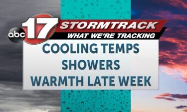
TODAY: Tuesday is a cloudy and cool day, with winds from the northwest through the day. Clouds will bring scattered showers on and off through the day. This will keep temperatures falling through the day, into the 40s this afternoon. Wind chills may be in the 30s by noon. Winds are sustained from the northwest
Continue Reading
UPDATE: FINAL UPDATE – TUESDAY MORNING: As of 2 a.m. our severe threat has come to an end. A tornado watch technically remains in effect for a few of our southern tier counties through 3 a.m. but the storm threat has cleared. Storm reports gathered thus far have largely centered around hail, with up to
Continue Reading
COLUMBIA, Mo. (KMIZ) Several power outages were reported Monday evening into Tuesday morning in Mid-Missouri, and Pulaski and Phelps counties saw significant outages after a round of storms rolled through the area. Last night a tornado warning was issued for Pulaski and Phelps counties, and several customers in those areas are waking up Tuesday morning
Continue Reading
COLUMBIA, Mo. (KMIZ) The first round of heavy storms on Monday hit Mid-Missouri in the afternoon. A tornado warning was issued for Cole and Osage counties and was lifted just before 7 p.m. Several viewers submitted photos of hail in various sizes. Do you have photos you would want to share? Share them on our
Continue Reading
The ABC 17 Stormtrack Weather Team has issued an ABC 17 Stormtrack Weather Alert Day for Monday. Wind, hail and tornadoes are all possible Monday afternoon and evening.
Continue Reading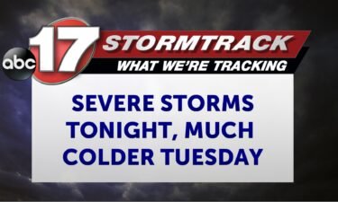
TONIGHT: Scattered to widespread storms, some could be severe with very large hail, damaging winds, and tornadoes along with heavy rain. The severe threat ends by around midnight, with lows falling into the upper 40s. TOMORROW: Scattered showers and colder with temperatures remaining in the upper 40s with gusty winds. EXTENDED: A warm front has
Continue Reading
TODAY: Monday is an ABC 17 Stormtrack Weather Alert day. Today is expected to be quite warm, in the mid-70s, as we are south of a warm front that exists somewhere near the Missouri/Iowa border. This will also put us squarely in the window for severe storms this afternoon and evening. Wind, hail, and tornadoes
Continue Reading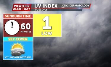
The UV index will be very low with widespread storms. Allergen levels remain high through the weekend. Oak, Juniper, and Elm are the primary allergens.
Continue Reading
TODAY: Monday is an ABC 17 Stormtrack Weather Alert day. Today is expected to be quite warm, in the mid-70s, as we are south of a warm front that exists somewhere near the Missouri/Iowa border. This will also put us squarely in the window for severe storms this afternoon and evening. Wind, hail, and tornadoes
Continue Reading TONIGHT: I’m tracking the chance for isolated storms to develop to the north of I-70 throughout the rest of the evening. If any storms become strong to severe, hail will be the main concern. Temperatures will only drop into the low 60s by the end of the night because of persistent cloud cover. TOMORROW: Monday
Continue Reading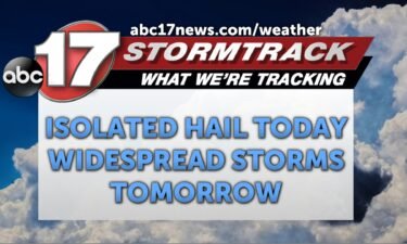
EASTER: A front is tracking through the area today and will settle along I-70, leading to widely scattered morning showers. North of this front this afternoon, storms may produce hail up to 1″ though this is a very isolated risk and most stay dry. Highs remain above average in the 70s despite clouds and rain.
Continue Reading TONIGHT: I’m tracking light rain picking up in southern Missouri slowly lifting north throughout the night. At most a rumble of thunder could be heard as there is a lack of energy throughout the area. Temperatures will drop down into the low 50s by the end of the night. TOMORROW: I’m tracking scattered showers in
Continue Reading
SATURDAY: Today will still be dry for outside plans with highs around 70 degrees. Winds will be calmer from the northwest at 5-10 mph. Scattered showers and storms pop up after sundown. EASTER SUNDAY: Conditions are likely drier for sunrise services, but have a backup plan north of I-70 where slim rain chances exist in
Continue Reading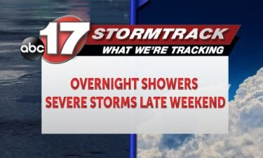
TONIGHT: Overnight temperatures cool to the mid-50s as isolated showers and storms push through the region. Most of Mid-Missouri looks to remain dry, but some light showers and thunder remains possible. Winds remain out of the southwest with gusts up to 30 mph possible. TOMORROW: Saturday looks to see highs near 70 degrees with partly
Continue Reading
There are several ways to view the eclipse with filtered sunglasses or through a protected camera, and you can find more details in previous Insiders. You can also project the shape of the eclipse onto the ground by making your own kind of lens, which is surprisingly easy to do! Creating a pinhole projector takes
Continue Reading
THIS AFTERNOON: Friday is warm and partly cloudy with gusty winds at times from the southwest. Winds will be sustained near 20 mph and gust up to 30+ mph, pushing temperatures into the mid-70s. TONIGHT: We’ll stay warm overnight ahead of a weak cold front. Some light showers will be possible but it’s likely that
Continue Reading
TODAY: Friday is warm and partly cloudy, with winds breezy at times from the southwest. Winds sustained near 20 mph will gust to 30+ mph and climb temperatures into the mid-70s despite some added clouds. TONIGHT: We’ll stay warm overnight, ahead of a weak cold front. Some light showers will be possible ahead of and
Continue Reading
While you’re grabbing filtered sunglasses to view the upcoming eclipse don’t forget to get extra gear if you’re trying to snag some good photos. Taking good shots of faraway objects in space is difficult and the lighting changes dramatically during an eclipse. Before anything, you should never look at the eclipse directly even in totality,
Continue Reading
TONIGHT: Overnight lows cool tp the mid-40s as skies look to remain partly cloudy. Winds continue out of the southwest at 5-10 mph. A slight haze will remain possible due to controlled burns to the southeast of Mid-Missouri and wild fires in Oklahoma. TOMORROW: Friday remains partly cloudy with highs into the mid-70s by the
Continue Reading