-ALL CLEAR- Weather Alert Day: Large hail, destructive winds, and tornadoes Monday night
UPDATE:
FINAL UPDATE - TUESDAY MORNING:
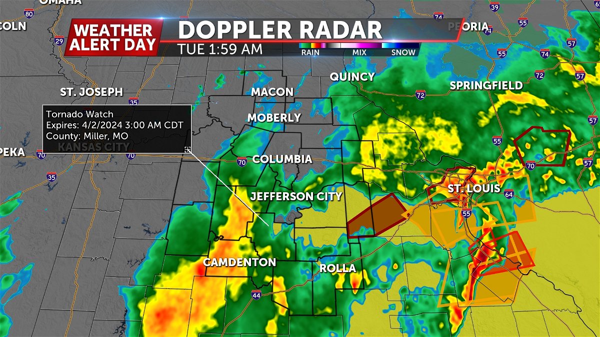
As of 2 a.m. our severe threat has come to an end. A tornado watch technically remains in effect for a few of our southern tier counties through 3 a.m. but the storm threat has cleared.
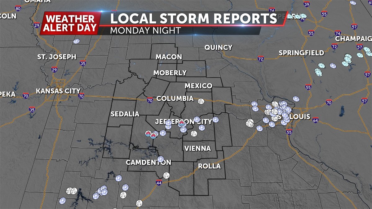
Storm reports gathered thus far have largely centered around hail, with up to golf ball and egg sized hail being the extent to our current knowledge. Sporadic wind damage has also been reported, as some storms were warned for nearly 80 mph winds. No tornadoes have been confirmed yet with any of the warned storms from Monday.
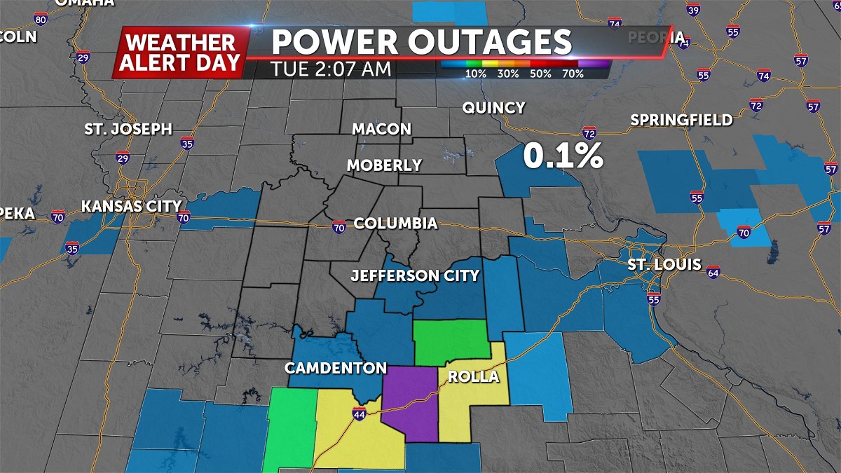
Widespread power outages are still being reported south of Jefferson City, as of 2 a.m.
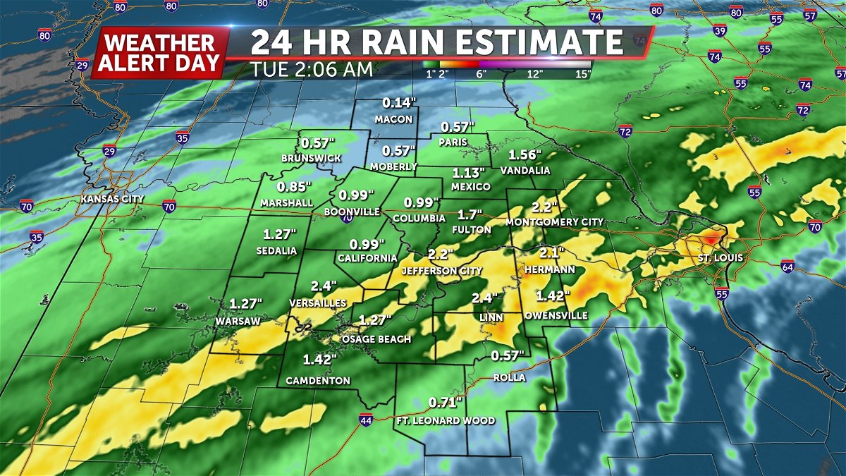
This was a healthy rain event, with upwards of two inches estimated in some spots.
MONDAY AFTERNOON UPDATE:
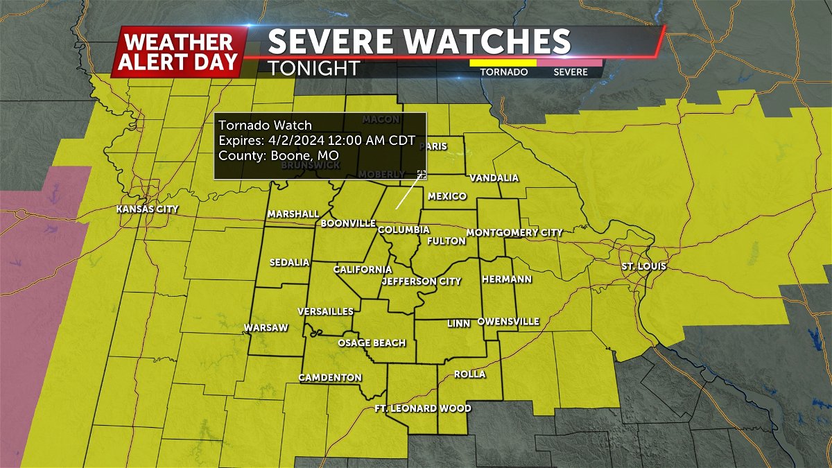
A Tornado Watch is in effect for areas west of Highway 63 until 11:00 PM, and points east until 12AM.
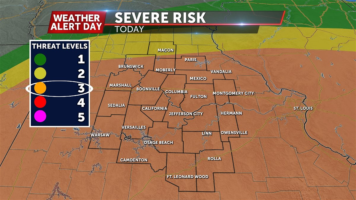
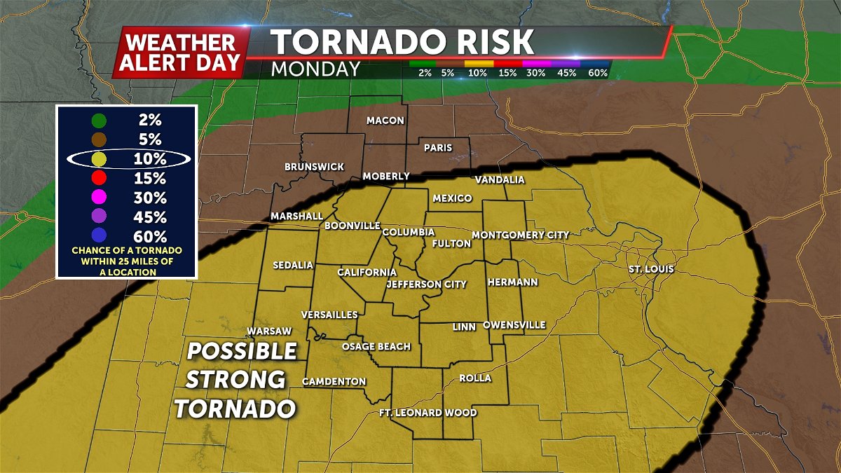
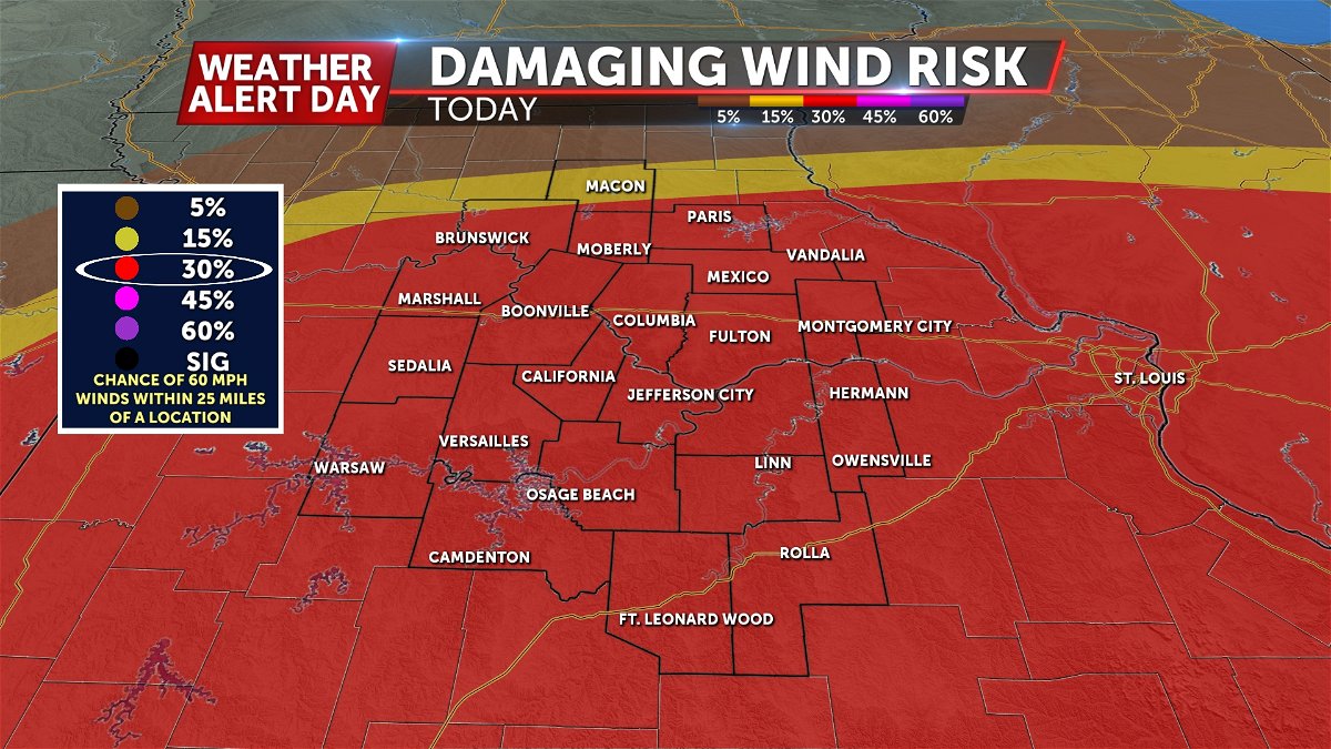
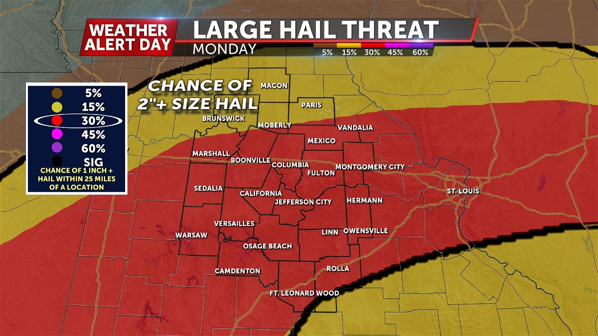
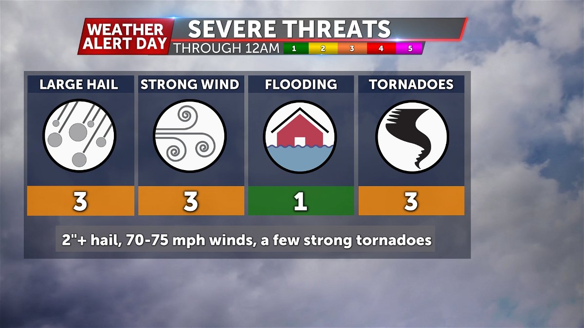
The latest severe weather outlook from the Storm Prediction Center has almost all of Mid-Missouri in a level 3 out of 5 severe weather risk for this afternoon into this evening. 70-75 mph winds, golf ball to baseball size hail, and a few strong (EF-2+) tornadoes are all possible given the ingredients that are setting up today.
This comes as the warm front has settled fairly far north overnight; somewhere near the Missouri and Iowa border. Take a look at this loop of the ABC 17 Stormtrack Doppler Radar from overnight. You'll see that storms that fired along the front stayed well north of mid-Missouri.
This means we have an increased risk for folks in the north, but there is still plenty of uncertainty. We mentioned a "high ceiling" previously, but there's also a "low floor." Depending on how the day takes shape ahead of storms, we could either see limited thunderstorm activity, or storms that could produce 2" or larger sized hail and strong tornadoes. Much of this hinges on how much sunshine we see. Long story short, the drier and brighter we are early in the day, the worse our severe threat looks this evening. If we see clouds take hold, or morning showers and storms clutter the skies, we may be looking at a lesser severe threat. Either way, it's likely that we see at least some instances of severe weather in mid-Missouri this afternoon into tonight.
Our concern with early storms is primarily hail, with a limited tornado threat for storms that develop in the far north near the front. A greater concern for tornadoes comes with the activity that moves in from southeast Kansas and western Missouri after 4 p.m. This is the area we need to watch for strong tornado potential. These storms are likely to produce large hail and damaging winds, but the tornado potential will need to be monitored. In terms of likelihood, hail and wind are our greatest threat, but in terms of impact potential, tornadoes are the greatest threat with these storms. This is where what happens earlier in the day will have it's greatest impact.
In general, our severe threat lasts through about midnight. Rain continues Tuesday morning, but severe threat is over by then.
IMPACTS:
As storms initially fire, large hail up to baseball size will be the main concern. As late afternoon and early evening wear on, the threat will shift to tornadoes, large hail, and damaging winds in excess of 70 mph.
PREPARE:
Have multiple ways to receive alerts of incoming severe weather, especially if you are away from home for the holiday. You can download the free ABC 17 Stormtrack Weather App to get watches and warnings for your location as soon as they are issued, along with live ABC 17 Stormtrack Doppler Radar.
It is imperative that you know where to take cover should a warning be issued as storms could quickly become damaging. Take cover underground in a basement or on the first floor of your home or business in an interior room away from windows. Ahead of time, make sure you have a pair of sturdy shoes, bike or sports helmet, and a portable charger in your safe spot along with any necessary personal items such as medicines. If you have an infant and have the time, strap your child into their pumpkin seat for added safety.
