
Monday’s UV index and pollen tracker
Monday’s UV index will be high in the afternoon before storms arrive. Pollen levels will be lower on Monday, but increase toward the end of the week.
Continue Reading Monday’s UV index will be high in the afternoon before storms arrive. Pollen levels will be lower on Monday, but increase toward the end of the week.
Continue Reading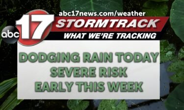
TODAY: Sunday will be mostly dry again to get outside but anyone with plans at the Lake should remain aware of showers and storms this afternoon. These could track in from the south by midafternoon at the earliest, with rain staying south of I-70 through the evening. Highs today remain comfortable in the lower 70s.
Continue Reading
TONIGHT: I’m tracking a line of storms forming across our southeastern counties that will continue to move to the east throughout the rest of the night. Severe weather unlikely, but storms could produce gusty winds and sub-severe hail (<1″ in diameter) if they become strong enough. Mid-Missouri will cool down into the low 50s by
Continue Reading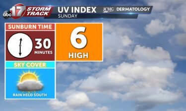
There is a chance at rain tomorrow, but this is held to the south. This means that a UV Index of 6 is expected. It will only take 30 minutes to receive a sunburn without proper protection. Pollen levels will be high to start next week. Primary allergens will be oak, ash, and mulberry.
Continue Reading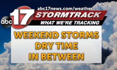
TODAY: Highs reach the upper 70s as a cold front tracks through the area. This could produce showers from midmorning to afternoon with a low severe risk past midday. Large hail and damaging winds are possible but much of Mid-MO may find themselves dry today. TOMORROW: More showers and storms are possible for the southern
Continue Reading
Saturday sees chances of showers and storms leading to a UV Index of 5. Pollen levels remain high throughout the first weekend of May as tree pollen levels continue to remain near peak levels.
Continue Reading
TONIGHT: Overnight lows cool to near 60 degrees with partly cloudy skies. Winds remain out of the east at 5-10 mph. TOMORROW: Saturday welcomes scattered showers and storms by mid-day. Storms remain at a threat level 1/5 with large hail and damaging winds up to 60 mph as the primary threats. Highs rise into the
Continue Reading
It has been an active spring and severe weather season for Missouri this year with high winds and hail and several tornadoes reported across the state. Storms also produced a rare landspout yesterday afternoon near Joplin with minor damage reported. Landspouts are a weak type of tornado produced by a specific atmospheric setup that differentiates
Continue Reading
Renewable energy has grown steadily over the last decade and 2023 was no different with the United States producing more clean energy than ever before. Missouri is also following this trend as the state saw a marked increase in its solar capacity just last year. Like our Midwest neighbors, the Show-Me state sources most renewable
Continue Reading
TODAY: Friday is a brighter and drier day with partly cloudy skies. Highs reach the mid-70s. TONIGHT: Winds will shift more southeasterly overnight, and lingering clouds will keep lows near 60. EXTENDED: Rain chances return on Saturday as a quick-moving cold front brings a line of thunderstorms through from late morning to early afternoon. There’s
Continue Reading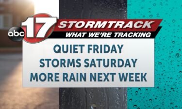
TODAY: Friday is a brighter and drier day after widespread clouds and rain across the region Thursday. We’ll be partly cloudy with a high in the mid-70s and a light easterly breeze for much of the day. TONIGHT: Winds will shift more southeasterly overnight, keeping temperatures near 60. Clouds thicken, leaving us partly cloudy for
Continue Reading
The UV index will be higher on Friday with clouds exiting the region. Tree pollen levels will continue to be high despite rain over the weekend.
Continue Reading
TONIGHT: Scattered storms decrease, lows in the upper 50s. TOMORROW: Mostly sunny with highs in the upper 70s. EXTENDED: Rain starts to taper off late tonight, leaving us drier and a touch cooler tomorrow morning. Highs reach the mid-upper 70s with more sunshine returning tomorrow afternoon. I’ll be tracking storms out ahead of a cold
Continue Reading
Mid-Missouri has seen long-standing drought that looks to be coming closer to an end. Rainfall the past month has lead to improving conditions within each weeks drought monitor. The change in drier than normal conditions and moderate drought seem to be day and night with this mornings update in comparison to that to start the
Continue Reading
TODAY: Expect a high in the low 80s, at least until rain begins this afternoon. We’ll likely begin to see showers and storms overspread the region by this afternoon, from west to east. This will take some time, so many east of Columbia and Jefferson City will remain dry until after 3 p.m. Rain may
Continue Reading
TODAY: Thursday starts dry for most. We may see a few showers and weak thunderstorms northwest of Columbia through the morning, but otherwise, we’ll be dry and partly cloudy, with temperatures warming nicely. Expect a high in the low 80s, at least until rain begins this afternoon. We’ll likely begin to see showers and storms
Continue Reading COLUMBIA, Mo. (KMIZ) This past weekend, both Morgan and Moniteau counties saw confirmed tornadoes. This lead to damage across some portions of Mid-Missouri. Thankfully, nobody was injured or killed. But this isn’t always the case with severe storms and the effects could range from loss of property to large mass casualty events like that seen
Continue Reading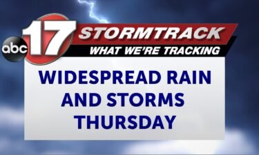
TONIGHT: Mostly cloudy and warm with lows in the mid-60s. TOMORROW: Mostly cloudy early with temperatures rising to near 80 before more showers and storms move in by early afternoon. Some storms could be strong with isolated strong winds and 1″ hail. EXTENDED: We stay mostly dry tonight into tomorrow morning, but cloud cover keeps
Continue Reading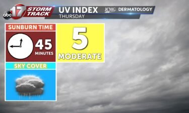
Thursday’s UV index will be a bit lower due to rain in the area. Pollen levels will also be lower with rain and storms through the next few days.
Continue Reading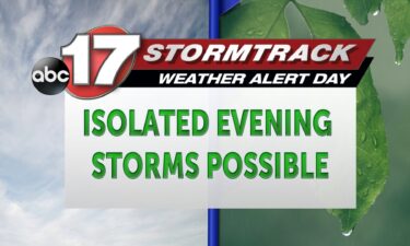
TODAY: A passing cold front leads to partly cloudy skies this afternoon with isolated storm chances closer to 5 pm. Moderate downpours will be the main threat with smaller hail and stronger winds possible. TONIGHT: Isolated storms remain possible with lows cooling into the lower 60s. EXTENDED: We’ll climb into the 80s Thursday ahead of
Continue Reading