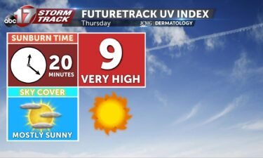
Thursday’s UV index and pollen tracker
The UV index will be high with plenty of sunshine to start the day. Pollen levels will continue to be high, especially as temperatures increase this weekend.
Continue Reading The UV index will be high with plenty of sunshine to start the day. Pollen levels will continue to be high, especially as temperatures increase this weekend.
Continue Reading
Today: Temperatures look to remain below average this afternoon with highs topping out into the mid-80’s. Skies remain mostly clear as allergen levels increase to high levels. Tonight: Skies continue to remain mostly clear as winds continue out of the northwest promoting cooler temperatures once again. Lows bottom out into the lower 60’s. Extended: Temperatures
Continue Reading
TODAY: Mostly clear skies this morning, partnered with calm to light winds has led to some fog potential this morning. Temperatures in the low to mid-60s by sunrise will give us a cool and crisp start to the day. This will also set us up for cooler than normal expected highs in the mid-80s. Patchy
Continue Reading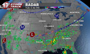
Every day, meteorologists mention cold fronts, warm fronts, high-pressure systems, and low-pressure systems.
Continue Reading
TONIGHT: Mostly clear with fog developing after midnight. Lows in the low to mid-60s. TOMORROW: Mostly sunny and comfortable with highs in the mid-80s. EXTENDED: Tonight will be quite comfortable with lows falling into the low 60s. With light winds and high relative humidity as temperatures sit near the dew point, we could wake up
Continue Reading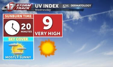
The UV index will be higher Wednesday with less cloud cover over the area. Pollen levels remain high with little rain in the forecast.
Continue Reading Today: Skies become partly cloudy as the last showers push to the southeast along with the past cold front we experienced this morning. Highs top out into the mid-80’s. Tonight: Skies remain partly cloudy with overnight lows cooling to the upper 60’s. Winds remain out of the northeast at 4-8 mph. Extended: High’s remain into
Continue Reading
TODAY: Showers this morning will continue to diminish through sunrise. Partly cloudy skies will remain, if not mostly cloudy south of I-70 where the best rain has remained overnight. Closer to I-44, residual moisture will lead to the chance for isolated storms this afternoon. Highs this afternoon climb into the mid-80s, while dewpoints land in
Continue Reading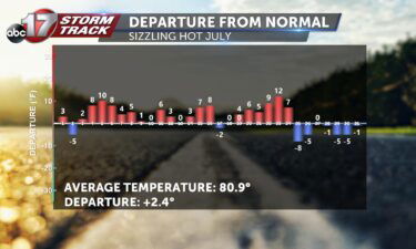
Most Mid-Missourians have felt the effects of high heat this past July into early August. When breaking down the recorded statistics for Columbia, Mo., the average departure from normal temperatures wanes on the positive side indicating temperatures averaged above average for July of 2022. Many days indicate substantial increases in temperatures averaging out to 2.4
Continue Reading
TONIGHT: Scattered showers and storms becoming more widespread overnight. A Flood Watch is in effect for areas south of Highway 50 through Tuesday morning. Lows in the upper 60s to around 70. TOMORROW: Clouds decreasing with highs in the lower to mid-80s with lower humidity. EXTENDED: I’m tracking a cold front moving slowly across the
Continue Reading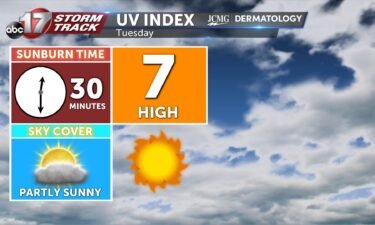
The UV index will be slightly lower tomorrow with morning rain and clouds exiting. Pollen levels will increase as rain moves out the rest of the week.
Continue Reading Today: A slow moving cold front will continue to pass through Central Missouri leading to scattered showers and storms throughout the day. Storms will begin to become the focal point this afternoon after 5 PM. Isolated heavy downpours and lightning will be the main threats. Afternoon high’s top out at 90 degrees. Tonight: Scattered showers
Continue Reading
TODAY: Showers and storms will keep the forecast a little cooler today. While the chance for rain will be widespread, not all will see a soaker today. Showers have developed ahead of the a cold front approaching from the northwest this morning. As it enters our northern counties this morning, it will bring another chance
Continue Reading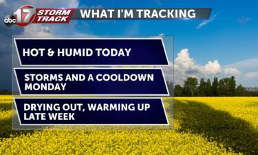
Today: Another hot and humid day with highs in the mid-90s and excessive moisture bringing the heat index up to triple digits. Widely scattered storms are possible across southeast Missouri again this afternoon. Tomorrow: A slow-moving cold front digs in early; don’t expect much relief for Monday though. Highs reach near 90 and moisture pooling
Continue Reading Tonight: Skies remain mostly clear throughout the overnight hours as temperatures fall slowly into the upper 70’s. Winds remain out of the southwest at 5-10 mph. Tomorrow: Temperatures soar to the mid-90’s once again with high dewpoints leading to the heat index creeping just over 100 degrees. Skies become partly cloudy with scattered storms by
Continue Reading
SATURDAY AM UPDATE: A Heat Advisory has been extended further into the weekend for Central Missouri. Less cloud cover expected the next few days will allow the heat index to breach triple digits on Saturday and Sunday afternoons. SETUP After a toasty end to the week, we’re gearing up for yet another hot weekend in
Continue Reading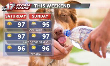
TODAY: Mostly sunny and muggy with highs in the upper 90s. Heat index from 103-106 with a pop-up storm possible in the afternoon. TOMORROW: Clouds filling in early; highs still reach the mid-90s. A slight drop in humidity brings the feels-like down a few degrees to 100-103. Widely scattered showers possible again in the afternoon.
Continue Reading
TONIGHT: Mostly clear and muggy, lows in the mid-70s. TOMORROW: Mostly sunny and hot with highs in the mid-upper 90s. Heat index between 103-105. Spot storm possible by late afternoon. EXTENDED: We remain mostly clear tonight as temperatures hold in the mid-70s. Tomorrow is the hotter day of the weekend with highs getting into the
Continue Reading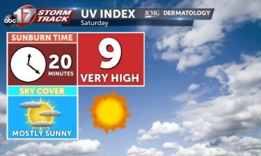
Saturday will be bright and hot with a UV index at a 9, with the sunburn time between 20-30 minutes. Pollen levels will be high all of next week with limited rain chances.
Continue Reading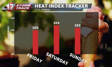
This Afternoon: Mostly sunny skies with highs in the mid-90s. Increased moisture today will bring the heat index up to 100 degrees. Tonight: Skies remain mostly clear and southerly winds keep conditions stifling overnight with lows in the mid-upper 70s. Extended: A stationary boundary to the southeast may be enough to fuel a pop-up storm
Continue Reading