The science behind fronts and pressure systems
Both June and July in Mid-Missouri have seen well below-average rainfall totals with dangerous flash flooding conditions by later parts of July. Every day, meteorologists mention cold fronts, warm fronts, high-pressure systems, and low-pressure systems. Although they are pointed out often, you might be asking yourself, "Just what are they actually?"
Fronts are areas where two different types of air masses meet. When these air masses collide, current weather conditions often change.
Warm fronts
One of many fronts identified is warm fronts.
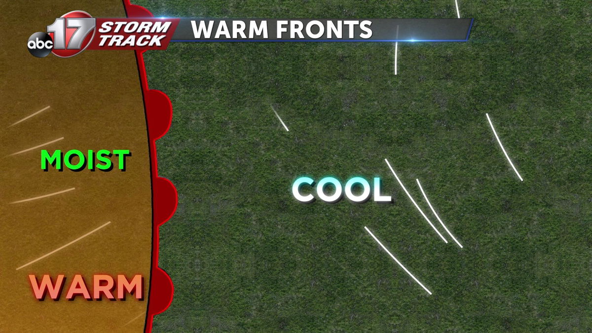
Warm fronts occur when a more humid warm air mass catches up to a cooler drier air mass. The cooler air in the cold air mass is typically more dense and heavier, leading to it pooling near the earth's surface.
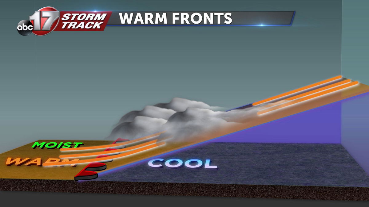
The warmer air is less dense and more buoyant leading to it rising about the cooler air mass. After the more humid warm air mass rises, it then cools and condenses forming clouds. These clouds can often lead to light drizzles or wintery mixes during later seasons. Typically, warm fronts move slower than cold fronts leading to a slower change in weather conditions.
Cold fronts
These fronts are indicative of stronger showers and storms that can lead to more severe conditions.
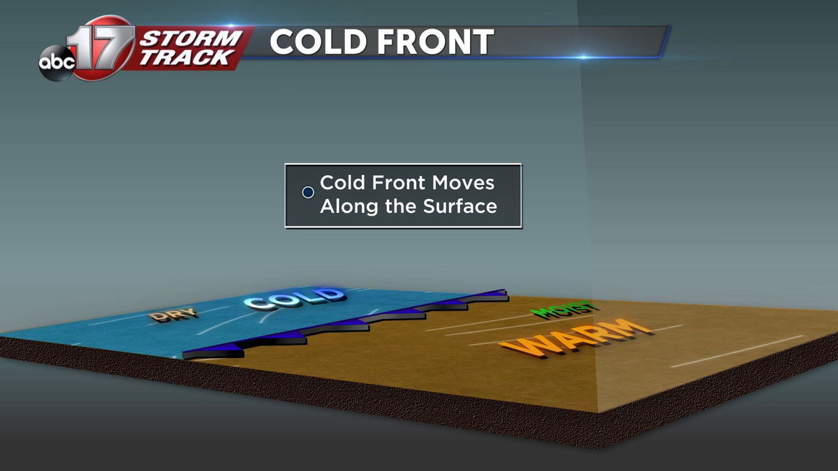
Cold fronts occur when a cooler and drier air mass catches up to and passes a warmer air mass.
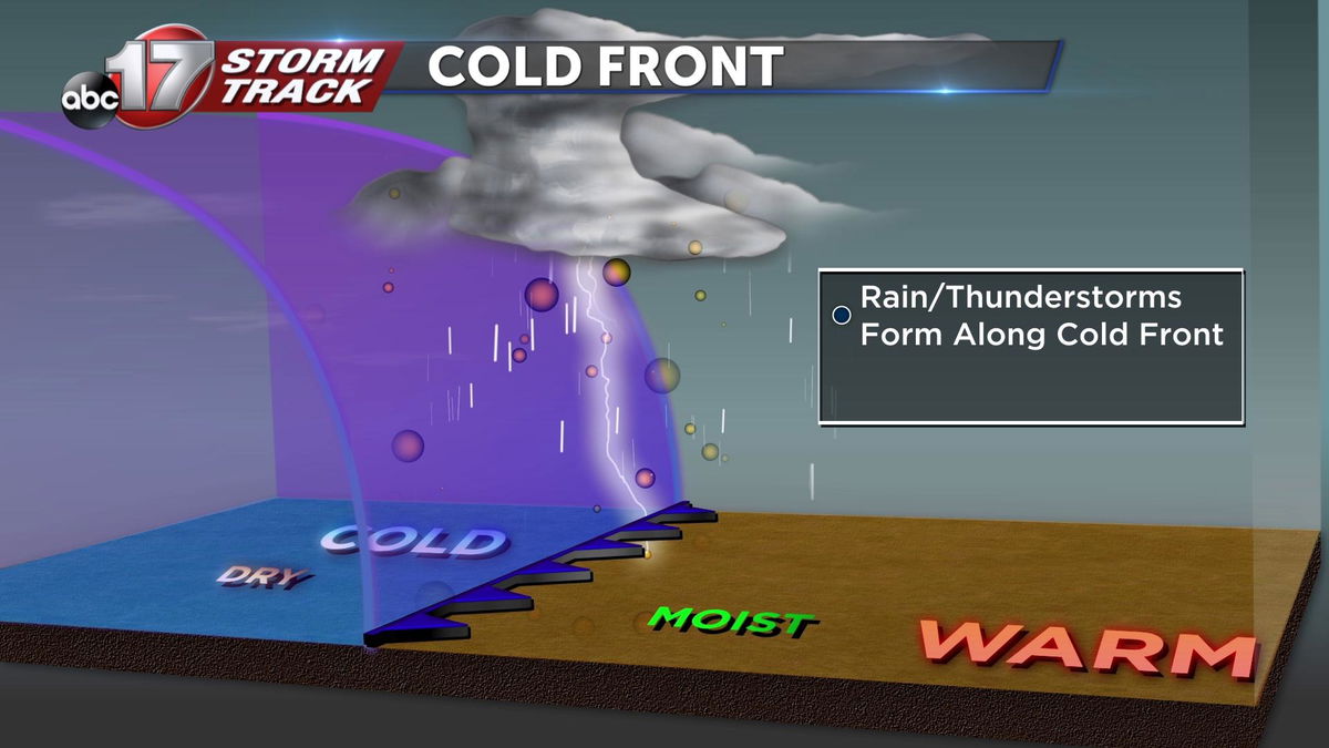
The incoming cool air forces the warmer air to rise more quickly leading to the development of showers and storms. Because the surfaces ahead of the cold front have already been heated, more energy is available in the atmosphere to cause more dramatic rising motions. This in turn can lead to severe storms with the right circumstances leading to hail, downpours, strong winds, and tornadoes. Just earlier this Tuesday, a cold front sped through Mid-Missouri from Iowa leading to showers and storms that produced just over two inches of rainfall. When cold fronts pass, temperatures typically decrease and conditions become more stable.
Pressure systems

When speaking of fronts, pressure systems are usually talked about. There are two types of pressure systems, a low-pressure system, and a high-pressure system. A high-pressure system indicates more calm and clear conditions. Wind directions around high-pressure systems rotate clockwise. In the northern hemisphere, this leads to more pleasant conditions. This pressure system acts like a shield, fanning away moisture and low systems.
A low-pressure system signals changing weather conditions. All fronts are tied to lows. Winds around low-pressure systems rotate counterclockwise. When thinking of a low-pressure system, a similarity can be made to a vacuum cleaner. A deficit of air in the bag or container of a vacuum leads to the surging of air and dirt molecules. These dirt molecules then rush into the container to fill the void. The same occurs with low-pressure systems. Moisture rushes into the center of a low system. When fronts collide, clouds and other resulting precipitation types occur.
For the past two months, we have seen drought-like conditions in Central Missouri due to high-pressure systems to the west over the Rocky Mountains. These high-pressure systems park, blocking low-pressure systems to bring much-needed rainfall.
