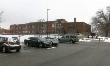
JC Schools sees only minimal bus delays amid Tuesday’s late start, district said
Officials with the Jefferson City School District said everything went as expected during Tuesday morning’s adjusted start time.
Continue Reading Officials with the Jefferson City School District said everything went as expected during Tuesday morning’s adjusted start time.
Continue Reading
THIS AFTERNOON: Low-lying cloud cover and fog continue to hang across the area this afternoon. Temperatures remain in the teens and low 20s because of this. Slick spots will continue to be possible, especially into the evening commute. Continue to give yourself extra time to get to your destination. TONIGHT: Mostly clear skies overhead will turn into
Continue Reading
Tuesday 6AM Update: Roads are still in poor shape, but we could be throwing a wrench into the road treatment plans this morning in some of our western counties. Clouds are streaming in, and it looks like we could be cold enough at the surface to essentially pull some of that cloud cover down, creating
Continue Reading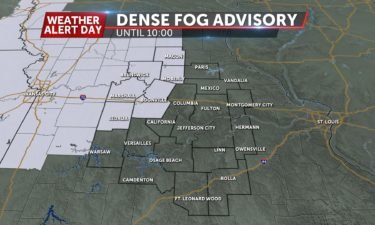
TUESDAY: A frigid start with snow on the ground is leading to some fog trying to develop this morning. That looks to be dense in some spots this morning, which will lead to patchy slick spots on top of what already exists. Take it easy on the roads, especially this morning. We’ll try to start
Continue Reading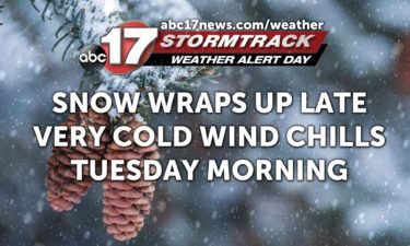
TONIGHT: Snow ends before midnight, and temperatures drop into the teens. Morning wind chills between 5-10 degrees. TUESDAY: Cold and becoming mostly sunny with highs in the low 30s. EXTENDED: Wednesday morning will be the coldest of the week with lows falling into the teens, and the wind chills in the single digits. Patchy slick
Continue Reading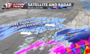
THIS AFTERNOON: More snow has started to fall across central portions of mid-Missouri this afternoon. Light to moderate snow is possible through the afternoon and evening commute. Additional accumulations of 1-2″ are possible. Snow looks to end by 10pm for most areas. TONIGHT: That snow looks to wrap up from west to east this evening, as colder
Continue Reading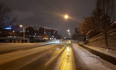
Several inches of snow covered Mid-Missouri starting Sunday and continuing Monday.
Continue Reading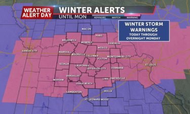
The next round of snow arrives this morning and wraps up later tonight with an additional 1-3″ of snow possible.
Continue Reading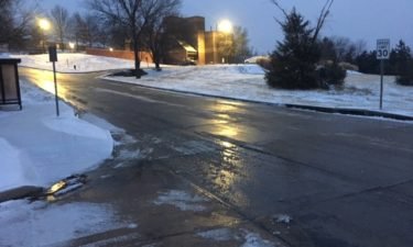
Authorities say at least five people have died in weather-related crashes in Missouri and Kansas amid a storm that dumped nearly a foot of snow in places and forced schools to close.
Continue Reading
MONDAY: Another round of snow is on the way as we head into this afternoon. The heaviest of the snow looks to fall across our southeastern counties, but all of us will be dealing with some light snow throughout the day. TONIGHT: That snow looks to wrap up from west to east this evening, as
Continue Reading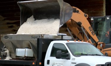
Cole County Public Works had 26 trucks treating the roads Sunday, according to Director Larry Benz. Benz said he called his entire team in before the snow started to make sure roads were treated across the county. The department will have trucks out overnight to give the main crew a chance to rest before the
Continue Reading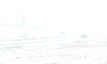
COLUMBIA, Mo. (KMIZ) Dozens of school districts in Central Missouri have called off school for Monday due to the winter storm moving through the area. The ABC 17 Stormtrack Weather Team issued a Weather Alert Day for Sunday and Monday. You can find the latest forecast here. Columbia Public Schools and the Jefferson City School
Continue Reading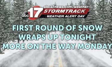
TONIGHT: Snow continues before midnight for areas along and north of I-70. Freezing drizzle is possible south, creating a glaze to 0.1″ of ice. Lows in the mid-20s. MONDAY: Another round of snow moves in from the west by morning and lasts for much of the day. An additional 1-3″ of snow will be possible.
Continue Reading SUNDAY: We’ll see snow start to move in this morning. It doesn’t look to start to affect things and add up until this afternoon, when we’ll see some higher snowfall rates. This first wave looks to primarily be falling in the form of snow, with about 2-3” being picked up. TONIGHT: We’ll see a break
Continue Reading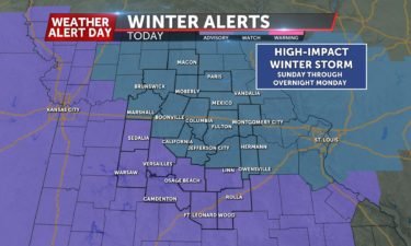
TONIGHT: Mostly cloudy and staying dry. Lows in the low 20’s. SUNDAY: Snow will begin to fly around 9am tomorrow and continue through the afternoon. Generally, 1-3″ of snow can be expected through the evening before snow tapers off to light freezing drizzle/sleet overnight. EXTENDED: Monday morning will likely be dry through 7-8am before snow picks
Continue Reading
SATURDAY: A cold front is driving just a bit of rain out of the viewing area through the morning hours. That should clear out leaving us cloudy in the early AM hours. We will gradually clear throughout the day until we reach mostly sunny in the afternoon. We will be falling in temperatures throughout the
Continue Reading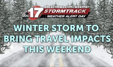
TONIGHT: Mostly cloudy with a few showers. Lows near 35. SATURDAY: Temperatures falling through the day from the 30s through the 20s. Mostly cloudy with a few showers or light snow showers. No significant impacts expected. EXTENDED: A Weather Alert Day is in effect Sunday and Monday as our next winter storm takes shape and
Continue Reading
FRIDAY: Cloudy skies will greet us heading out the door and will stick with us this afternoon as temperatures make it back into the low 50s. TONIGHT: We’re tracking a disturbance moving in tonight that will bring some light rain chances back along with some colder air. Some of that cold air will mix in
Continue Reading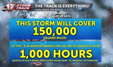
“Those meteorologists are never right, they get paid to be wrong!” is one of the many solipsisms we face in the weather business.
Continue Reading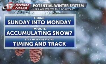
TONIGHT: Mostly cloudy with lows in the mid-30s. FRIDAY: Mostly cloudy and not as windy with highs in the upper 40s to low 50s. EXTENDED: A cold front moves through the area Friday night into Saturday, dropping the temperatures into the upper 30s for highs on Saturday with the potential for a few rain and
Continue Reading