The difficulties behind winter weather forecasting
"Those meteorologists are never right, they get paid to be wrong!" is one of the many solipsisms we face in the weather business.
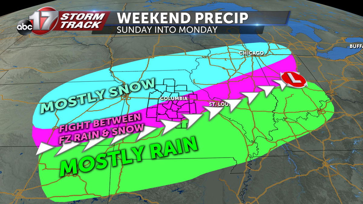
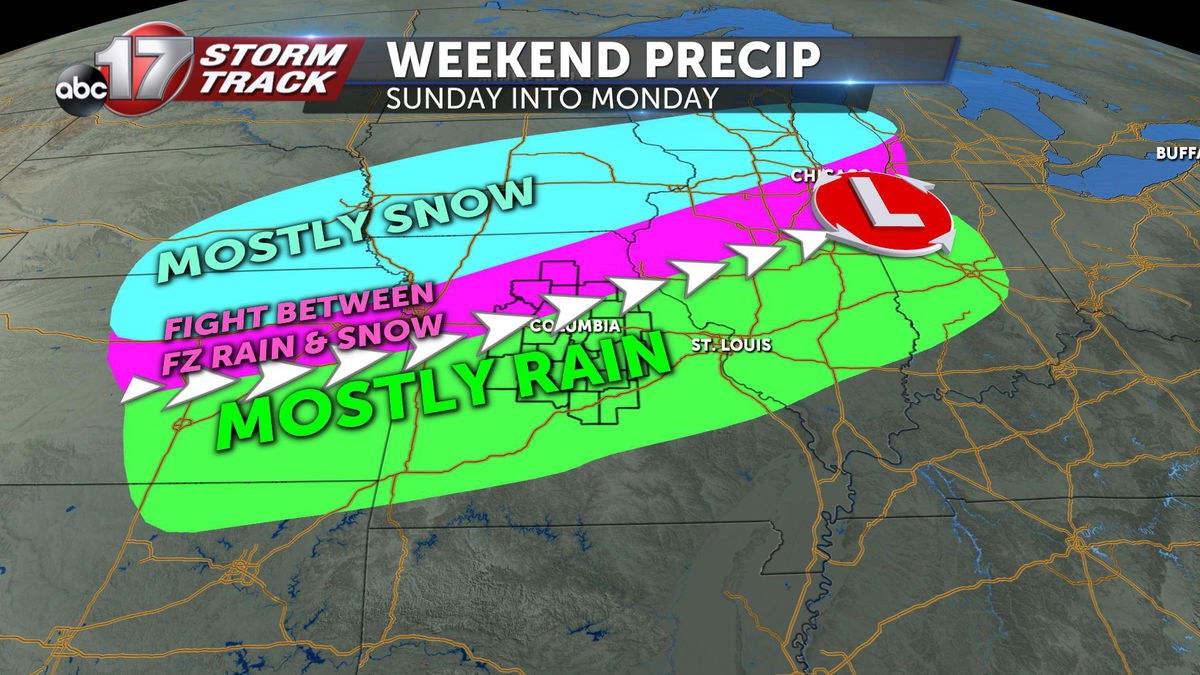
I hope to shed some light on the troubles we face when forecasting for wintry weather. This weekend, the ABC 17 StormTrack weather team is forecasting winter weather. Based on the data we have right now, the map below is what we believe to be the most likely outcome of precip Sunday afternoon into Monday morning. We've pored over hundreds of hours (into the future) worth of data about this system, and this seems to be the best "average" of all the solutions we've seen.
Let's throw a wrench in those plans...
Now, for a moment, imagine we begin getting new data this evening that starts to tip the scales a bit. Let's say we start seeing a northern shift in the center of low pressure.
Subsequently, the "zones of precipitation" will also shift north. This means snow, instead of being in northern mid-Missouri, would now be centered over Iowa and Nebraska. Freezing rain chances would be farther north, as well as rain chances.
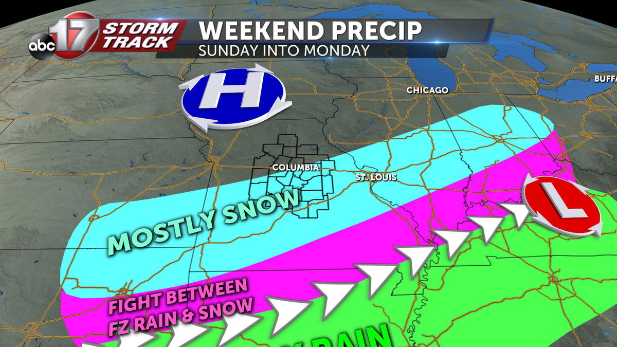
Or maybe the new data comes in with a stronger area of high pressure from Canada and forces the low farther south. This would yield the center of the snow along and south of Interstate 70.
Models shmodels...
The good news is that we haven't seen any big shifts in the low's track thus far. For the most part, we've been seeing tracks like the first map we showed you. But big shifts are never out of the question. It's happened before and that's why a forecast can go from showing big snow, to nothing at all within a span of 24 hours.
So why the heck do models stink so bad?
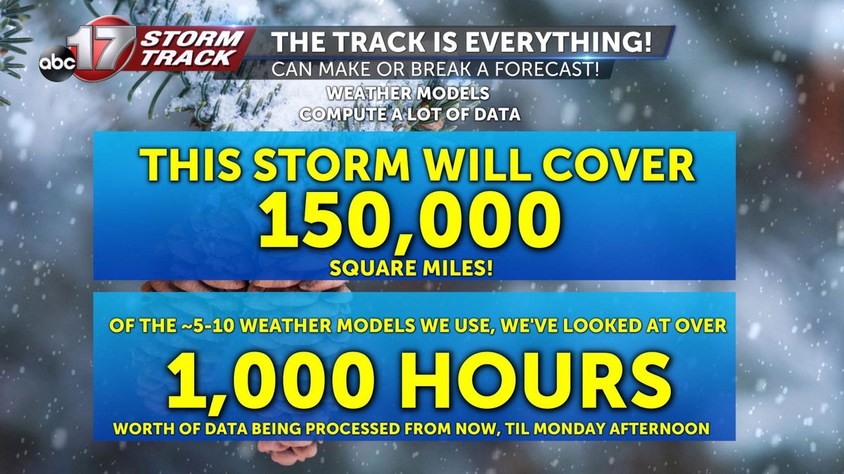
Well, they don't. They're actually pretty sweet. But you have to take into account what these computers are trying to calculate. The developing area of low pressure will eventually cover over 150,000 square miles! These models have to account for this entire storm's temperatures, moisture amounts, pressure values (and much, much, much more).
Think of it like trying to predict a March Madness bracket ... with thousands of teams. (Probably -- I'm not really sure how to check the math on that ...)
The good news is that these supercomputers are very good at calculating all the math that goes into a developing storm system, especially the closer we get to the event occurring. But even then, small-scale changes can have a domino effect to create larger problems in a forecast depending on the quality of data put into the model at initialization.
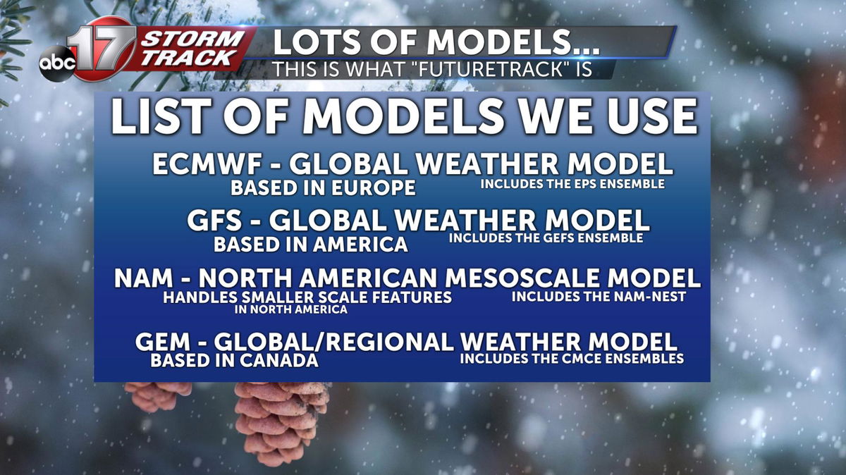
This is just a partial list of all the data we use to make a forecast. If it looks like a lot, that's because it is. We use a combination of operational global/mesoscale models, as well as ensemble data, which works to average out data given several different variables based on current weather conditions.
If absolutely none of this made sense to you...
Don't worry about it. I'm not necessarily trying to get you to be a weather forecaster. That's why we went to school to get a better understanding of how our atmosphere flows.
It's why we spend hours and hours each week, translating this data and creating graphics to help you understand whether you need to cancel your plans. We don't try to be wrong, but sometimes there are things that are impossible to account for, which shatter our forecasts.
Hopefully, this gave you some insight on how our operations work, and the scale of data we have to work with to keep you ahead of the next storm.
-Luke
