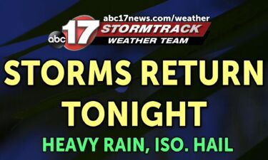
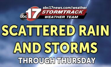
Rain causes flooding on some roads, more rain expected Wednesday night
Crews closed at least two roads in mid-Missouri after rainfall Wednesday.
Continue Reading
Crews closed at least two roads in mid-Missouri after rainfall Wednesday.
Continue Reading
TONIGHT: Scattered showers and storms possible through about midnight. A few storms may contain small hail and brief heavy rain. Lows in the upper 40s with wind gusts up to 30 mph. TOMORROW: Mostly cloudy and warmer with scattered showers and storms possible again by afternoon. Highs in the low to mid-70s. EXTENDED: Scattered showers
Continue Reading
Today: Temperatures top out into the upper-’50s this afternoon thanks to widespread showers and storms. Showers and storms will remain widespread throughout this afternoon into the evening hours. Tonight: Showers and storms will continue promoting southerly flowing winds leading to overnight lows bottoming out near average into the mid-’40s. Extended: Showers and storms will push
Continue Reading
TODAY: Ongoing showers this morning will persist throughout the morning before beginning to taper off this afternoon. Rainfall will likely intensify throughout the mid to late morning, with a few rumbles of thunder likely as well. After a lull in precipitation during much of the afternoon, another round of showers and storms returns this afternoon
Continue Reading
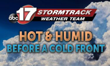
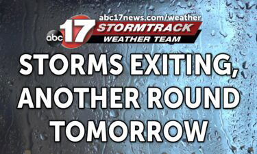
TONIGHT: Mostly cloudy with scattered showers possible. Lows in the mid-40s. TOMORROW: Scattered showers and storms and windy with gusts up to 35 mph. Highs near 60. EXTENDED: Scattered showers move in ahead of a warm front that will be lifting northeast across the region tonight. Temperatures will be more than 15 degrees warmer than
Continue Reading
TODAY: Tuesday morning will start with clear skies, and temperatures below freezing. A Freeze Warning remains in effect through 9 a.m. Once the sun comes up, those clear skies work to our advantage through about noon, when we start to pick more clouds. These clouds will precede a southerly wind shift and chances for rain
Continue Reading
Tonight: Winds remain out of the northwest at 8-12 mph leading to cooler overnight temperatures. A freeze warning is in effect for all of Central Missouri until 9 AM Tuesday morning. The overnight low cools to the lower ’30s south of Columbia with areas to the north of Boone county falling into the upper ’20s.
Continue Reading
TODAY: Clouds will will linger to start your Monday morning, but by mid-morning clouds will start to break apart and more sunshine will debut from west to east. Beyond the late morning, the rest of the day remains mostly sunny. Still, despite the sunshine, a breezy north wind will keep things cool. Highs Monday afternoon
Continue Reading
Tonight: Temperatures will continue to fall thanks to winds pushing in from the northwest. The overnight low drops to the mid-’30s with counties to the north of Randolph falling to freezing leading to a chance of morning frost. Rain will continue to push to off to the east exiting Central Missouri after 10 pm. Tomorrow:
Continue Reading
Easter Sunday: A few sprinkles will be possible near sunrise, with rain chances increasing by late morning. Scattered showers move through Mid-MO during the afternoon. Temperatures will be stuck in the 40s with the soggy conditions. Tomorrow: Skies clear early, helping temperatures warm back to the upper 50s. Breezy with wind gusts up to 25
Continue Reading
Tonight: Clouds begin to enter Mid-Missouri from the west as temperatures begin to fall to the upper ’30s with winds calm out of the northeast. Easter Sunday: Waking up, temperatures will hover into the upper-’30s until mid-morning when light isolated showers will become more widespread leading to afternoon showers. The high peaks into the upper
Continue Reading
SATURDAY: Cool conditions kick off the weekend with highs in the upper 50s today. Skies will remain partly cloudy throughout the afternoon and Mid-MO stays dry. EASTER SUNDAY: Sunrise services should watch for a stray sprinkle in the early morning, with rain chances picking up close to noon. Showers will move through the area from
Continue Reading
First responders and meteorologists give the warning every spring when heavy rains move through Mid-Missouri – “turn around, don’t drown.”
Continue Reading
TONIGHT: Most of us have kicked the rain to the curb, with the last of the showers activity on radar keeping south of Jefferson City as of about 4 p.m. Skies will start to clear after the rain exits, but high cloud cover moves in from the west. This won’t introduce any more chances for
Continue Reading
TONIGHT: Rain exits for most by mid-afternoon, with a cold front pushing it completely out of mid-Missouri by 7p.m. or so. Skies will start to clear after the rain exits, but high cloud cover moves in from the west. This won’t introduce any more chances for rain overnight. We’re cooling into the low 40’s early
Continue Reading
Today: Showers begin to creep in from the southwest after 7 AM leading to widespread showers by 9 AM. Temperatures continue to rise as winds filter in from the southwest with gusts up to 25 mph. Friday’s afternoon high tops out into the mid-’60s. Tomorrow: Temperatures cool slightly after the passage of Friday’s cold front
Continue Reading
TONIGHT: Under clear skies Temperatures fall into the low to mid-40’s by early Friday. TOMORROW: Friday morning, clouds return with a chance for showers. Some south of I-70 may hear thunder. Expect highs in the mid-60’s. EXTENDED: Saturday is a touch cooler but boasts more sunshine. Saturday will be the best day for egg hunts and
Continue Reading
Today: Winds remained sustained at 10-15 mph with gusts up to 30 mph as sky conditions remain mostly sunny. The afternoon high tops out at 60 degrees. Tonight: Strong winds slowly begin to diminish as sustained winds remain at 8-12 mph. The overnight low crawls to the lower ’40s with partly cloudy skies. Extended: Chances
Continue Reading
TODAY: Clear skies and near freezing early; a warmup will still get highs to the upper 50s. TOMORROW: Clouds return with a chance for showers. Highs in the mid-50s. EXTENDED: Friday will bring a few more clouds and a weak front that could trigger a couple showers or storms, but no severe threat is expected with
Continue Reading
TONIGHT: Clearing skies and much cooler with lows in the lower 30s. TOMORROW: Breezy and mostly sunny with highs in the upper 50s to around 60. EXTENDED: Temperatures have fallen off dramatically after this morning’s storms, and we managed to escape much of the severe threat with a handful of severe storm warnings this morning thanks to more
Continue Reading