Thursday’s UV index and pollen tracker
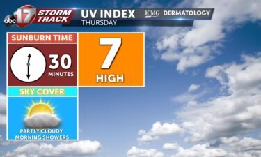
The UV index will be high after chances for rain in the morning. Pollen levels will be moderate Thursday. Grass, plantain, and nettle are the primary allergens.
Continue Reading The UV index will be high after chances for rain in the morning. Pollen levels will be moderate Thursday. Grass, plantain, and nettle are the primary allergens.
Continue Reading
JEFFERSON CITY, Mo. (KMIZ) Inclement weather began passing through Mid-Missouri Wednesday evening and power outages have already been reported throughout the area. In Cole County, Three Rivers Electric is showing 502 customers without power and Ameren Missouri had 165 customers without power at its peak. The Ameren number has come down to 140. The storms
Continue Reading
TONIGHT: An ABC 17 Stormtrack Weather Alert Day is in place for tonight, as strong storms are expected between 6 p.m. and 12 a.m. Flooding will also be possible with these storms into the early hours of Thursday, in our eastern counties. TOMORROW: Some showers and weak storms will linger into early Thursday, but it’s
Continue Reading
Excessive rainfall has recently brought widespread chances for flooding to Mid-Missouri with more possible further into August. Some localized areas have seen instances of half a foot of rain falling in a few hours, which can bring flash floods in just minutes. It’s important not to take these events lightly, as flooding is an underestimated
Continue Reading
UPDATE: Wednesday Afternoon A renewed Areal Flood Watch precedes what will likely be another round of flooding tonight into early Thursday morning. Storms will redevelop after 6 p.m. and bring a risk for heavy and repetitive rainfall, but also severe weather. The threat for severe weather will be higher tonight in comparison to the last
Continue Reading
This Afternoon: Isolated nonsevere rain is possible early afternoon, with possible stronger storms developing after 5 PM. These will last through tonight bringing all severe hazards, winds up to 60 MPH, hail up to 1″ in diameter and a low but not zero chance for a tornado. Tonight: Severe storms exit the area likely around
Continue Reading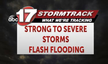
Today: Showers and storms continue to make their way into eastern portions of Mid-Missouri throughout the early morning hours leading to flash flooding across portions of the region. Showers and storms throughout the morning remain until closer to noon where the region begins to dry. This afternoon sees partly cloudy skies with highs reaching into
Continue Reading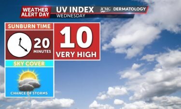
The UV index will be very high between chances for rain around midday. Still, rain will reduce this number for most of the morning. Pollen levels will remain low until Thursday. Grass, plantain, and nettle are the primary allergens.
Continue Reading
Heavy rainfall has inundated portions of central Missouri due to persistent storms tracking over the same regions recently. A specific atmospheric setup is needed for consecutive storms to move over the same area of land in quick succession; typically, the first round will use up most energy. However, our area has been seeing an influx
Continue Reading
COLUMBIA, Mo. (KMIZ) The Boone County Office of Emergency Management is giving a reminder to residents for flood safety tips as Mid-Missouri has the potential to experience flooding. The ABC 17 News Stormtrack Weather Team has issued a Weather Alert Day for Tuesday night and Wednesday morning due to the potential for flooding. The Boone
Continue Reading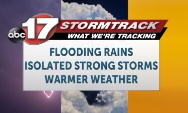
TONIGHT: Mostly dry conditions will stick with us through the dinner hour, with mild temperatures. We expect thunderstorms to redevelop later tonight, sometime around midnight. We have issued an ABC 17 Stormtrack Weather Alert Day from 10 p.m. tonight through 10 a.m. tomorrow for flooding. You can read more details in our ABC 17 Stormtrack
Continue Reading
This Afternoon: Rain exits for the late afternoon with lingering cloud cover keeping conditions mild. Temperatures reach the lower 80s with some parts of Mid-MO only in the 70s today. Overnight: Overnight lows cool to the upper 60s with late-night storms developing after midnight. These storms could bring strong winds, but flash flooding is the
Continue Reading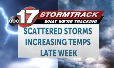
Today: Scattered showers and storms remain across much of Mid-Missouri throughout the day with the possibility of flash flooding and gusty winds being the main threat. A few strong to severe storms remain possible with an addition of hail up to 1″ possible. Afternoon highs climb into the early 80s. Tonight: Overnight lows cool to
Continue Reading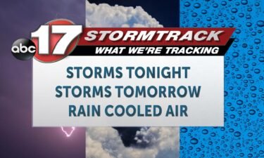
TONIGHT: After steady showers through the day, rainfall will gradually come to an end this evening, and skies will begin to clear for some, especially in the north. Storms will redevelop near midnight, brings heavy rain and an isolated chance for hail. Our biggest concern will be for flash flooding anywhere storms develop, as these
Continue Reading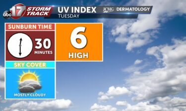
The UV index will be high with mostly cloudy skies through the day with chances for storms through midday. Pollen levels will remain moderate until Thursday, when they temporarily improve. Grass, plantain, and nettle are the primary allergens.
Continue Reading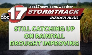
Dry conditions have prevailed most of summertime across our area with the season starting off exceptionally quiet, but a big pattern shift has brought recent changes. July saw more weather systems with scattered periods of rainfall, and large portions of Missouri have caught up on seasonal rain. We saw the highest rain amounts this past
Continue Reading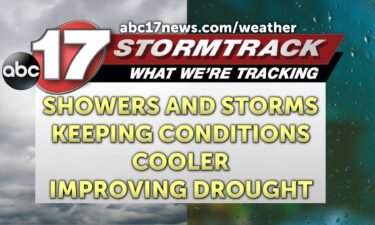
This Afternoon: Highs reach the mid-80s with chances of scattered showers and storms lasting through early evening. Brief dry time is possible around sundown, but we won’t be entirely clear of rain. Tonight: Overnight lows cool to the lower 70s with chances of isolated storms redeveloping. This activity will carry into the early half of
Continue Reading
Today: Afternoon highs climb into the mid-80s with chances of scattered showers and storms beginning after 7 AM lasting throughout the afternoon hours. Winds vary in direction remaining at 4-8 MPH. Tonight: Overnight lows cool to the lower 70s with chances of isolated showers possible. Winds remain out of the southwest at 5-10 MPH. Extended:
Continue Reading
TONIGHT: I’m tracking mostly clear and calm conditions for the evening hours, then overnight we could see storm development. This will be very late night action, and seems to be lasting into the morning hours tomorrow. There are some slight chances these overnight storms produce hail. TOMORROW: I’m tracking those early morning showers and storms
Continue Reading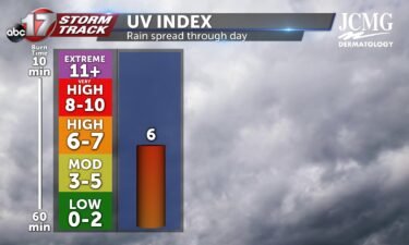
I’m tracking a UV index of 6 tomorrow as rain chances along with cloud cover will be spread throughout the day. This is still a high level though, and with enough sun exposure, it’ll only take about 15-25 minutes to receive a sunburn without protection of sunscreen that’s SPF 50 or higher. With rain spread
Continue Reading