WEATHER ALERT DAY: Severe storms and more flooding likely Wednesday night
UPDATE: Wednesday Afternoon
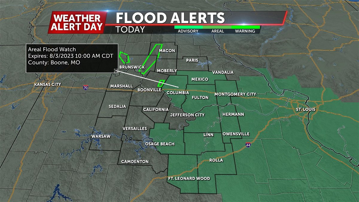
A renewed Areal Flood Watch precedes what will likely be another round of flooding tonight into early Thursday morning. Storms will redevelop after 6 p.m. and bring a risk for heavy and repetitive rainfall, but also severe weather.
The threat for severe weather will be higher tonight in comparison to the last two nights, where storms produced isolated hail and damaging winds.
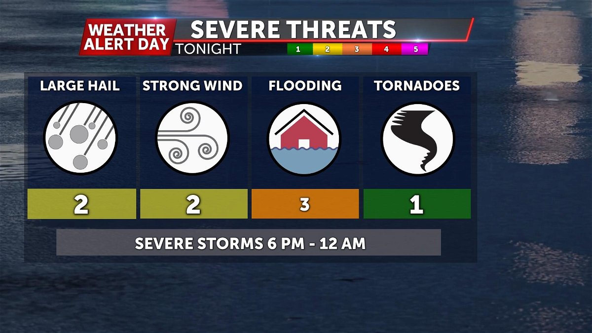
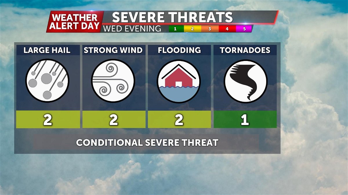
Expect storms tonight to carry a risk for damaging winds, large hail, and the potential for tornadoes. Our greatest concern is with the potential for damaging winds as it appears it will be the most widespread impact.
These storms will push southeast and likely end our severe threat around midnight. Around this time, training thunderstorms may bring even more rain behind the first wave, leading to concerns for flooding into the overnight. As always, TURN AROUND - DON'T DROWN. This flooding will occur after sunset, making it hard to detect flooded roadways. Flooding can damage roadways, meaning it is never safe to drive through flooded roads.
UPDATE: Wednesday Morning
Flash flooding conditions remained widespread throughout the eastern half of Mid-Missouri throughout much of Wednesday morning.
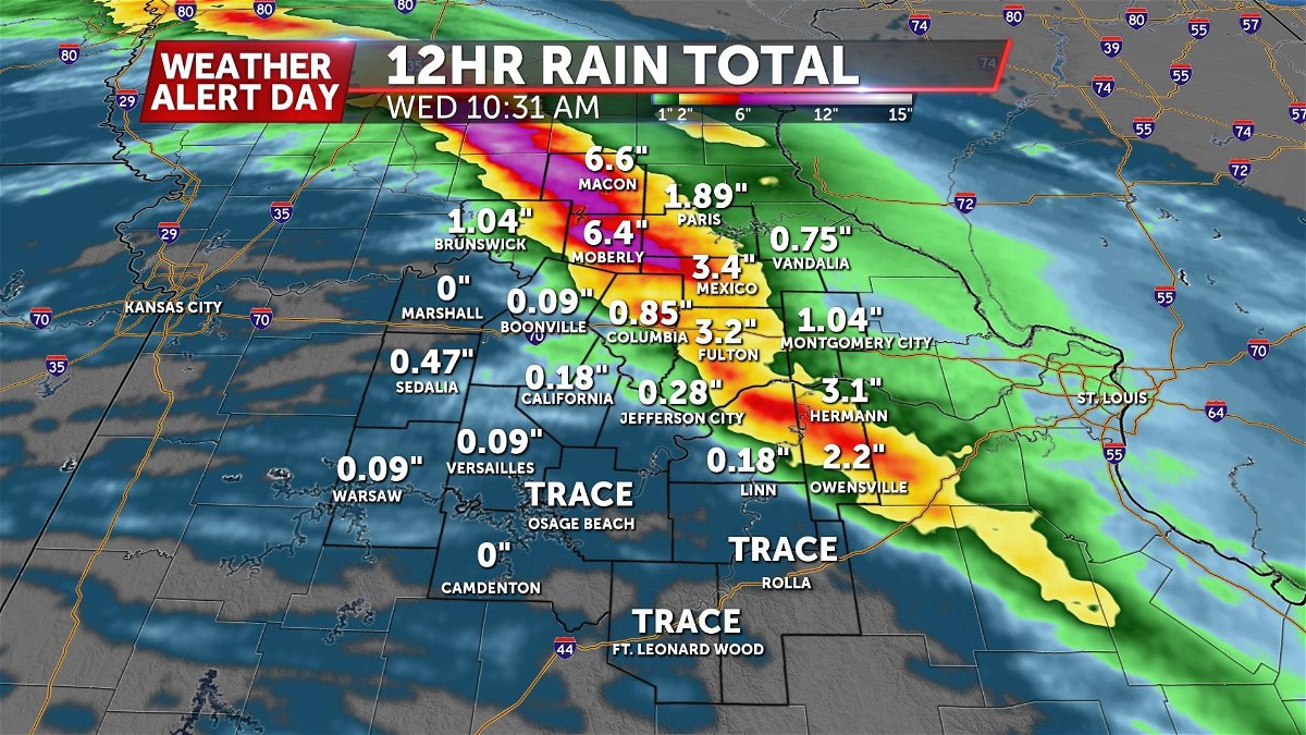
Radar estimated rainfall totals by late morning Wednesday place some areas near Macon and Moberly at over 6" of rainfall leading to saturated surfaces which could cause more issues with the second round of showers and storms this afternoon/ evening.
Storms may develop anytime after 5 p.m. as an upper level wave moves in and triggers development.
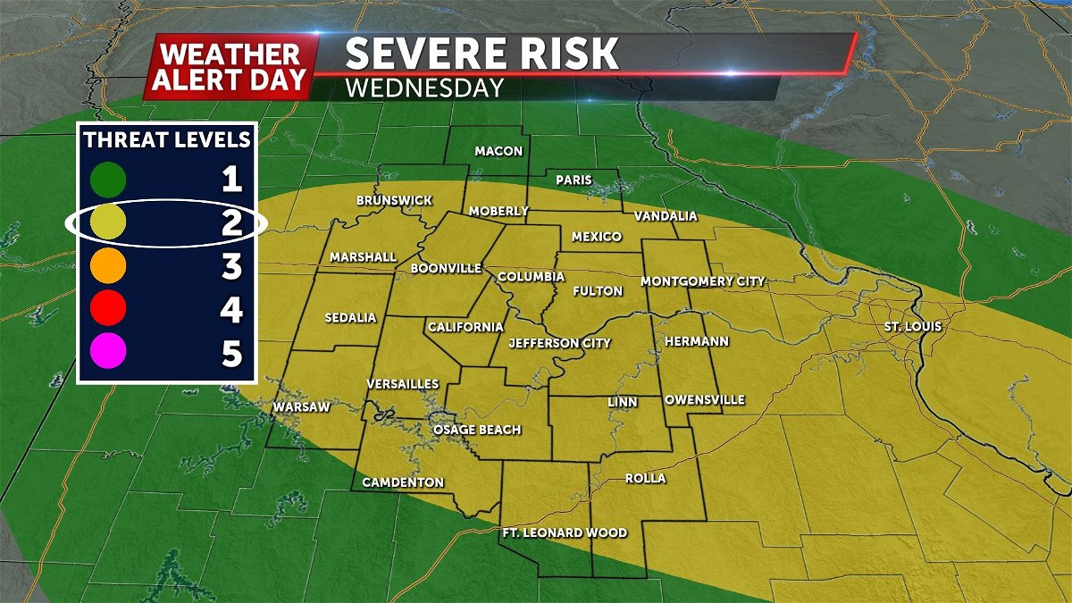
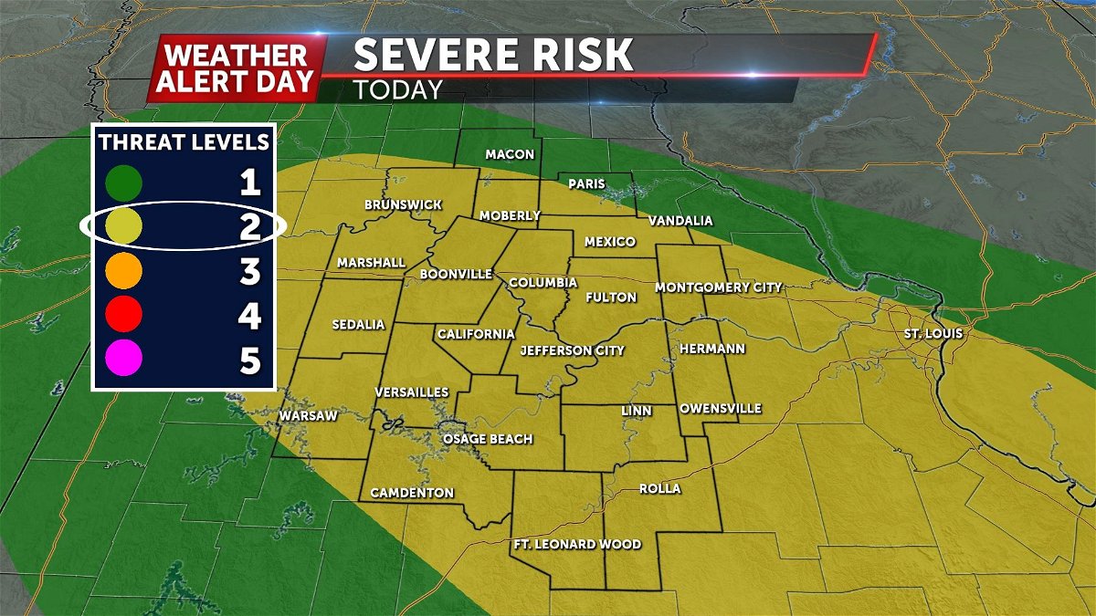
Our greatest chance for strong storms will be along and south of I-70. All types of severe weather are possible, but our greatest risk is for wind and hail. Additionally, flooding may redevelop, but the likelihood of this is best as these storms leave to the southeast.
BLOG:
A combination of factors will create an environment favorable for additional localized flooding Wednesday night. While flooding is our greatest concern, storms both overnight and Wednesday afternoon may have some isolated severe potential. In the areas that don't see much in the way of rain, extreme heat may creep back into the forecast. Read ahead for further details on all of this.
SETUP:
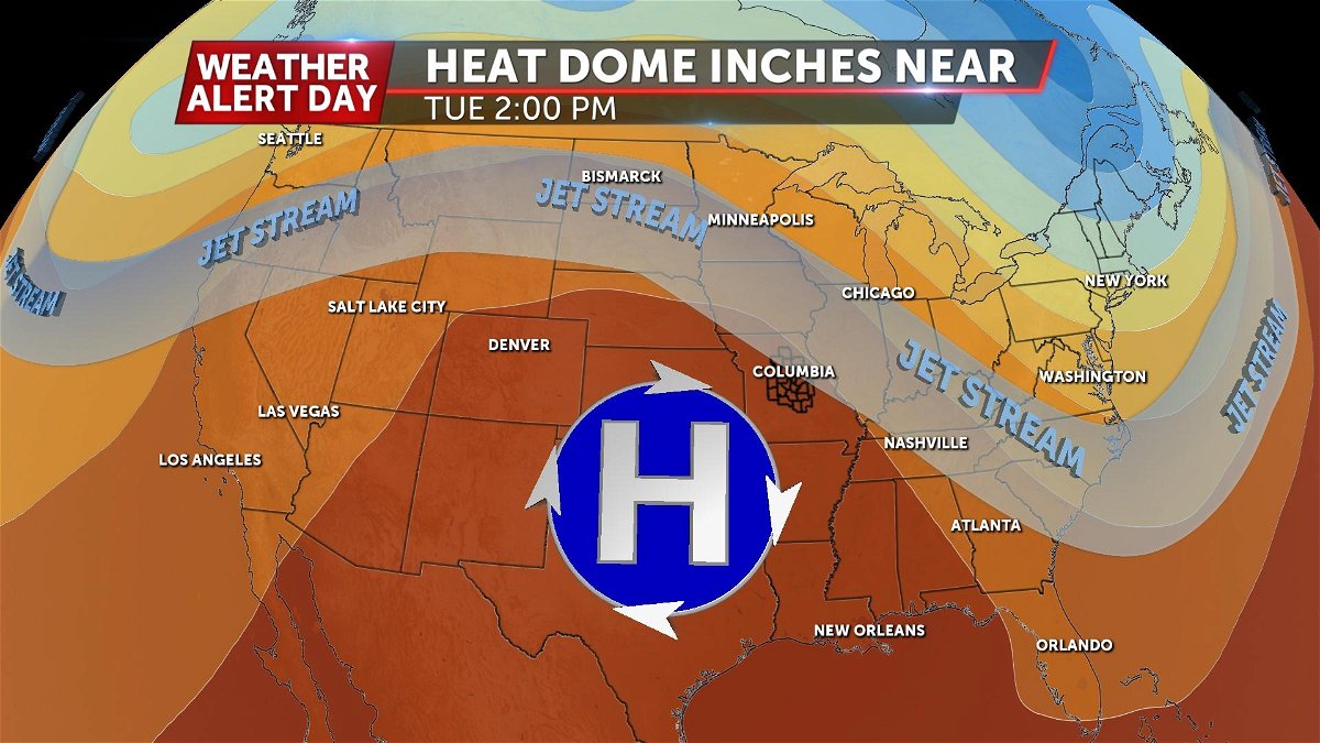
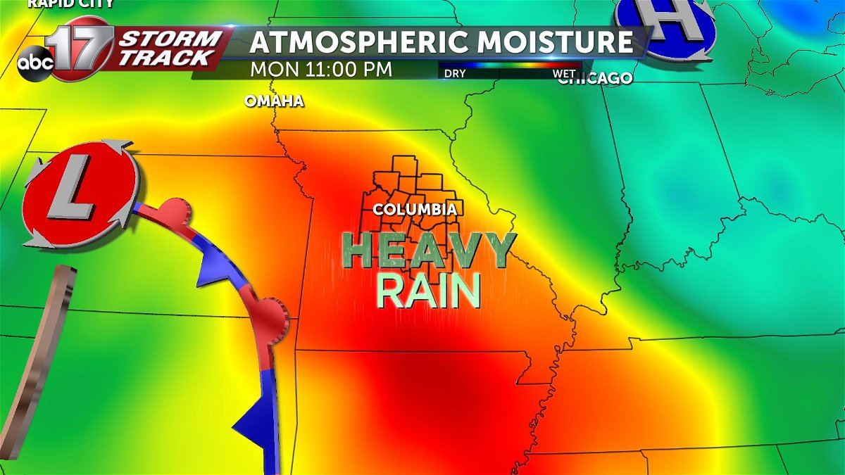
A the upper levels of the atmosphere, high pressure still dominates the picture. Sitting just to our southwest, this upper level high will be close enough to keep the pressure on when it comes to heat. Additionally, the fact that we are just on the outer edge of this high pressure, means that our upper level winds are from the northwest. This is what we call an active pattern, because it typically brings us frequent "disturbances" that often equate to rain and thunderstorm chances if the ingredients are there.
The ingredients certainly are there tonight. While there is high pressure aloft, there is actually a low pressure below it at the surface, in western Kansas.
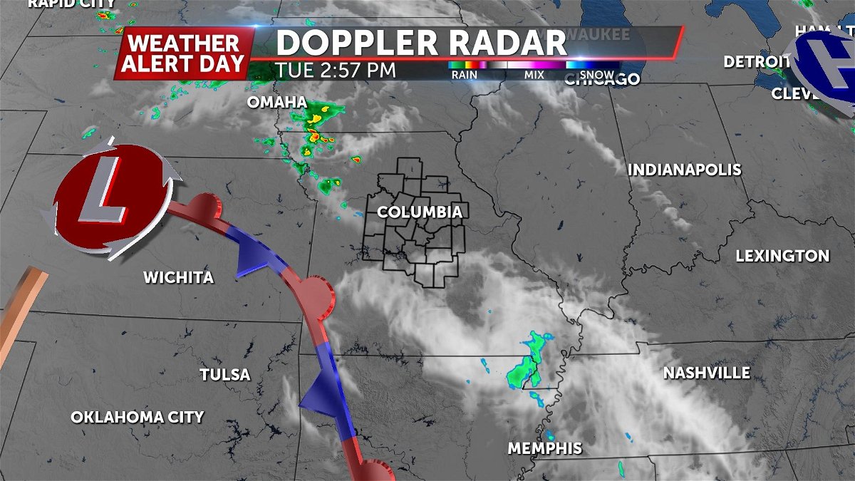
Out ahead of the low, there is a stationary boundary, and associated low-level jet. We'll call this the "LLJ." This LLJ is essentially a stream of wind that will reach over that surface boundary, bring us moisture and lift. The moisture will supply storms with the ability to dump plentiful amounts of rain, and the lift will help generate storms. This boundary, and associated LLJ is moving very slowly, meaning there will be very little movement from east to west with storms that develop tonight. The vast majority of movement will come from our upper level winds (aka: jet stream). The upper level jet will actually be moving parallel to our surface boundary, and there fore our thunderstorms.
TIMING:
Our Weather Alert Day official runs until after midnight Wednesday. This is essentially the expected lifespan of these strong to severe storms tonight. After midnight, the risk of stronger storms pushes east and isolated storms with lesser impacts remain into Thursday morning before clearing by the afternoon.
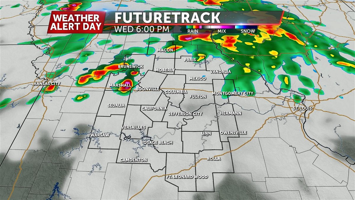
The start time for these storms begins after 5 PM in northwestern portions of Mid-Missouri as they look to move southeast gaining strength through the environment.
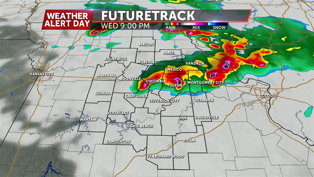
These storms become more widespread after 6PM carrying the severe potential well into central portions of Mid-Missouri by 9 PM. Eventually moving east after midnight.
IMPACTS:
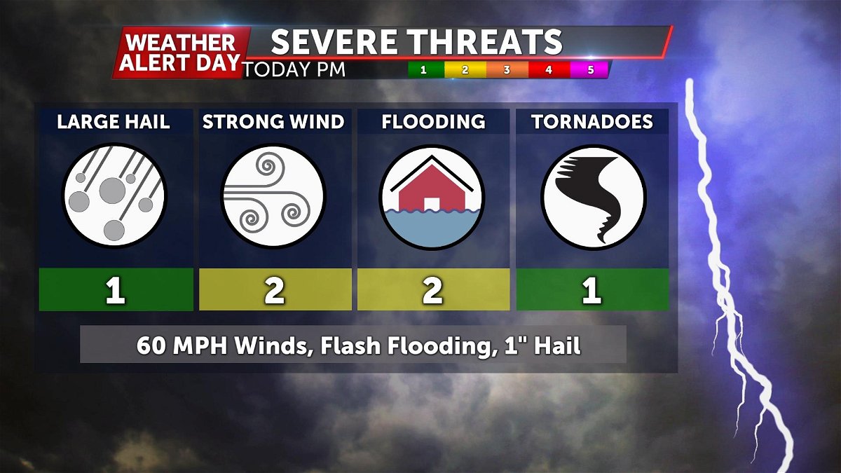
Storms Wednesday afternoon into the overnight hours provide conditions favorable for damaging winds and localized flooding once again.
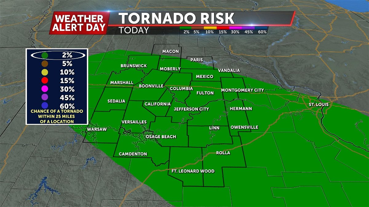
A level 1/5 risk exists for much of Mid-Missouri for the possibility of a isolated tornado or two. Conditions this afternoon could add to some rotating motions on storms driving this potential. Although this risk remains possible, it is very low and dies off after midnight.
