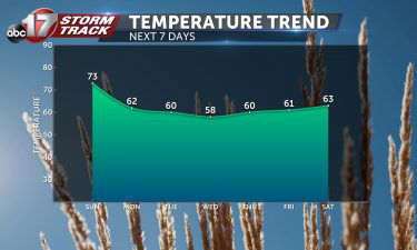
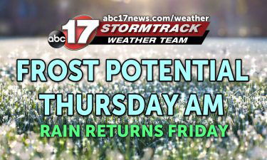
Skip to Content

Weather Video

Tracking significant impacts into Friday with wintry mix moving in

*A Weather Alert Day is in effect through Friday afternoon for the threat of dangerous road conditions and power outages due to ice accumulation* TONIGHT: Cloudy with temperatures hovering below freezing. Precipitation moves in late, likely after midnight for most areas. Freezing rain continues overnight into Friday morning, causing slick roads and potential power outages.

Continue Reading

Tracking an icy close to 2020

THURSDAY: The day is going to be misleadingly quiet. Temperatures will struggle to warm up much, only topping out in the middle 30’s. Don’t let the sunshine fool you today, though. TONIGHT: Our next system pushes in tonight and looks to bring a widespread mix of freezing rain and rain to the viewing area. The timing looks

Continue Reading

Tracking winter weather

TUESDAY: A wintry mix is expected to move in this morning. Will start out as snow before changing over to a mix of sleet and freezing rain into the early afternoon hours. Limited impacts expected for most of us, but our extreme northwestern counties should expect some slick roads this afternoon. Tempeatures will struggle to warm

Continue Reading