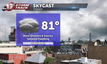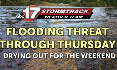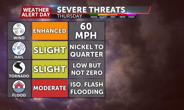
Tracking the last of the rain overnight into Thursday
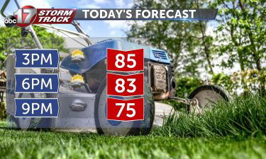
TONIGHT: Mostly cloudy with scattered showers and a few thunderstorms. Lows in the upper 60s to around 70. TOMORROW: Mostly cloudy with scattered showers becoming more sparse by afternoon. Highs in the lower 80s. EXTENDED: Most of the measurable rainfall will come to an end south of I-70 by around midday with a few lingering
Continue Reading