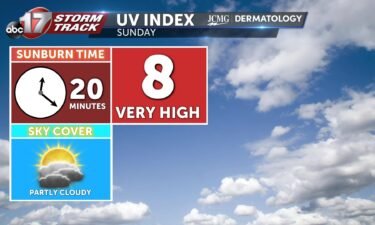
Sunday’s UV index and pollen tracker
The UV index will be very high with partly cloudy skies. Pollen levels will be moderate to high. Grass, plantain, and nettle are the primary allergens.
Continue Reading The UV index will be very high with partly cloudy skies. Pollen levels will be moderate to high. Grass, plantain, and nettle are the primary allergens.
Continue Reading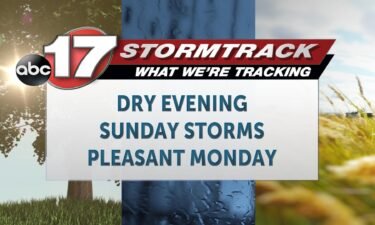
TONIGHT: Mostly dry conditions should continue through the rest of the evening, before more storms Sunday morning. Temperatures in the 80’s this evening are expected to cool into the upper 60s. TOMORROW: Sunday’s storm forecast is complex. We’ll see showers and storms nearby overnight, and they will have potential to carry over into the region
Continue Reading
Today: Nearly all of Saturday is expected to be dry with partly cloudy skies. Highs reach around 90 degrees, and it’ll still be muggy as you head out so stay hydrated. Today is a great day to head to the fair as we stay dry! Tomorrow: Storm chances have shifted even further into Sunday, with
Continue Reading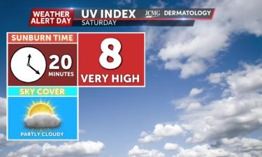
The UV index will be very high on Saturday with partly cloudy skies. Pollen levels will be moderate to high. Grass, plantain, and nettle are the primary allergens.
Continue Reading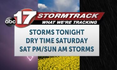
TONIGHT: Today is an ABC 17 Stormtrack Weather Alert Day. Storms will develop before 6 p.m. this evening, just East of Kansas City, and arrive in our western counties closer to 6 p.m. Storms will likely arrive near Marshall and Brunswick. Areas from here to Mexico, and south to Sedalia and Jefferson City, will have
Continue Reading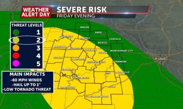
UPDATE: Friday evening Timing of storms Storms will arrive around 6 p.m. near Brunswick and Marshall, before spreading east through the night. Storms will have severe potential all the way across mid-Missouri. SETUP: In the upper atmosphere, high pressure is still staying strong. We aren’t seeing as many impacts heat wise from this system, but
Continue Reading
Today: Friday morning sees continuous scattered showers and storms leading to increased chances of flooding conditions for areas hit with higher rainfall the past several days. Highs warm into the mid-80s. Friday late afternoon sees increased chances of a few isolated stronger to possibly severe storms with the primary impact of strong winds up to
Continue Reading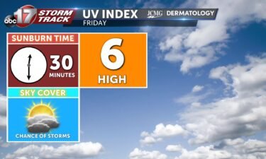
The UV index will be high after chances for rain in the morning. Pollen levels will be moderate. Grass, plantain, and nettle are the primary allergens.
Continue Reading
TONIGHT: Showers and a few rumbles are expected through the rest of the evening, but mostly dry conditions should remain at least through midnight. Some more thunderstorm development is possible again after midnight, near I-44. An isolated strong storm is possible here. Confidence in additional flooding is low, and the severe threat very isolated as
Continue Reading
A major state highway along the Missouri River in Callaway County was among those listed as closed by flooding Thursday morning across the state.
Continue Reading
Early this morning, a strong storm moved through Columbia Regional and Ashland that brought damaging winds along with heavy rain. On average, the areas surrounding Columbia Regional were observing winds in the 50-60 mph range, but Columbia Regional submitted a storm report of winds up to 80 mph. This was recorded at approximately 3:42 AM,
Continue Reading
TONIGHT: I’m tracking more isolated PM shower and storm chances, with temperatures getting down into the low 70s. It will be humid, as dewpoints will be staying a couple degrees lower than the actual temperatures outside. TOMORROW: I’m tracking more chances for scattered showers and storms, with temperatures getting up into the high 80s. This
Continue Reading
Hundreds of homes were without power and parts of Mid-Missouri were under flash flood warnings Thursday morning as storms continued to hammer the area.
Continue Reading
Today: Afternoon highs only reach into the mid-80s thanks to mostly cloudy sky conditions throughout the region. Isolated showers and storms remain possible throughout the afternoon hours mainly along and south of I-70. Brief downpours will be the main impact with these showers/ storms. Tonight: Isolated showers/ storms remain along and south of I-70 throughout
Continue Reading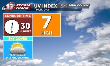
The UV index will be high after chances for rain in the morning. Pollen levels will be moderate Thursday. Grass, plantain, and nettle are the primary allergens.
Continue Reading
JEFFERSON CITY, Mo. (KMIZ) Inclement weather began passing through Mid-Missouri Wednesday evening and power outages have already been reported throughout the area. In Cole County, Three Rivers Electric is showing 502 customers without power and Ameren Missouri had 165 customers without power at its peak. The Ameren number has come down to 140. The storms
Continue Reading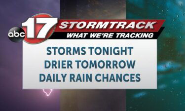
TONIGHT: An ABC 17 Stormtrack Weather Alert Day is in place for tonight, as strong storms are expected between 6 p.m. and 12 a.m. Flooding will also be possible with these storms into the early hours of Thursday, in our eastern counties. TOMORROW: Some showers and weak storms will linger into early Thursday, but it’s
Continue Reading
Excessive rainfall has recently brought widespread chances for flooding to Mid-Missouri with more possible further into August. Some localized areas have seen instances of half a foot of rain falling in a few hours, which can bring flash floods in just minutes. It’s important not to take these events lightly, as flooding is an underestimated
Continue Reading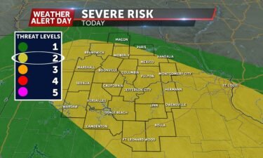
UPDATE: Wednesday Afternoon A renewed Areal Flood Watch precedes what will likely be another round of flooding tonight into early Thursday morning. Storms will redevelop after 6 p.m. and bring a risk for heavy and repetitive rainfall, but also severe weather. The threat for severe weather will be higher tonight in comparison to the last
Continue Reading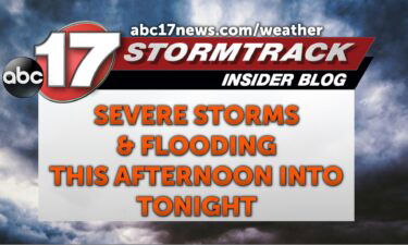
This Afternoon: Isolated nonsevere rain is possible early afternoon, with possible stronger storms developing after 5 PM. These will last through tonight bringing all severe hazards, winds up to 60 MPH, hail up to 1″ in diameter and a low but not zero chance for a tornado. Tonight: Severe storms exit the area likely around
Continue Reading