Tracking more mild conditions before an active workweek
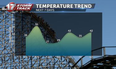
Sunday: Winds will switch from the southwest to the northwest leading to a cooler breeze today. We still start out warmer in the 20s but only make it to near 40 in the afternoon. Monday: Another shift in winds will lead to a nice warmup to start the workweek. Highs break into the mid-50s under
Continue Reading