Sunday’s UV Index and Pollen Tracker
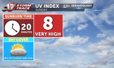
Sunday’s UV Index is an 8, which is very high. This means it will only take 20 minutes to receive a sunburn without the proper protection. Pollen levels will be increasing throughout next week.
Continue Reading Sunday’s UV Index is an 8, which is very high. This means it will only take 20 minutes to receive a sunburn without the proper protection. Pollen levels will be increasing throughout next week.
Continue Reading
TODAY: Scattered showers and storms bring lightning and heavy downpours to some spots. Temperatures are hot but a few degrees below average in the mid to lower 80s. TOMORROW: Rain chances drop on Sunday but isolated showers and storms are possible in the afternoon and evening. Highs will be a few degrees warmer with less
Continue Reading
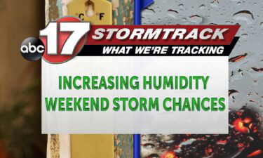
TONIGHT: Overnight rain chances diminish after sunset with partly cloudy skies. Lows cool to the upper 60s near 70 degrees. TOMORROW: Saturday welcomes scattered shower and storm chances throughout the day as highs rise into the lower 80s. Moderate downpours and lighting continue to remain the main threats. EXTENDED: Storm chances remain around the region
Continue Reading
It’s the time of year when everything outdoors is hot and sometimes dangerous. Pavement can burn bare skin during the day, and cars are notorious for baking in the summer heat. While we’ve already seen several months of hot temperatures it’s important to stay vigilant while heading out for summer plans. Cars can be dangerous
Continue Reading
THIS AFTERNOON: Friday remains hot and humid with the feels like up to 90 degrees. Isolated storms are possible in the heat of the day. TONIGHT: Rain chances drop as temperatures fall overnight to the lower 60s. Cloud cover sticks around all night. EXTENDED: Saturday starts mostly dry but scattered showers and storms will move
Continue Reading
TODAY: Friday will be much the same as Thursday, with partly cloudy skies and isolated afternoon storms. Highs will reach mid-to-upper 80s, and feel like 90s thanks to humidity. TONIGHT: Skies cloud overnight, as an upper level low moves in from the south. Temperatures fall into the upper 60s, with mostly dry weather overnight. EXTENDED:
Continue Reading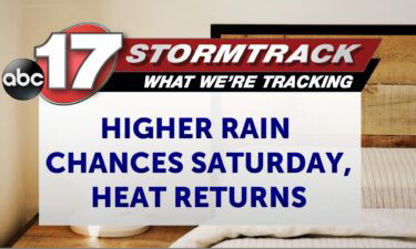
TONIGHT: Isolated storms through sunset with mostly clear skies overnight. Lows in the upper 60s. TOMORROW: Partly to mostly sunny with highs in the mid-upper 80s. Feels like the low 90s. Best chance of rain south of I-70. EXTENDED: Spotty storms have developed as a cold front works its way south across Mid-Missouri, but most
Continue Reading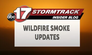
Skies across the region are filled with clouds from scattered storms, and also haze from wildfire smoke originating over northwestern portions of Canada. Conditions Thursday evening show the western half of the United States coated with lower level smoke. Friday morning into the rest of the afternoon, starts to see smoke pulling back west allowing
Continue Reading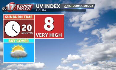
TODAY: Thursday is another warm and muggy day, with highs in the upper 80s, but feeling like low 90s. An isolated storm or two is possible, but we’re mostly dry. TONIGHT: Temperatures fall into the 60s under mostly clear skies. EXTENDED: Friday brings another mostly dry day with a chance for pop up storms and
Continue Reading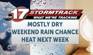
TODAY: Thursday is another warm and muggy day, with highs in the upper 80s, but feeling like low 90s. An isolated storm or two is possible, but we’re mostly dry. TONIGHT: Temperatures fall into the 60s under mostly clear skies. EXTENDED: Friday brings another mostly dry day with a chance for pop up storms and
Continue Reading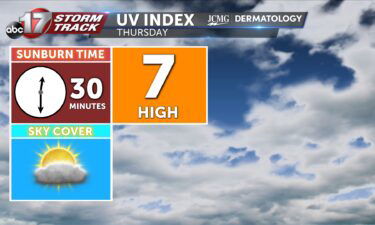

The black bear population is looking up as we head into the future across the state. This also means increased sightings possible across Mid-Missouri. Black bear populations are increasing at a rate of 8%. The current population estimation is just under 1,000 across the Show-Me State. This means in the next ten years, we could
Continue Reading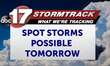
TONIGHT: Mostly clear with lows in the upper 60s. Patchy fog in low lying areas. TOMORROW: Partly sunny with a few isolated showers and storms. Highs in the upper 80s. EXTENDED: We can expect another quiet night as temperatures fall into the upper 60s overnight. Fog won’t be as likely, but could be patchy in
Continue Reading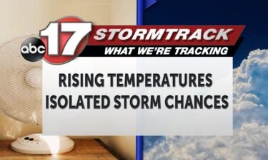
TODAY: Wednesday will be much like Tuesday, with partly cloudy skies and a high in the mid-to-upper 80s, but likely a degree or two warmer and less of a chance for a pop-up shower. Dry conditions will likely remain through the day. TONIGHT: Skies will clear into the night, and temperatures will once again fall
Continue Reading
As Mid-Missouri sits into later portions of July, isolated pulse thunderstorms remain a possibility most days this week. Just southeast of Mid-Missouri, pulse thunderstorms can be observed towards Cape Girardeau. These single celled storms have brought lighting, brief wind gusts, and moderate downpours across isolated areas, but remain short lived falling well short of becoming
Continue Reading
TONIGHT: Mostly clear with fog developing late. Lows in the upper 60s. TOMORROW: Mostly sunny and warm with highs in the upper 80s. A few spotty storms are possible by late afternoon into early evening. EXTENDED: Overnight, we’ll continue to track light winds and temperatures falling to near the dew point, allowing for more fog
Continue Reading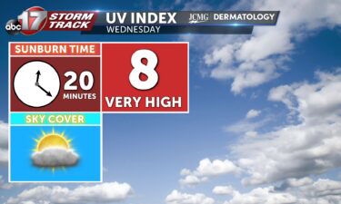

TODAY: Tuesday is much like Monday, with a high in the mid-80s and mostly dry. Only a slim chance for an isolated storm returns this afternoon from partly cloudy skies, but any one person has an extremely low chance at finding themselves underneath one. Winds are light and variable. TONIGHT: Skies will clear out overnight,
Continue Reading