Weather
Tracking lasting heat with late week possible spotty storms
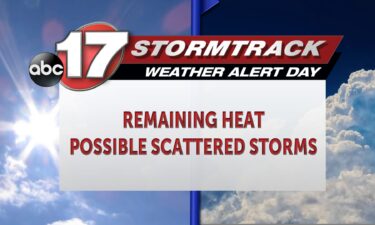
TODAY: Tuesday is an ABC17 Stormtrack Weather Alert Day as heat lingers that could be dangerous with prolonged exposure. Highs will reach mid-90s with enough humidity to have us feel about 10 degrees warmer. TONIGHT: A few storms may develop after 4 p.m. this evening. Severe weather is not anticipated, but if a storm can sustain itself
Continue Reading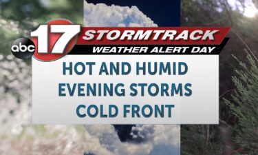
Tracking a muggy and stormy week ahead of a cool and calm weekend
TODAY: Tuesday is an ABC17 Stormtrack Weather Alert Day as heat lingers that could be dangerous with prolonged exposure. Highs will reach mid-90s with enough humidity to have us feel about 10 degrees warmer. TONIGHT: A few storms may develop after 4 p.m. this evening. Severe weather is not anticipated, but if a storm can
Continue Reading
Above average heat grips the Midwest
With an ABC 17 Stormtrack Weather Alert Day issued for both Monday and Tuesday due to dangerously high heat indices, many people across the region have felt caught off guard. Highs have reached into the mid-90s with the heat index surpassing the triple digit threshold this afternoon. This puts as well above average considering our
Continue Reading
Tracking another day of dangerous heat, few storms Tuesday
TONIGHT: Mostly clear and muggy with lows in the mid-70s. TOMORROW: Mostly sunny and hot with highs in the upper 90s and heat index values near 105 degrees. A few isolated showers and storms are possible by late afternoon into early evening, especially north of I-70. EXTENDED: In addition to tomorrow’s heat, we’ll be tracking
Continue Reading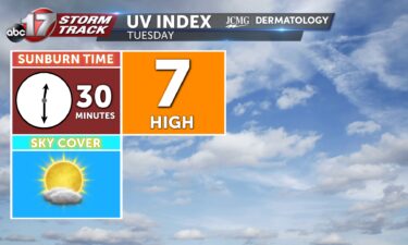
Tracking the return of dangerous heat
TODAY: Monday is an ABC17 Stormtrack Weather Alert Day as it is hot. We will have a feels like temperature above 105 for some today and Tuesday which is also an alert day. TONIGHT: After a hot and sunny day, we’ll have a warm overnight, keeping lows in the 70s under mostly clear skies. EXTENDED: Tuesday as
Continue Reading
Tracking dangerous heat, storms, and a distant cooldown
TODAY: Monday is an ABC17 Stormtrack Weather Alert Day as it is hot. We will have a feels like temperature above 105 for some today and Tuesday which is also an alert day. TONIGHT: After a hot and sunny day, we’ll have a warm overnight, keeping lows in the 70s under mostly clear skies. EXTENDED:
Continue Reading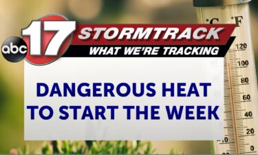
Tracking dangerous heat the next few days
TONIGHT: Mostly clear and muggy with lows in the mid-70s. TOMORROW: Mostly sunny and hot with highs in the upper 90s and a heat index near 105. A Weather Alert Day is in effect. EXTENDED: We can expect a muggy night as upper high pressure has settled in with the northern edge of the high
Continue Reading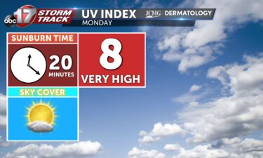

Tracking dangerous heat into the workweek
TODAY: Clouds exit quickly in the morning. Temperatures warm back to the lower 90s with the heat index nearing 100 degrees. TOMORROW: Heat gets worse on Monday with constant sunshine and more humidity. The heat index will top out at 105 north of I-70. EXTENDED: Widespread dangerous heat lasts through Wednesday before rain chances begin
Continue Reading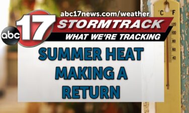
Tracking summer heat taking over the work week
TONIGHT: I’m tracking cloud cover breaking apart as rain continues to move to the southeast throughout the evening. Temperatures will drop into the high 60s and low 70s by the end of the night with winds out of the southeast at 5-10 mph. TOMORROW: I’m tracking a lower chance at rainfall (20%) during the morning
Continue Reading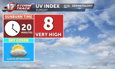
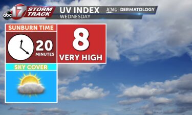
Sunday’s UV Index and Pollen Tracker
Sunday’s UV Index is an 8, meaning it will only take 20 minutes to receive a sunburn without the proper protection. Pollen levels will be very high throughout the start of the work week.
Continue Reading
Tracking dry time this weekend in between storms
TODAY: Scattered morning storms in southwest Mid-MO last until noon. Temperatures reach the mid to upper 80s. TOMORROW: Another round of morning storms is possible Sunday morning east of Hwy 63. Highs will still return to the 90s after these storms for parts of the area. EXTENDED: High heat and humidity for the first half
Continue Reading
Tracking Spotty Rain Chances and Summer Heat Returning
TONIGHT: I’m tracking a gradual increase in cloud cover with the low possibility to run into light rain throughout the evening. Temperatures will drop into the low 70s by the end of the night and winds will be out of the southeast at 5-8 mph. TOMORROW: I’m tracking a better shot at rainfall from the
Continue Reading
First named storm in Central Pacific in 5 years impacts Hawaii this weekend
It was a quiet start to the Pacific hurricane season, but things are heating up again with a storm passing south of Hawaii early next week. Tropical Storm Hone is expected to reach hurricane strength tomorrow and is the first named storm in the Central Pacific basin since 2019. At the same time, the strongest
Continue Reading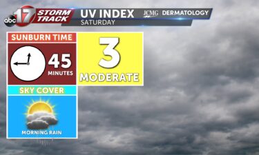
Saturday’s UV Index and Pollen Tracker
Saturday will have a UV Index of 3, meaning it will take 45 minutes to receive a sunburn without the proper protection. Pollen levels will be very high throughout the weekend into next week.
Continue Reading
Tracking a weekend warmup despite storm chances
TODAY: Friday is warmer thanks to the return of south wind. Expect highs in the mid-80s under partly cloudy skies. TONIGHT: A sprinkle or two will be possible this evening, otherwise just partly cloudy skies and a low in the 60s and 70s is expected. EXTENDED: Chances for showers and storms arrive by 5-7 a.m.
Continue Reading
Tracking rain and a warmup
TODAY: Friday is noticeably warmer thanks to the return of south wind. Expect highs in the mid-80s under partly cloudy skies. TONIGHT: A sprinkle or two will be possible this evening, otherwise just partly cloudy skies and a low in the 60s and 70s is expected. EXTENDED: This has us warmer and somewhat muggy to
Continue Reading
Tracking the return of heat and humidity, scattered storms
TONIGHT: Mostly clear and slightly warmer with lows in the upper 50s to around 60. TOMORROW: Partly to mostly sunny and warmer with highs in the mid-upper 80s. EXTENDED: We can expect our last cool night for the week as lows dip to near 60 for one more evening. Winds begin to shift to the
Continue Reading