Skip to Content

Tag: daily forecast

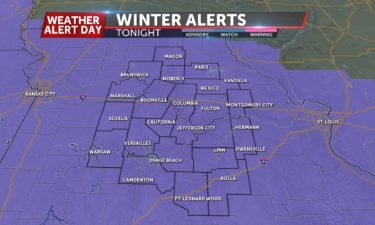
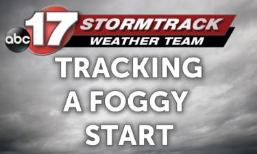
Tracking a foggy start to the week

MONDAY: Areas of patchy fog are possible this morning as well as some light snow. A rather weak disturbance is rolling through this morning with enough moisture that a dusting could be possible in some spots. That, along with potentially freezing fog and yesterday’s melting snow running off and refreezing in some locations could lead

Continue Reading

Finally settling down, for now

TUESDAY: Things look slick in some spots as heading out this morning. Temperatures will start out around 10 but will improve more than yesterday, topping out near the freezing mark with more sunshine. TONIGHT: Clouds will increase overnight. That, combined with winds out of the south will keep temperatures in the 20s overnight. EXTENDED: We’re

Continue Reading

Warmer temperatures returning

MONDAY: Winds have swung around to a more southerly direction which will help temperatures get back into the upper 40s to near 50 later this afternoon, even as we battle cloud cover throughout the day. TONIGHT: Mostly clouds conditions stick around, but that helps keep temperatures into the upper 30s overnight. EXTENDED: Sunshine looks to

Continue Reading

Winter returns to Mid-Missouri

SATURDAY: We’ll see a transition to a wintry mix, and eventually over to mostly snow. Accumulations are expected to be in the 1-4” range, for a detailed breakdown CHECK OUT THE INSIDER BLOG TONIGHT: We’ll see any lingering flurries taper off tonight as overnight lows fall into the teens. Any untreated roads will still be

Continue Reading

Sunday Warm Up

TODAY: Sunshine returns once more to Mid-Missouri. We’ll see a pleasant warm up into the lower 50s across the area with a light breeze. The wind may pick up slightly north of I-70. TONIGHT: Clouds build in as a weak cold front pushes through our area. Lows will be in the upper 20s. EXTENDED: The cold front

Continue Reading

Tracking rain chances tonight

THURSDAY: Clouds return but the mild temperatures stick around with highs reaching the low to mid 50s again. TONIGHT: Some of our southeastern counties pick up a chance of light showers overnight. Lows will fall into the mid to upper 30s. EXTENDED: This system looks to bring some colder air in addition to those rain

Continue Reading

New Year New Warmth

NEW YEAR’S DAY: Lots of sunshine will warm us into the lower 50s. TONIGHT: Some clouds will move back into the area. Lows in the upper 30s. EXTENDED: Showers begin Thursday evening into Friday, ending as light snow showers through Saturday morning. Previously, we had anticipated more moisture moving into our area during the day

Continue Reading
Skip to content