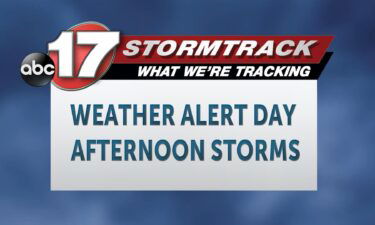
WEATHER UPDATES: Basketball games at Harrisburg High School canceled due to snow
Check back for updates about the winter storm.
Continue ReadingCheck back for updates about the winter storm.
Continue ReadingWatch a live-streamed newscast at 7 a.m. in the player below. The ABC 17 Stormtrack Weather Team is tracking the latest chance at accumulating snow that could impact Mid-Missouri early this weekend. With a complex situation, we’ll have the latest updates as we learn them below: SATURDAY MORNING UPDATE: Warm air has held stubbornly overnight
Continue ReadingSATURDAY Accumulating snow falling this morning. Most of us will end up with 1-3” but areas north and east will see some slightly higher amounts. Temperatures will hold in the upper 20’s this afternoon as that snow moves south. Winds out of the north, gusting to 30 mph, will keep the wind chill in the
Continue ReadingSnow will be coming back to Mid-Missouri and it’s expected to be a couple of inches of snowfall.
Continue ReadingAccording to the National Weather Service, if you find yourself in a situation where you have to drive during a snowstorm there are specific safety steps to take which include checking your speed and being attentive while driving.
Continue Readingbest to stay off of the roads during a winter storm but at times that can be unavoidable.
Continue ReadingABC 17’s Stormtrack team has issued a Weather Alert Day for Saturday because of the chance for snow.
Continue ReadingTONIGHT Rain showers will increase in coverage this evening, before turning over to snow from north to south. The onset of snow looks to begin after 7PM in the north, and move south overnight. Temperatures will drop into the upper 20’s overnight. SATURDAY Once the changeover occurs, it will stay as snow falling into Saturday
Continue ReadingToday: Moisture moves into Central Missouri this afternoon leading to scattered light showers with highs into the mid-’40s. Tonight: Scattered showers begin transitioning into a wintery mix before finally switching completely to snow for the northern half of the viewing area. Temperatures begin to drop just below freezing overnight tonight. Extended: Any moisture in Central
Continue ReadingFRIDAY Clouds are on the increase and could get low enough to reduce visibility along and north of HWY 24 this morning. We’ll manage to stay dry until showers start to move in this afternoon. Highs will top out in the low to mid 40’s. TONIGHT Temperatures will cool off overnight. Enough that the rain
Continue ReadingRoad crews with Jefferson City Public Works and Columbia Public Works are putting their plans in place to get the cities roads cleared as fast as possible.
Continue ReadingTONIGHT A continued north breeze will drop temperatures down into the low 30’s tonight, with clouds increasing. FRIDAY We are waking up to cool and cloudy conditions on Friday, ahead of an approaching storm system. Showers are moving in by the late morning and afternoon hours, with a changeover to snow coming later in the
Continue ReadingToday: Temperatures continue to warm up this afternoon thanks to mostly clear skies into the lower ’50s. Tonight: Winds switch back out of the northwest as cloud cover slides in late this evening allowing for temperatures to bottom out just below freezing. Extended: Friday afternoon a low-pressure system moves in from the Dakotas bringing with
Continue ReadingTHURSDAY A stray sprinkle will be possible east of HWY 63 this morning but most of us will stay dry. Highs today will reach the lower 50’s again as sunshine returns this afternoon. TONIGHT Clouds will be on the increase late tonight as lows fall to about 30. We’ll stay dry but it will feel
Continue ReadingTONIGHT Temperatures cool into the 30’s again tonight, with a westerly breeze under partly cloudy skies. A weak front will pass through overnight into Thursday, but we stay dry, and minimal impact is expected on temperatures. THURSDAY More partly cloudy skies are in store for Thursday. Temperatures will likely bounce back to near 50 degrees
Continue ReadingToday: Temperatures continue to increase into the mid-’50s as winds switch from the southwest back out of the northwest. Skies remain mostly sunny. Tonight: Temperatures cool down to near freezing thanks to northerly flowing winds with partly cloudy skies. Extended: A low-pressure system moves in Friday afternoon bringing with it cooler temperatures and increased chances
Continue ReadingWEDNESDAY It’ll be another enjoyable afternoon! Temperatures will top out in the middle 50’s with a few clouds passing by. The breeze we were tracking yesterday will back off some, as well. TONIGHT The partly cloudy skies will stick around. We’re tracking a front moving through overnight that could bring a passing shower by daybreak
Continue ReadingTONIGHT After a day with temperatures in the mid 50’s, a continued southwest breeze keeps us relatively warm with lows tonight dropping into the low 30’s by Wednesday morning. WEDNESDAY Temperatures are back into the low 50’s on Wednesday with winds still out of the southwest. Some extra clouds will move in tomorrow, but it
Continue ReadingTUESDAY Gusty southerly winds will boost highs to the upper 40s today. Sunny all day with wind gusts up to 30 mph. TONIGHT A few clouds move in overnight as breezes stick around, and lows dip to the lower 30s. EXTENDED Temperatures continue to climb tomorrow as we reach the low 50s. This may last
Continue ReadingTUESDAY We’re off to a chilly start again but we’ll start to warm things up going forward. Winds will pick up, gusting to 30 mph at times today, and plenty of sunshine will push temperatures into the low 50’s. TONIGHT We pick up a few clouds overnight, with the breeze sticking around. Temperatures won’t be
Continue Reading