Saturday’s UV Index and Pollen Tracker
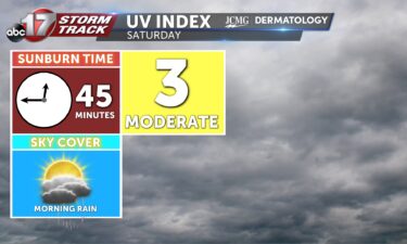
Saturday will have a UV Index of 3, meaning it will take 45 minutes to receive a sunburn without the proper protection. Pollen levels will be very high throughout the weekend into next week.
Continue Reading Saturday will have a UV Index of 3, meaning it will take 45 minutes to receive a sunburn without the proper protection. Pollen levels will be very high throughout the weekend into next week.
Continue Reading
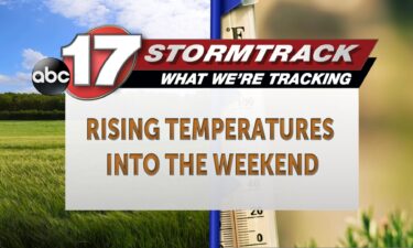
TODAY: Friday is warmer thanks to the return of south wind. Expect highs in the mid-80s under partly cloudy skies. TONIGHT: A sprinkle or two will be possible this evening, otherwise just partly cloudy skies and a low in the 60s and 70s is expected. EXTENDED: Chances for showers and storms arrive by 5-7 a.m.
Continue Reading
TODAY: Friday is noticeably warmer thanks to the return of south wind. Expect highs in the mid-80s under partly cloudy skies. TONIGHT: A sprinkle or two will be possible this evening, otherwise just partly cloudy skies and a low in the 60s and 70s is expected. EXTENDED: This has us warmer and somewhat muggy to
Continue Reading
TONIGHT: Mostly clear and slightly warmer with lows in the upper 50s to around 60. TOMORROW: Partly to mostly sunny and warmer with highs in the mid-upper 80s. EXTENDED: We can expect our last cool night for the week as lows dip to near 60 for one more evening. Winds begin to shift to the
Continue Reading
Several pollens are continuing to rise, causing issues for Mid-Missourians. The primary three being seen right now are Ragweed, Chenopods, and nettle. These three allergens alone occur towards the end of the summer months. Ragweed is the most common and heavily saturates the atmosphere each year. It is also known as the main culprit for
Continue Reading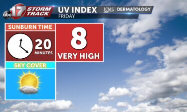
TODAY: Thursday is another mild day with highs near 80 under partly cloudy skies. TONIGHT: Temperatures fall into the low 60s and high 50s overnight, with partly cloudy skies. EXTENDED: A south wind returns by Friday, helping us warm into the low 80s. Saturday and Sunday, we’ll see shower and thunderstorm chances return, with the
Continue Reading
The average high temperatures are beginning to finally slowly cool, and we continue to see shorter periods of daylight heading into fall. With all of this happening, we inch closer to the upcoming fall and winter duck migration where ducks hunters and watchers get excited to get out to their nearest marshes. Ted Shanks Conservation
Continue Reading
TONIGHT: Mostly clear with patchy fog developing by daybreak. Lows in the lower 50s. TOMORROW: Mostly sunny and nice with highs in the upper 70s to low 80s. EXTENDED: Tonight will be our coolest of the week as lows dip into the lower 50s…we could have some upper 40s on the board across northern Missouri!
Continue Reading
TODAY: Wednesday is likely the coolest afternoon this week, as we see continued east winds and some partly cloudy skies yield high temperatures in the 70s. TONIGHT: The coolest morning comes tonight, with temperatures falling into the 50s under a few high clouds through the early morning. EXTENDED: Thursday marks the beginning of our warm
Continue Reading
TONIGHT: Partly to mostly clear with lows in the upper 50s to around 60. TOMORROW: Partly to mostly sunny with highs in the upper 70s and continued low humidity. EXTENDED: Despite the increase in cloud cover, we will still see temperatures dipping into the upper 50s to around 60 overnight. Tomorrow will be the coolest
Continue Reading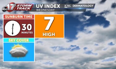

If you have woken up the last several mornings early and have had the duty of taking your pet outdoors, you might have gotten wet shoes and pants walking through the grass. This is caused by the formation of dew which has been limited until recently across the region. The formation of dew occurs due
Continue Reading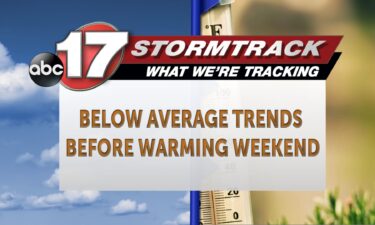
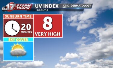
TODAY: Tuesday brings more north flow and partly cloudy skies, keeping high temperatures in the upper 70s for many through the afternoon. You may notice some activity on radar this afternoon, but showers aloft will be likely too weak to bring rain through a lot of dry air closer to the surface. Humidity is low,
Continue Reading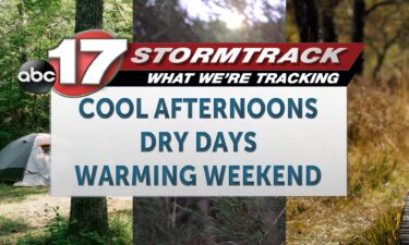
TONIGHT: Mostly clear with patchy river valley fog. Lows in the upper 50s to around 60. TOMORROW: Partly sunny with a sprinkle possible. Highs in the upper 70s to around 80. EXTENDED: Expect clear skies overnight with lows dropping into the upper 50s along with some patchy fog in river valleys by daybreak. Tomorrow will
Continue Reading