Thursday’s UV index and pollen tracker
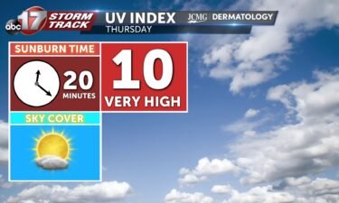
Thursday’s UV index will be dangerously high with a sunburn time around 20 minutes. Pollen levels will get a little lower behind a cold front Friday into Saturday.
Continue Reading Thursday’s UV index will be dangerously high with a sunburn time around 20 minutes. Pollen levels will get a little lower behind a cold front Friday into Saturday.
Continue Reading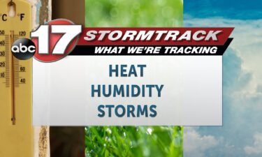
TODAY: Wednesday will be warm, and somewhat humid, especially in the morning. Humidity levels will drop a smidge this afternoon as highs reach near 90. This comes as skies remain mostly sunny through the day. TONIGHT: Winds remain from the southwest overnight, and with clear skies, we’ll start the day Thursday warm, sunny and feeling
Continue Reading
The UV index will be very high on Wednesday as sunshine returns, with a burn time of only around 20 minutes. Pollen levels will be moderate to high, with mainly grass pollen as the primary allergen.
Continue Reading
ABC 17 Stormtrack is digging into how globally warming temperatures is and could continue to impact precipitation rates over the next several decades. Most of the country is expected to see precipitation extremes increase with 3.6 degrees of global warming, according to Climate Central. The indicators of Global Climate Change (IGCC) initiative has put together
Continue Reading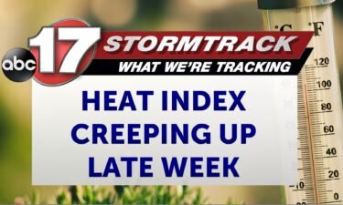
TONIGHT: Mostly clear and mild with lows in the lower to mid-60s. TOMORROW: Mostly sunny and warmer with highs in the upper 80s to around 90. Heat index values in the low 90s. EXTENDED: Our upper pattern begins to shift as a high pressure ridge nudges in our direction. We’ll be on the northern periphery
Continue Reading
THIS AFTERNOON: Beautiful and bright with highs in the lower 80s with low humidity. TONIGHT: Mostly clear and mild with lows in the lower to mid-60s. EXTENDED: Our upper pattern begins to shift as a high pressure ridge nudges in our direction. We’ll be on the northern periphery of that, right near the storm track
Continue Reading
THIS MORNING: Mostly clear and cool with lows in the mid-50s. TODAY: Sunny and seasonal with highs near 80. The UV index reaches very high levels that can cause sunburn in 20 minutes. EXTENDED: High pressure building out west will move in our direction by midweek, allowing temperatures to increase as winds shift more to
Continue Reading
Things are about to get pretty hot in Mid-Missouri.
Continue Reading
We’re coming off a stormy spring across Mid-Missouri ahead of another expected warmer than average summer. Monthly average temperatures this past spring were anywhere from 2-5 degrees warmer than normal, and we finally busted out of the drought area-wide with near average rainfall. Severe weather reports were much more frequent than normal, with 92 reports
Continue Reading
TONIGHT: Mostly clear and cool with lows in the mid-50s. TOMORROW: Mostly sunny and beautiful with highs near 80. EXTENDED: Northwest upper flow keeps us cool through tomorrow with highs just under our seasonal average, but upper high pressure building out west will move in our direction by mid-week, allowing temperatures to increase as winds
Continue Reading
Tuesday will be bright yet again with a high UV index, as sunburn time will be around 20 minutes. Pollen levels increase midweek as winds pick up from the south.
Continue Reading
THIS MORNING: Mostly clear and cool starting in the mid-upper 50s. Patchy fog is possible to the south where the heaviest rain fell over the weekend. TODAY: Mostly sunny and comfortable with low humidity and highs in the upper 70s. The UV index reaches very high levels that can cause sunburn in under a half
Continue Reading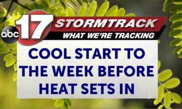
TONIGHT: Mostly clear and cool with areas of patchy fog. Lows in the mid-upper 50s. TOMORROW: Mostly sunny and comfortable with low humidity and highs in the upper 70s. EXTENDED: After a wet Saturday night, we have cleared out completely across Mid-Missouri with northwest upper flow continuing into the first part of next week. That
Continue Reading
The UV index will be high to start the week with plenty of sunshine on Monday. Pollen levels will be steady all week with grasses as the primary allergen.
Continue Reading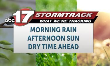
TODAY: Showers linger behind storms that developed overnight. Showers will be widespread south of I-70 through the morning, and then taper by late morning, leaving most dry and clearing by noon. TONIGHT: After a viewable sunset, we’ll be mostly clear overnight, with temperatures falling into the 50s with a light north breeze. EXTENDED: Humidity will
Continue Reading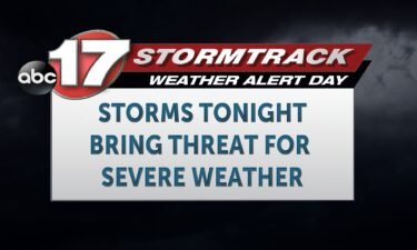
BLOG: The ABC 17 Stormtrack Weather Team has issued a Weather Alert Day for the potential of severe storms tonight. Storms have begun to form, and there is a severe thunderstorm watch in effect until 1 a.m. for our southern counties. These will continue to move east and gradually south throughout the rest of the
Continue Reading
TONIGHT: I’m tracking increasing strong to severe storm potential to the south of Highway 50 after 5 pm. This is why an ABC 17 Stormtrack Weather Alert Day has been issued from 5 pm tonight to 6 am tomorrow morning. Large hail and damaging winds will be the main concern throughout the evening hours, although
Continue Reading
After rainfall and cloud cover exit the region in the morning, a mostly sunny afternoon is expected throughout mid-MO. This means a UV Index of 9 is expected, and indicates that it will only take 20 minutes to receive a sunburn without proper protection. Pollen levels will be medium for the next couple of days.
Continue Reading
TODAY: Showers from passing thunderstorms linger early this morning, but generally drier time ensues by 9 a.m. Then, spotty showers will be possible through the rest of the morning and early afternoon. By late afternoon, we’re tracking a better chance for thunderstorms. We’ll be warm and humid with temperatures in the mid-80s feeling more like
Continue Reading
Saturday sees a UV index level 3 with scattered showers and storms.
Continue Reading