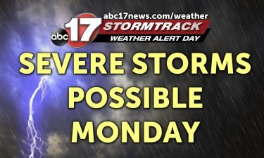
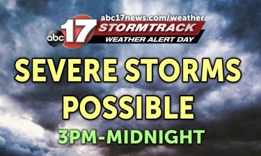
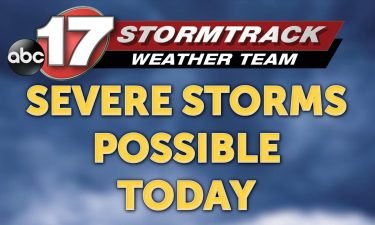
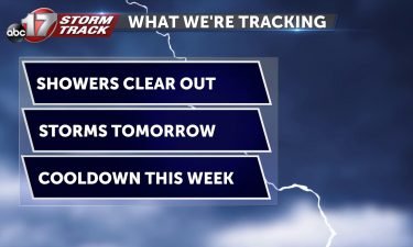
WEATHER ALERT DAY: Tracking another round of strong storms Wednesday
The ABC 17 Stormtrack weather team has issued a Weather Alert Day for Wednesday with the threat of severe storms returning.
Continue Reading
The ABC 17 Stormtrack weather team has issued a Weather Alert Day for Wednesday with the threat of severe storms returning.
Continue Reading
TONIGHT: The severe threat will continue until about 8-9 PM but the rain will stick around. Overnight lows will fall to into the mid and upper 30s as winds turn more northerly by daybreak and pick up. Gusts will reach up to 25 mph. Some of our western counties could see rainfall transition into a wet
Continue Reading
COLUMBIA, Mo. (KMIZ) According to Columbia Parks and Recreation, common areas that tend to flood are along the MKT Trail, The Hinkson Creek Trail, and the Grindstone Nature Area. It says as of Wednesday afternoon, most of those places were underwater. The Director of Columbia Parks and Recreation Mike Griggs says visitors should watch out
Continue Reading
Mayor Carrie Tergin said she wanted the Cole County Emergency Management Office and power companies to sit down together to go over what the public should know if something were to happen.
Continue Reading
Several roads around Mid-Missouri were closed Wednesday and a flood warning was in effect for a Missouri River tributary in Boone County as more storms threatened the area.
Continue Reading
WEDNESDAY: Showers and storms will move in early and stick around throughout the day. A few could become strong to severe, with large hail the primary threat. Highs will top out in the 50’s despite a stormy afternoon. For the latest timing and details on those storms, head over to the Insider Blog. TONIGHT: The
Continue Reading
Boone County Fire is asking drivers to look out for low lying areas Wednesday as storms roll into Mid-Missouri.
Continue Reading
Tonight: Temperatures will fall into the mid-40s for an overnight low as clouds stubbornly hang on. A few spot showers will begin after midnight with the main event gearing up to start just before sunrise. Tomorrow: As many of us wake up to venture out for our morning commute, our first round of storms will
Continue Reading
After a 14-day stretch of below-freezing temperatures last month, we’ve started this spring with several days above average, hinting at a continued La Niña pattern over the next few months.
Continue Reading
In Boone County, there are about 80 outdoor warning sirens that are in service and are activated when a tornado warning is issued by the National Weather Service or a trained weather spotter.
Continue Reading
Tuesday Afternoon: Temperatures will continue to rise into the mid 50’s for Central Missouri. Our overcast skies will remain with us throughout this afternoon. Tonight: Temperatures begin to dip into the mid 40’s for the overnight low thanks to our overcast sky conditions. We look to stay dry, but that won’t last very long. Extended:
Continue Reading
TUESDAY: Plan on some dense fog throughout this morning. Visibility will start to improve around 10-11 AM, but the clouds might be slow to clear into this afternoon. Where we do pick up some fuller sunshine, near the lake, temperatures will push towards 60 this afternoon. Further north, clouds will hold better, keeping temperatures in
Continue Reading
TONIGHT: Storms move out before midnight. Patchy fog developing late with lows near 40. TOMORROW: Partly cloudy with highs in the mid-50s. EXTENDED: Another low pressure system will track across southern Missouri Wednesday into Thursday, bringing another chance of showers and storms to Mid-Missouri by Wednesday morning. Heavy downpours will be possible in the morning,
Continue Reading
Monday Afternoon Update: Scattered storms have developed across Mid-Missouri with the severe storms staying to our west around the Kansas City area as of 5:00. A few strong storms will be possible between now and 9-10:00 PM. Setup The same upper-level low that brought us the rain yesterday is slowly crawling east. It’s taking long
Continue Reading
Daylight Saving Time started yesterday, but why was this time change ever created? Contrary to some thought processes, it’s actually not solely because of the weather! I wanted to dive into why Daylight Saving Time was created and the steps that were taken to get it implemented across the nation. The history of Daylight Saving
Continue Reading
We wrapped up winter with an active February with several winter weather events and a long cold stretch, but we actually ended up with less snow than normal through March 1st.
Continue Reading
MONDAY: One round of rain is making its way out of the area but we’re not done just yet. This upper-level system will slide through this afternoon, sparking a few thunderstorms as it does. Some of these could pose a risk for large hail or even a brief spin-up. Timing will be around 3-4 PM
Continue Reading
TONIGHT: Rainfall will take it’s sweet time exiting the area with most of us dealing with moderate to heavy rain until early tomorrow morning. Lows will fall into the mid 40s. MONDAY: Rain and clouds will begin exiting the area early to boost highs into the low 60s. Winds will be a little breezy with
Continue Reading
TODAY: The morning kicks off with light showers and temperatures in the mid-40s. Rain will back off slightly in the early afternoon, but a line of heavy rain will begin entering the area later. Highs again reach the mid-50s in the afternoon. These storms will continue through the evening and early Monday morning. MONDAY: Rain
Continue Reading