Tracking dangerous heat before early week storms
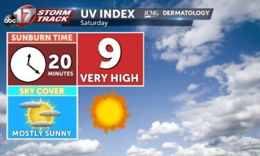
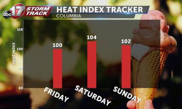
Tonight: Skies remain mostly clear throughout the overnight hours as temperatures fall slowly into the upper 70’s. Winds remain out of the southwest at 5-10 mph. Tomorrow: Temperatures soar to the mid-90’s once again with high dewpoints leading to the heat index creeping just over 100 degrees. Skies become partly cloudy with scattered storms by
Continue Reading