Weather Alert Day: Dangerous heat continues through Wednesday
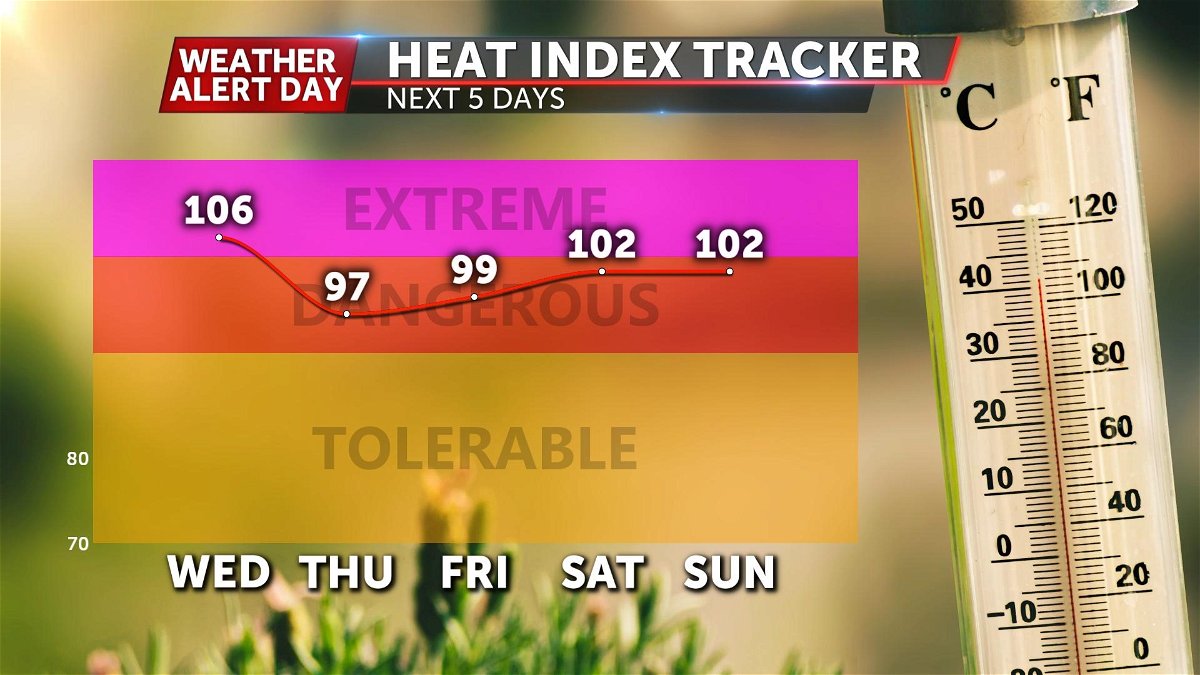
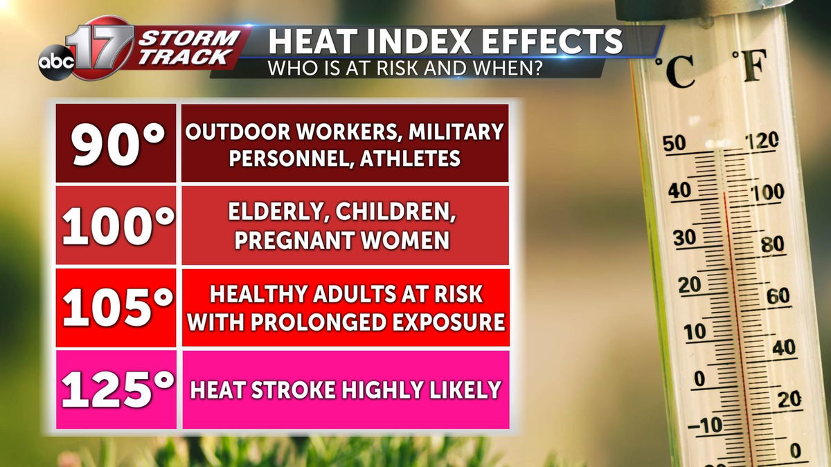
A Weather Alert Day is in effect through Wednesday evening as dangerous heat continues to be a problem. Heat index values could reach 105 this afternoon and yet again on Wednesday afternoon.
We're on the edge of a dome of high pressure at the upper levels of the atmosphere. This, for the most part is keeping any strong waves from the north away. This will allow for little relief from building heat, if any at all.
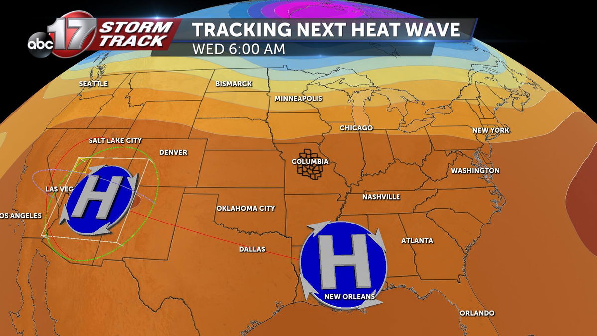
Closer to the surface, our winds are strong out of the south, with low pressure to our west, and higher pressure to our southeast. This strong southerly flow will pull in warmth Monday through Wednesday. At the same time, dewpoints will be approaching the mid 60s to low 70s across mid-Missouri. This will create conditions favorable for heat index values ranging from 100 degrees to 105 degrees through Wednesday afternoon.
PREPARE:
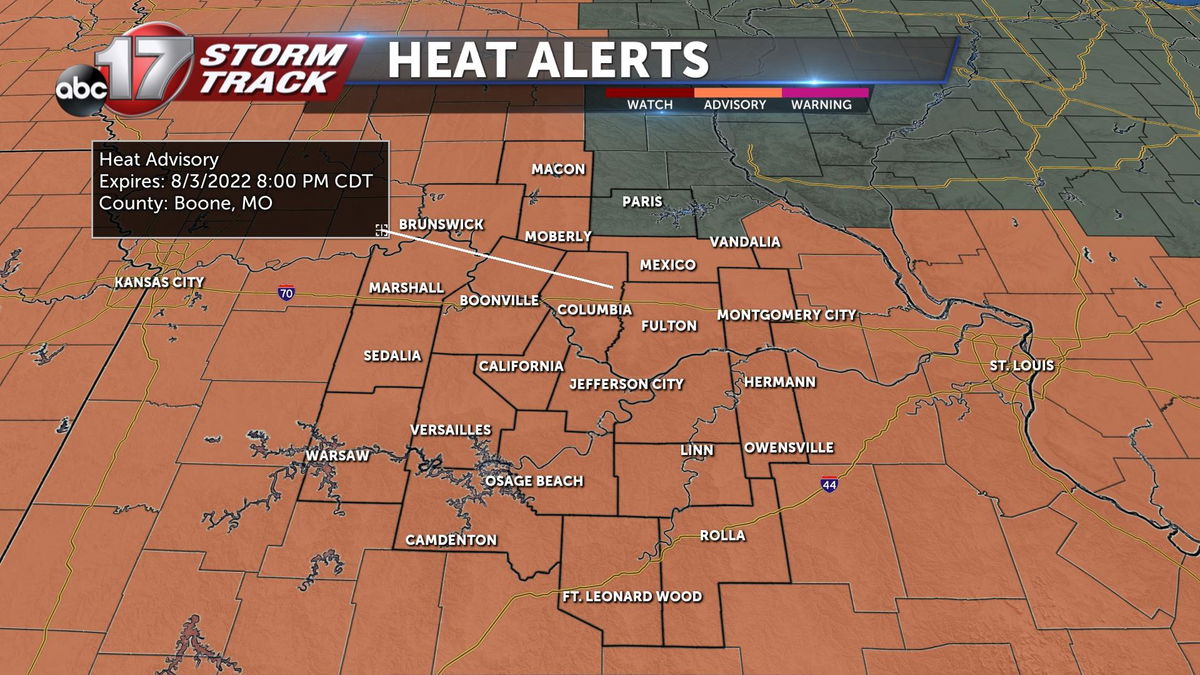
The National Weather Service has issued a Heat advisory lasting through 8:00 p.m. Wednesday.
Until then, try to limit outdoor exercise to around sunrise or sunset. Stay hydrated by drinking more water than usual, and supplement with low sugar sports drinks with electrolytes. If you must work outside during the day, plan to take plenty of breaks.
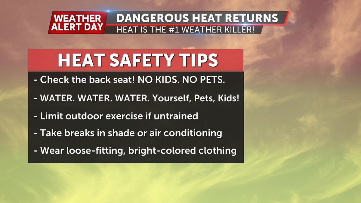
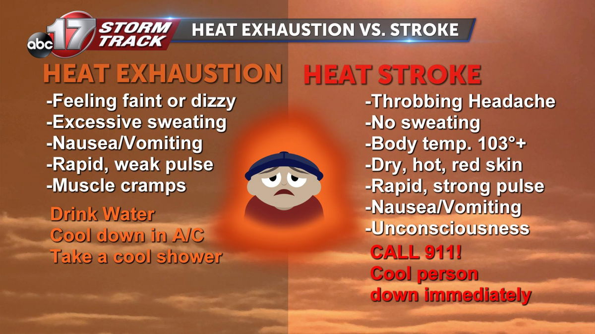
Be aware of the signs and symptoms of heat exhaustion and heat stroke. Heat exhaustion is characterized by excessive sweating, feeling dizzy, nauseous, and crampy with a weak pulse. Ways to treat it include getting into a cool room, drink water, and take a cool shower.
Heat stroke can be deadly and is different from heat exhaustion in that the person will stop sweating, skin will be dry, hot, and red, and the person will have a rapid, strong pulse. The person may become unconscious and 911 should be called if heat stroke is suspected.
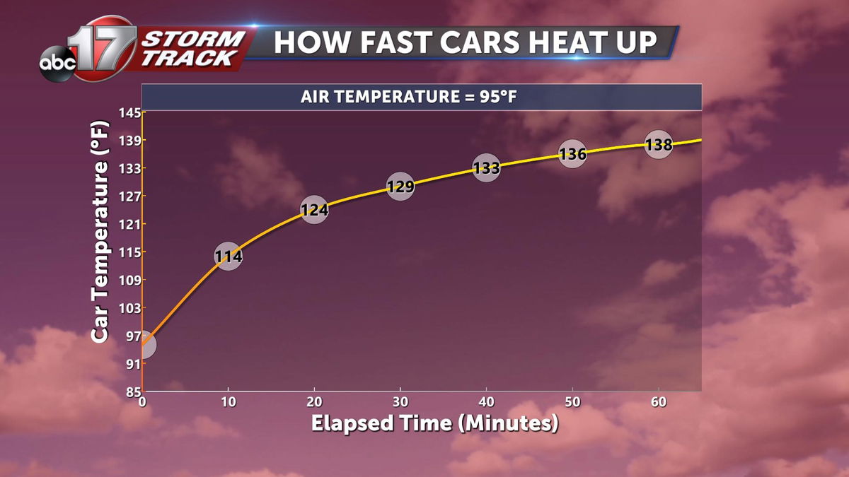
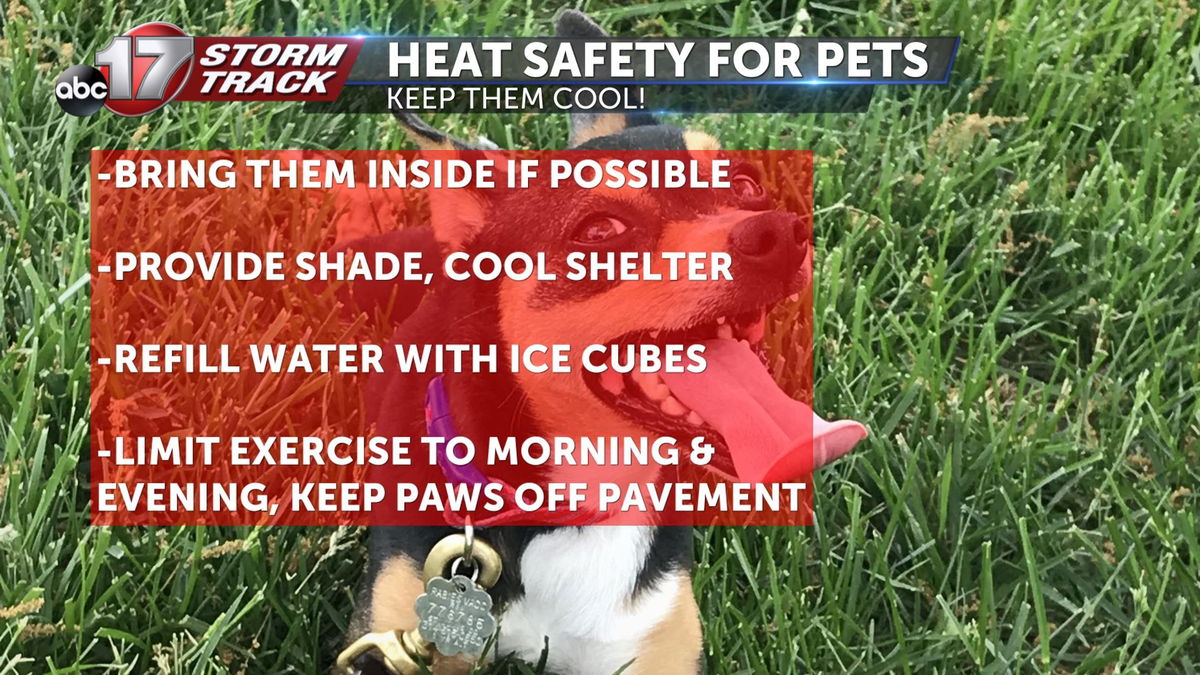
Always, always check the backseat of your car for pets and children. The temperature inside the car can rise up past 130 degrees when air temperatures are at 95 after just a few minutes with the engine shut off. Pets need cool shelter with plenty of cool water. Limit their walks to early morning and near sunset, and try to keep their paws off hot pavement as extreme temperatures can cause burns to their paws.
WHAT COULD CHANGE
Since we are on the edge of the upper level high pressure, we are vulnerable to upper level waves from the north that may be able to stunt our warm up. Some guidance suggests that Tuesday morning showers may be more widespread than isolated in coverage through the morning hours. If this is the case, then we will be spared from the heat. Still, the more likely scenario is that showers will be sporadic enough in nature to allow a decent warm up on Tuesday.
