Skip to Content

Weather

Missouri River flood stages rising

This past week, portions of Mid-Missouri saw radar estimated rainfall totals reaching up to 5″. This prompted various areal flood advisories and many flood warnings widespread across the region. The Missouri River at Glasgow is currently seeing the affects from all of this rainfall as the river levels have risen to minor flood levels and

Continue Reading

Tracking a quiet start to the week

TODAY: Standing water currently has some roads closed across the region, so check the MODOT Traveler Information Map for information on low lying areas that typically flood. We have an array of flood alerts across the region this morning after a very wet weekend. The rain has come ton an end this morning, and clouds

Continue Reading
Saturday could be the most dangerous day of the four if certain atmospheric conditions align.

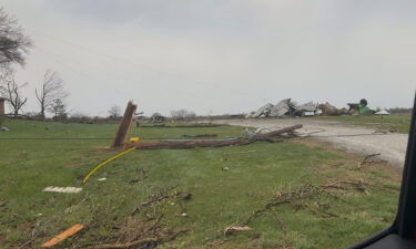
Powerful tornadoes tear across Nebraska and Iowa as weather service warns of ‘catastrophic’ damage

By Mary Gilbert, Zoe Sottile, Sarah Dewberry, Jamiel Lynch, Raja Razek, Sharif Paget, Sara Tonks and Brandon Miller, CNN (CNN) — Devastating tornadoes are tearing across parts of eastern Nebraska and Iowa on Friday as a multiday severe thunderstorm event ramped up in the central United States, injuring at least three people. Storms began in

Continue Reading

Tracking strong storms possible this weekend

THIS AFTERNOON: Friday, Saturday, and Sunday are ABC 17 Stormtrack Weather Alert Days. Get the latest details here. After a rain-soaked morning parts of Mid-Missouri clear out early afternoon. Redevelopment of storms is possible this evening mostly to our west where all severe hazards are possible; current data keeps this activity out of our area but

Continue Reading
Skip to content