Weather
Tracking showers and storms tomorrow, much cooler Labor Day weekend
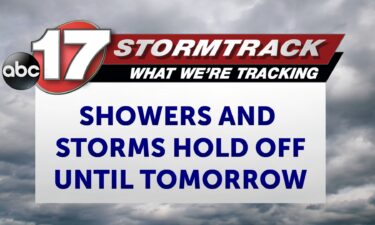
TONIGHT: Warm with increasing clouds and a few showers by daybreak. Lows in the lower 70s. TOMORROW: Warm and humid with scattered showers and storms likely. Highs in the mid-upper 80s. EXTENDED: A very isolated shower or storm is possible, but any issues with storms are unlikely through the evening. Temperatures remain in the 80s
Continue Reading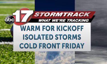
Tracking a hot and mostly dry day
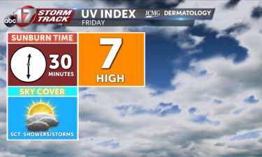
TODAY: Thursday is another hot and humid day, with abundant sunshine and plenty of dry time for tailgating and all things Mizzou. One hiccup could be the chance for isolated evening storms, but these should be very spotty in coverage, so there’s a good chance we’ll stay dry. Just check radar periodically and have a
Continue Reading
Corn sweat adds to high humidity in summer
High humidity has been hard to avoid recently and farmers out in the field face more of it from the crops they tend. Those with an agriculture background are likely familiar with “corn sweat” which describes the extreme humidity produced by plants in the summer. Like many other crops and plants, corn “sweats” to cool
Continue Reading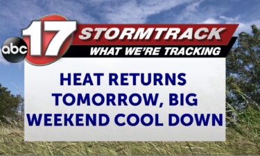
Tracking a hot and humid Thursday before Friday storms
TONIGHT: Increasing clouds and muggy with a low storm chance. Lows in the lower 70s. TOMORROW: Partly cloudy, hot and humid with highs in the low to mid-90s. The heat index will range between 98-100, and a few storms are possible by late afternoon. EXTENDED: We are tracking partly cloudy skies tonight and a spot
Continue Reading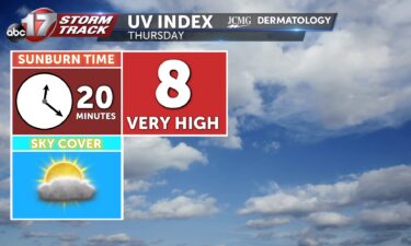
Tracking cooling temperatures into Labor Day weekend
TODAY: Wednesday will be hot and humid, feeling like near 100 with a true temperature expected only in the 90s. Spotty showers this morning will be possible, fizzling out through midday, only to redevelop as storms this afternoon and evening. The best chance tonight comes near I-44. Most will be dry. TONIGHT: Clouds will clutter
Continue Reading
Tracking heat, storms, and a beautiful weekend
TODAY: Wednesday will be hot and humid, feeling like near 100 with a true temperature expected only in the 90s. Spotty showers this morning will be possible, fizzling out through midday, only to redevelop as storms this afternoon and evening. The best chance tonight comes near I-44. Most will be dry. TONIGHT: Clouds will clutter
Continue Reading
Heat related deaths and injuries on the rise across the U.S.
Heat continues to remain a problem following much of the Midwest into the end of August. This has resulted in a multi-day stretch of triple digit heat indices across mid-Missouri that looks to last through Thursday. Heat remains the deadliest weather related causation over the past ten years with flooding coming in a distant second
Continue Reading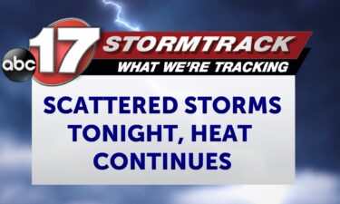
Tracking a few storms tonight, hot and humid again tomorrow
TONIGHT: A few showers and storms, otherwise warm and humid with partly cloudy skies and lows in the mid-70s. TOMORROW: Partly sunny with isolated storms possible by late afternoon. Highs in the low 90s with a heat index near 100. EXTENDED: Storms could pop up by this evening and will be widely scattered through about
Continue Reading
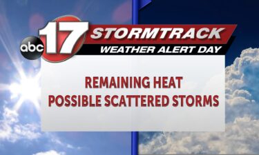
Tracking lasting heat with late week possible spotty storms
TODAY: Tuesday is an ABC17 Stormtrack Weather Alert Day as heat lingers that could be dangerous with prolonged exposure. Highs will reach mid-90s with enough humidity to have us feel about 10 degrees warmer. TONIGHT: A few storms may develop after 4 p.m. this evening. Severe weather is not anticipated, but if a storm can sustain itself
Continue Reading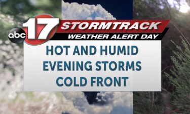
Tracking a muggy and stormy week ahead of a cool and calm weekend
TODAY: Tuesday is an ABC17 Stormtrack Weather Alert Day as heat lingers that could be dangerous with prolonged exposure. Highs will reach mid-90s with enough humidity to have us feel about 10 degrees warmer. TONIGHT: A few storms may develop after 4 p.m. this evening. Severe weather is not anticipated, but if a storm can
Continue Reading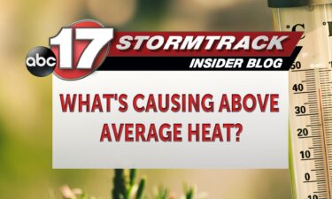
Above average heat grips the Midwest
With an ABC 17 Stormtrack Weather Alert Day issued for both Monday and Tuesday due to dangerously high heat indices, many people across the region have felt caught off guard. Highs have reached into the mid-90s with the heat index surpassing the triple digit threshold this afternoon. This puts as well above average considering our
Continue Reading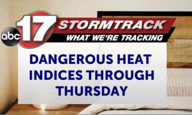
Tracking another day of dangerous heat, few storms Tuesday
TONIGHT: Mostly clear and muggy with lows in the mid-70s. TOMORROW: Mostly sunny and hot with highs in the upper 90s and heat index values near 105 degrees. A few isolated showers and storms are possible by late afternoon into early evening, especially north of I-70. EXTENDED: In addition to tomorrow’s heat, we’ll be tracking
Continue Reading
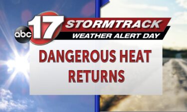
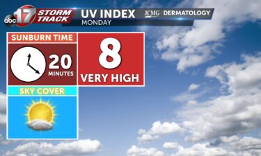
Tracking the return of dangerous heat
TODAY: Monday is an ABC17 Stormtrack Weather Alert Day as it is hot. We will have a feels like temperature above 105 for some today and Tuesday which is also an alert day. TONIGHT: After a hot and sunny day, we’ll have a warm overnight, keeping lows in the 70s under mostly clear skies. EXTENDED: Tuesday as
Continue Reading
Tracking dangerous heat, storms, and a distant cooldown
TODAY: Monday is an ABC17 Stormtrack Weather Alert Day as it is hot. We will have a feels like temperature above 105 for some today and Tuesday which is also an alert day. TONIGHT: After a hot and sunny day, we’ll have a warm overnight, keeping lows in the 70s under mostly clear skies. EXTENDED:
Continue Reading
Tracking dangerous heat the next few days
TONIGHT: Mostly clear and muggy with lows in the mid-70s. TOMORROW: Mostly sunny and hot with highs in the upper 90s and a heat index near 105. A Weather Alert Day is in effect. EXTENDED: We can expect a muggy night as upper high pressure has settled in with the northern edge of the high
Continue Reading