Jefferson City road crews facing issues with equipment as snow and cold batters area
ABC17 News previously reported that about 10 out of the Jefferson City Public Works Department’s 24 snowplows were past their life expectancy.
Continue Reading ABC17 News previously reported that about 10 out of the Jefferson City Public Works Department’s 24 snowplows were past their life expectancy.
Continue Reading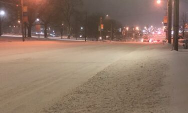
Crews with Columbia Public Works and Boone County Road and Bridge continue to fight the snow. Crews are plowing roads, but because the area has seen so much snowfall and the extreme cold temperatures, it is more difficult to clear them.
Continue Reading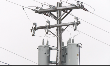
COLUMBIA, Mo. (KMIZ) Local utility providers in Mid-Missouri want customers to limit their usage. Three Rivers Electric Cooperatives tells these cold temperatures have put a strain on the electrical grid. The utility provider has more than 17,000 customers across seven counties. CEO Roger Kloeppel says customers who limit their use can help avoid problems like
Continue Reading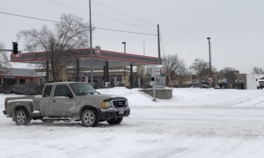
The City of Columbia has put its snow-route parking policy in effect as a winter storm continues to blanket Mid-Missouri.
Continue Reading
TONIGHT: Snow tapers off between 6-8PM. Roads will likely be slick overnight where untreated. Temperatures drop below zero, with wind chills between -20 to -25. TOMORROW: Mostly cloudy and cold with highs in the low teens. Snow moves back in late from the southwest. EXTENDED: Another low pressure system moves in from the southwest on
Continue Reading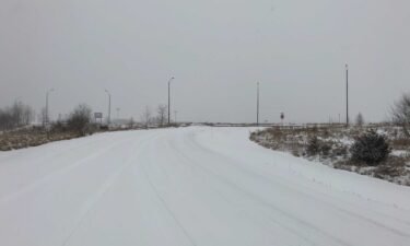
Check back for updates related to the winter storm in Mid-Missouri.
Continue Reading
To keep cell phones or other devices working during these bitterly cold temperatures, experts have several recommendations.
Continue Reading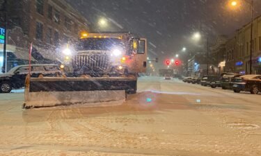
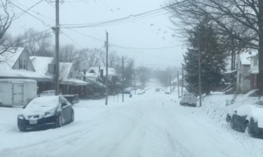
As snow continues to fall across Mid-Missouri early Monday morning, many roads have already been covered.
Continue Reading
MONDAY: Snow ongoing this morning, but relax a bit in intensity but will ramp back up mid-late morning. This will be the heaviest batch of and where we pick up the majority of our accumulations. Northerly winds won’t help much, blowing snow around and leading to subzero wind chills throughout the day. For more information
Continue Reading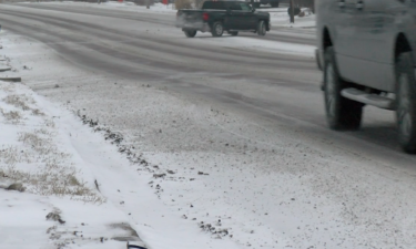
Corporal Kyle Green with Missouri State Highway Patrol Troop F said the department is urging people to stay home, to give road crews time to clear the roads and less work for first responders.
Continue Reading
TONIGHT: Another blast of snowfall is expected to arrive in the early evening hours. Many of us will pick up another 2-3″ of snowfall by the morning. Overnight temperatures will feel yet again like they are in the negative twenties. With chilly conditions and the accumulating snow, road conditions are expected to be hurt for
Continue Reading
The site is open from 7 p.m. to 6 a.m. every night. It is meant to be a resource for individuals unable to access local emergency shelter services
Continue Reading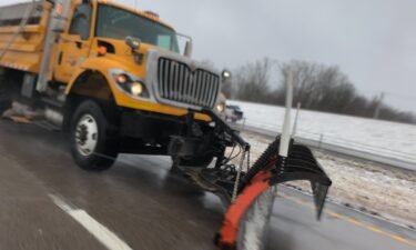
The city of Columbia brought plow crews in at 7 a.m. on Sunday to respond to winter weather.
Continue Reading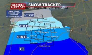
TODAY: Harsh wind chills continue today, starting out in the negative teens this morning. Temperatures will be even colder today with a high of around 5°. Snow will begin this morning and continue again into the evening. Expect accumulations by this afternoon around 1/2″ to 1″. THIS EVENING: The first round of snow from the
Continue Reading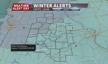
TONIGHT: Extreme cold will arrive overnight tonight with lows falling below zero. Wind chill values will feel like we are in the negative teens and twenties. The National Weather Service has issued Wind Chill Warnings for the northwestern portions of the viewing area. The rest of us are under a Wind Chill Advisory. SUNDAY: Another
Continue Reading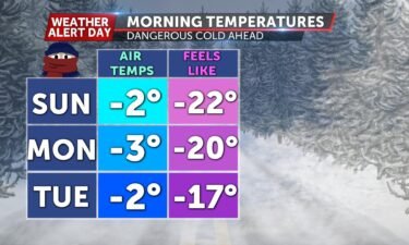
TODAY: Clouds and winds return this weekend to keep temperatures frigid. Mornings could see negative temperatures while wind chills plunge even lower between -10 and -20 degrees. SUNDAY: Another shot at snow develops on Sunday afternoon and continues into Monday. Temperatures will still be frigid over both days with highs in the single digits and
Continue Reading
COLUMBIA, MO (KMIZ) Salvation Army shelter locations in Columbia and Jefferson City are becoming near capacity with bitterly cold temperatures. Lori Benson, Regional Director of Community Relations of the Midland Salvation Army, said there’s been a significant increase in guests at the shelter since the low temperatures began. Benson said the shelters in both Columbia
Continue Reading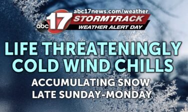
TONIGHT: Mostly cloudy and breezy with lows in the single digits. Wind chills -5 to -10 degrees. TOMORROW: Light snow showers possible early north of I-70. Little to no accumulation is expected. Highs around 10 with wind chills between -10 to -15 degrees. EXTENDED: Along with the cold, we’ll be watching for our next chance
Continue Reading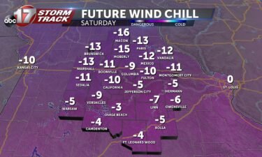
FRIDAY: The cold has stuck around this morning. Winds out of the north are going to lead to wind chills on the wrong side of zero all day long. Bundle up and cover all of the exposed skin that you can to prevent frostbite if you need to be outdoors for lengthy periods of time.
Continue Reading
As temperatures in Mid-Missouri continue to hover in the single digits, warming shelters in Columbia are keeping their doors open.
Continue Reading