
QUESTION OF THE DAY: Are you shooting fireworks this year?
The fireworks stands are open around Mid-Missouri and doing brisk business.
Continue Reading The fireworks stands are open around Mid-Missouri and doing brisk business.
Continue Reading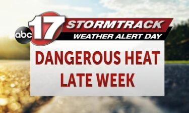
Tonight: Overnight lows cool to the upper 60s tonight with chances of scattered showers and storms. After sunset an isolated shower or two becomes possible with scattered showers and storms increasing after midnight. Brief downpours and lighting look to be the main impacts tonight with storms staying below the severe threshold. Tomorrow: Showers and storms
Continue Reading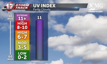
Skies look to remain partly cloudy Wednesday afternoon allowing for a UV Index of 11. Sunburn time can occur in as quickly as 15 minutes without SPF protection of 50 or higher. Pollen levels rise to medium levels after Tuesday with grass pollen being the primary allergen.
Continue Reading
COLUMBIA, Mo. (KMIZ) According to the National Weather Service, extreme heat was the leading cause of weather-related deaths in 2022, with 148 people dying as a result. Temperatures in Mid-Missouri could reach above 100 degrees this week, which could become potentially dangerous. Boone County Fire Protection District Assistant Chief Gale Blomenkamp said heat-related deaths can
Continue Reading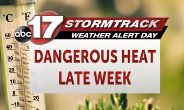
Today: Afternoon highs warm into the lower 90s this afternoon with partly cloudy skies as winds switch out of the southeast at 5-10 mph. Tonight: Scattered showers and storms move into the area after midnight tonight as lows cool into the upper 60s. Extended: Showers and storms exit by the afternoon hours as the heat
Continue Reading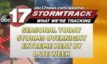
THIS MORNING: Light northwest winds push lows to the lower 60s/upper 50s early in the morning. A few sprinkles are possible in western Missouri as decaying storms track in from Kansas, but our area is expected to stay dry. TODAY: Despite skies becoming partly cloudy, highs increase into the lower 90s. Winds slowly switch from
Continue Reading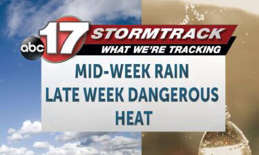
Tonight: Overnight lows cool to the lower 60s tonight with partly cloudy skies and winds out of the northwest at 5-10 mph. Tomorrow: Tuesday sees an increase in highs near or at 90 degrees as winds slowly switch out of the southwest during the afternoon at 5-10 mph. Skies become partly cloudy. Extended: Tuesday night
Continue Reading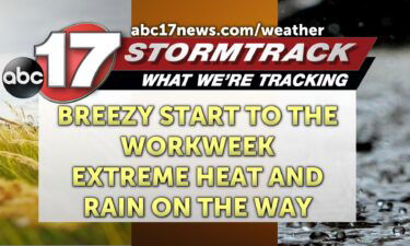
THIS MORNING: Winds will be calm to start, but pick back up to near 20 mph by late morning. Temperatures remain mild climbing through the 60s and 70s early in the day. TODAY: Winds from the northwest could gust up to 30 mph again this afternoon. Highs climb to near 90 degrees under sunny skies.
Continue Reading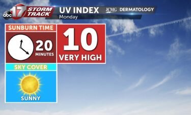
Skies remain clear to start the workweek, bringing Monday’s UV up to very high levels. The pollen forecast remains in the low to medium range, especially for grasses, plantain, and nettle.
Continue Reading
TONIGHT: I’m tracking winds calming down at about 10-12 mph from the WNW, and skies are staying clear. We’ll be calming back down into the mid 60s by the end of the night. TOMORROW: Winds will be picking back up, coming from the NW at 15-20 mph with gusts up to 30. I’m tracking mostly
Continue Reading
TODAY: Mostly sunny conditions will push highs to near 90 despite a cold front sweeping through the region. This front will bring down the mugginess, though, and increase afternoon winds to 15-20 mph with gusts up to 30 mph. TOMORROW: Monday is likely the mildest day of the week as we settle into cooler air
Continue Reading
TONIGHT: I’m tracking severe weather chances moving into NE Missouri right around 8 PM tonight that last into the overnight hours ahead of a cold front. The main threats are strong winds and isolated large hail, with very low chances of a weak tornado. As these storms keep tracking south and east from Iowa into
Continue Reading
TODAY: Saturday is an ABC 17 Stormtrack Weather Alert Day for the threat of severe storms in the afternoon and overnight. For the latest detailed forecast, click here. Overall, the confidence in storm development is rather low. Isolated storms could possibly develop in the early afternoon but will be fighting against a cap of warmer air
Continue Reading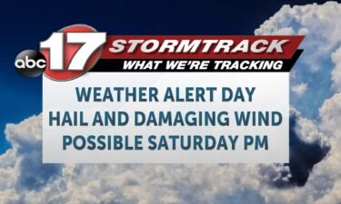
An ABC 17 Stormtrack Weather Alert Day has been implemented for Saturday afternoon until after midnight on Sunday due to the potential for isolated to widely scattered severe storms. The overall risk is relatively low, but if you have any outdoor plans, you’ll want to stay weather aware and have ways of receiving alerts that
Continue Reading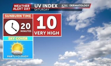
The UV index will be at a high level with partly cloudy skies in the forecast. Pollen levels will climb into the low to medium category for all allergens, with grass, plantain, and nettle the primary allergens. Reminder, Saturday is an ABC 17 Stormtrack Weather Alert Day. For the latest, click here.
Continue Reading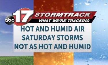
TONIGHT: It’s a hot and dry evening the rest of the evening. Humidity has increased over yesterday, but heat index values are in check compared to their temperature counter parts. Expect 80s all the way through sunset and then some. We’ll fall to near 70 by the sunrise hour on Saturday. TOMORROW: Saturday is an
Continue Reading
Today: Afternoon highs climb towards 90 degrees with winds out of the north at 4-8 mph. Skies remain partly cloudy. Tonight: Overnight lows cool to the upper 60s with partly cloudy skies as winds switch out of the northeast at 5-10 mph. Extended: Saturday welcomes warmer highs into the lower to mid-90s with feels like
Continue Reading
Summer officially arrived this week with the solstice.
Continue Reading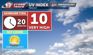
The UV index will be at a high level with partly cloudy skies in the forecast. Pollen levels will climb into the low to medium category for all allergens, with grass, plantain, and nettle the primary allergens.
Continue Reading
TONIGHT: Skies will clear at first this evening, but some partly cloudy skies will return by sunrise Friday when temperatures will have fallen into the mid-60s. TOMORROW: Friday will bring another very similar day sensibly, with temperatures again near 90, this time more likely crossing into the low 90s for most of us. Cumulus clouds
Continue Reading