
Friday’s UV index and pollen tracker
The UV index will be lower Friday due to rain and storms, but pollen levels continue to be high through the weekend.
Continue Reading The UV index will be lower Friday due to rain and storms, but pollen levels continue to be high through the weekend.
Continue Reading
TODAY: Thursday is partly cloudy and mostly dry, with a high near 80. Winds remain out of the southeast at 8 mph. TONIGHT: A warm front approaches this evening, driving another round of thunderstorms to move in from the west after 7 p.m. Storms will be isolated and have limited potential for hail and gusty
Continue Reading
TODAY: Thursday is partly cloudy and mostly dry, with a high near 80. Storms early this morning near I-44 will persist through the morning, and keep a chance for at least showers north to I-70 through about 9-10 a.m. Still, many will be dry through this period. TONIGHT: A warm front approaches this evening, driving
Continue Reading
On May 22, 2019, the National Weather Service in St. Louis issued its first-ever Tornado Emergency as an EF-3 tornado tore through the capital city just before midnight.
Continue Reading
TONIGHT: Partly cloudy and cool with lows in the mid-upper 50s. TOMORROW: Partly to mostly sunny with highs in the lower 80s. EXTENDED: Tomorrow starts off in the 50s with afternoon highs topping 80 degrees again by late afternoon. Late Thursday night into Friday, we’ll be tracking another system that will bring a front through
Continue Reading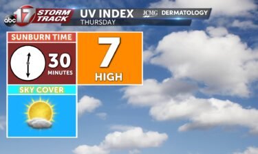
The UV index will be at a 7 tomorrow, bringing the sunburn time up to 30 minutes. Tree and grass pollens continue to be high.
Continue Reading
TODAY: Temperatures will be cooler and pleasant in the 70s behind a cold front. Isolated to scattered storms develop across the southeastern half of the area this afternoon but will remain weaker. TONIGHT: Lows remain elevated in the upper 50s to 60s with clouds lingering. Another round of storms redevelops in the same areas to
Continue Reading
TODAY: Wednesday is a cooler day, with highs about 10-15 degrees cooler than Tuesday. Highs reach only into the mid-70s with partly cloudy skies and a north breeze. A few showers and storms are likely near I-44 this afternoon. Most of mid-Missouri will be dry. TONIGHT: Outflow from storms south will build a chance for
Continue Reading
UPDATES: TUESDAY EVENING UPDATE: A few severe storms continue to work east, mainly south of Highway 50. The severe threat is likely to exit Mid-Missouri by around 10:00 PM. Several counties have been removed from the Tornado Watch. Power outages and wind damage has been reported across several areas, including in the Warsaw and Eldon
Continue Reading
TONIGHT: Severe storms possible before midnight with damaging winds and large hail. Storms exit with temperatures dropping in the upper 50s. TOMORROW: Partly cloudy with a few showers and storms near I-44. Cooler with highs near 75. EXTENDED: A few showers and storms are possible near where the cold front ends up, mainly across southern
Continue Reading
The UV index will be a bit lower on Wednesday following the exit of rain and clouds. Tree and grass pollen stays high through Friday.
Continue Reading
TODAY: Tuesday is an ABC17 Stormtrack Weather Alert Day. For the latest, click here. Temperatures will climb to near 90 today, with abundant sunshine and a steady 10-20 mph south breeze, gusting to 40. Storms likely hold off until around 4 p.m. in the west near Brunswick to Warsaw. These will spread across the region through
Continue Reading
TODAY: Tuesday is an ABC17 Stormtrack Weather Alert Day. For the latest, click here. Temperatures will climb to near 90 today, with abundant sunshine and a steady 10-20 mph south breeze, gusting to 40. Storms likely hold off until around 4 p.m. in the west near Brunswick to Warsaw. These will spread across the region
Continue Reading The UV index will be high at a 9 before storms arrive and bring rain and clouds. Pollen levels dip a little on Wednesday following rain and storms.
Continue Reading
It has been a busy start to this year’s severe-weather season. From large hail, widespread wind damage, and even confirmed tornado touchdowns, many people have felt the effects of this years storms so far. On average, April and May sees the highest activity for tornadoes across the state of Missouri with may being the highest
Continue Reading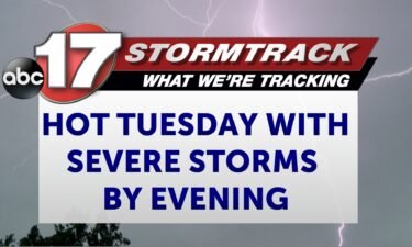
TONIGHT: Partly cloudy and mild with highs in the upper 60s to near 70. TOMORROW: Breezy and hot with highs near 90. Severe storms developing ahead of a cold front by late afternoon into the evening. Damaging winds are the primary threat. EXTENDED: A few spotty showers or storms are possible through about sunset, but
Continue Reading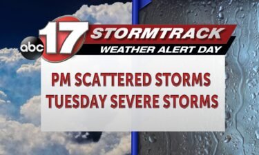
TODAY: Scattered showers and storms remain throughout the afternoon and early evening hours with an isolated stronger storm possible. It’s warm, with highs almost near where we were on Sunday, but just a touch cooler thanks to clouds. Expect highs in the mid-80s. TONIGHT: Skies are mostly clear overnight, with more dry time. We cant
Continue Reading
TODAY: Monday brings a chance at scattered showers and a rumble of thunder or two, but there will be plenty of dry time. Keep the umbrella handy just in case, but you’ll have plenty of time to get outside. It’s warm, with highs almost near where we were on Sunday, but just a touch cooler
Continue Reading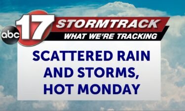
TONIGHT: Increasing clouds with a few showers and storms overnight. Staying mild with lows in the upper 60s to around 70. TOMORROW: Isolated to scattered showers and storms. Highs in the upper 80s. EXTENDED: Tonight will be mild as clouds trap in warm, humid air that was present across Mid-Missouri during the day. Decaying storms
Continue Reading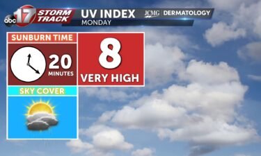
Monday’s UV index will be high by late afternoon following morning rain. Pollen levels pick up, with grass and tree pollens dominating.
Continue Reading