QUESTION OF THE DAY: Are you staying home on Monday because of freezing rain?
Schools started calling off Monday classes the day before, based on forecasts that freezing rain would coat Mid-Missouri in the morning.
Continue Reading Schools started calling off Monday classes the day before, based on forecasts that freezing rain would coat Mid-Missouri in the morning.
Continue Reading
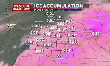
TONIGHT: An ABC 17 Stormtrack Weather Alert Day is in effect as I’m tracking light freezing rain moving over mid-MO after midnight. Temperatures at the surface will be in the mid 20s with temperatures in the upper atmosphere just above freezing. This is why we will observe rain freezing as it hits the ground. TOMORROW:
Continue Reading
TODAY: Extreme cold comes to an end this morning but wind chills remain well below freezing all day. As arctic air departs, rain will be right on its heels tonight and could cause icy roads for tomorrow morning. TOMORROW: Freezing rain begins early Monday morning with road and surface temperatures below freezing. How long it
Continue Reading
TONIGHT: I’m tracking temperatures cooling back down into the low single digits with a clear sky over mid-Missouri. With winds slowly increasing in intensity throughout the early hours tomorrow morning I’m expecting wind chills to once again be below zero. This is why the ABC 17 Stormtrack Weather Alert Day is in effect. TOMORROW: I’m
Continue Reading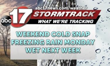
TODAY: Mostly sunny but breezy and bitterly cold with highs barely out of the single digits. The wind chill remains near or below zero all day. TOMORROW: Dangerous cold is now set to last through early Sunday with morning wind chills below zero. Although we are tracking recovering temperatures by the end of the weekend,
Continue Reading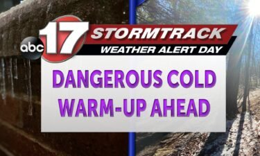
TONIGHT: Overnight lows cool to just under zero degrees as wind chills bottom out at into the negative teens. Winds remain out of the northwest at 8-12 mph with gusts up to 25 mph possible. TOMORROW: Saturday sees mostly sunny skies with highs only reaching into the early teens. The current ABC 17 Stormtrack Weather
Continue Reading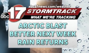
TODAY: Arctic air has returned behind another round of snow with highs today struggling out of the single digits. With a heavy breeze the feels-like will be below zero all day. TONIGHT: Temperatures fall to below zero overnight due to quiet conditions. Winds continue to gust up to 20 mph. The feels-like drops as low
Continue Reading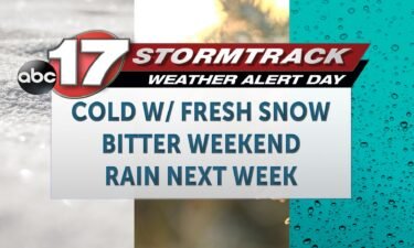
TODAY: After the return of snow overnight, Friday will be noticeably colder than Thursday. Highs may not climb out of the single digits for many. A forecast of 10 degrees is expected in Columbia through the heat of day. We’ll have some sunshine early, with more clouds returning late in the day. TONIGHT: Expect temperatures
Continue Reading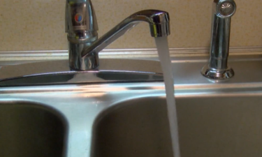
COLUMBIA, Mo. (KMIZ) The cold is coming back. After a short break from the bitter cold earlier this week that saw school closings and pipe bursts around Mid-Missouri, the ABC 17 News Stormtrack Weather Team has issued a Weather Alert Day as subzero wind chills are expected to go through Mid-Missouri the next few days.
Continue Reading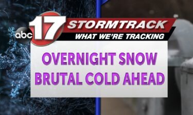
TONIGHT: Snow moves into the region after 5 pm beginning in Chariton and Macon counties. As the night continues on, the snowfall continues to move to the southeast becoming widespread by 9 pm. Snowfall totals range from a T-1″ north of I-70 with up to a trace possible south of I-70. TOMORROW: Winds switch out
Continue Reading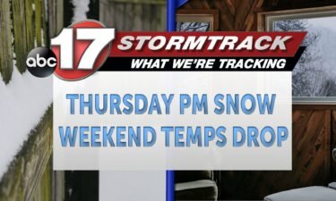
TONIGHT: Snow moves into the region after 5 pm beginning in Chariton and Macon counties. As the night continues on, the snowfall continues to move to the southeast becoming widespread by 9 pm. Snowfall totals range from a T-1″ north of I-70 with up to a trace possible south of I-70. TOMORROW: Winds switch out
Continue Reading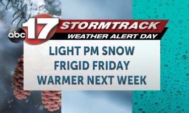
TODAY: It’s another mild day ahead, with warmth that moved in on Wednesday, sticking around. We’ll have highs in the mid-to-upper 30s, ahead of an arctic cold front that returns this evening. Winds through the day will remain light and southerly, until around the dinner hour, when the arctic front drops in and ushers in
Continue Reading
Our recent cold snap has brought an areawide hard freeze, even enough to freeze over some local lakes. As of January 17th, Stephen’s Lake is open for recreation and skating with the minimum required ice depth of 4″ recorded. More frigid temperatures in the short-term forecast should keep this ice around for some time, but
Continue Reading
Some Grayson Cottages residents were still without heat or water Wednesday, having already spent five days without those services in extremely cold weather.
Continue Reading
TONIGHT: Overnight lows cool to nearly 20 degrees with the possibility for some flurries to light snow showers. Trace amounts of accumulation remain possible. Winds remain out of the southwest at 5-10 mph. TOMORROW: Light snow showers remain possible towards the afternoon and overnight hours as highs warm into the mid-30s. Snowfall accumulations range from
Continue Reading
TODAY: Temperatures warm dramatically today thanks to southwest winds and sunshine. Highs will finally reach back above freezing, into the mid-30s for many. TONIGHT: We keep south winds overnight into Thursday, where we only cool into the upper teens and low 20s. EXTENDED: A system tracking through the region Thursday afternoon will bring light snow
Continue Reading
TODAY: Wednesday brings significant warmth to the region, given what cold has been entrenched in the area since before the weekend. Southwest winds and sunshine will likely bring temperatures back above freezing, into the mid-30s for many. TONIGHT: We keep south winds overnight into Thursday, where we only cool into the upper teens and low
Continue Reading
Mid-Missouri has been locked in a deep freeze for days.
Continue Reading
It’s been well below average in terms of temperatures for all of Mid-Missouri the last several weeks. This has lead to the formation of increasing floating ice on the Missouri River. The issue with long sustained cooler temperatures occurs whenever these floating ice pads increase substantially increasing the possibility of an ice jam. Ice jams
Continue Reading
TONIGHT: Mostly clear and cold with lows in the low single digits. Wind chills between -10 to -15 by daybreak. TOMORROW: Partly to mostly sunny with highs in the lower 30s. Evening flurries possible. EXTENDED: Bitterly cold air sticks around through tomorrow morning as our lows drop down into the single digits again tonight with
Continue Reading