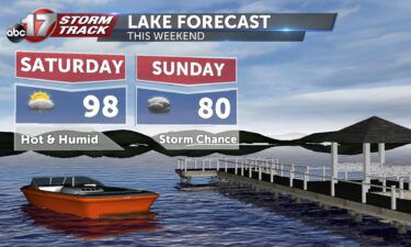
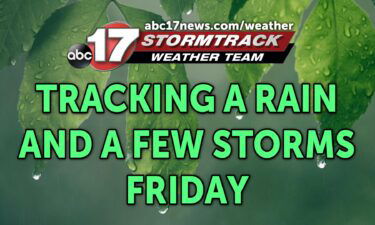
Tracking weekend showers and storms
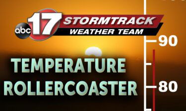
Today: Temperatures will continue to climb back into the lower 90’s this afternoon with winds returning out of the southwest at 10 mph. Skies remain mostly clear. Tonight: Temperatures continue the warming trend as the overnight lows top out near 70 degrees. Skies remain mostly clear. Extended: Heading into Friday, Central Missouri sees a stark
Continue Reading