
WATCH: Updated track of Mid-Missouri snow forecast
ABC 17 Stormtrack Weather’s Jessica Hafner gives an update on the snow expected to fall on Mid-Missouri on Saturday night.
Continue Reading ABC 17 Stormtrack Weather’s Jessica Hafner gives an update on the snow expected to fall on Mid-Missouri on Saturday night.
Continue Reading
Low presssure is tracking to the south of Mid-Missouri this afternoon, bringing clouds and a chance for winter precipitation. Scattered rain is transitioning to snow this early afternoon, with a possible heavier snow band setting up along the I-70 corridor. Snow totals have dropped with newest forecast models, as counties north of I-70 could receive
Continue Reading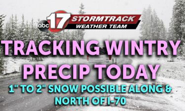
TODAY: Isolated cold rain possible in the morning with temperatures hovering above freezing. Highs reach the upper 30s south of I-70, keeping precip in the form of rain during the day. However, areas along and north of I-70 will see marginally colder temperatures, switching showers over to snow by mid to late afternoon. Accumulations are
Continue Reading
TONIGHT: Increasing clouds with spotty showers possible, lows falling into the mid-upper 30s. TOMORROW: Cloudy and chilly with highs in the lower 40s. Scattered showers with a few snow showers developing by early evening north of I-70. A dusting of snow is possible along and north of Highway 24 into Sunday morning. EXTENDED: A few
Continue Reading
THIS AFTERNOON: Southerly winds will warm temperatures greatly from the chilly start to the day, as highs reach the upper 40s. More sunshine will also aid in warmer conditions and make for a comfortable afternoon. TONIGHT: Clouds increase from the south, and with continued southerly winds, temperatures hold in the low 40s. Light rain is
Continue Reading
TODAY: Dry and warm is the name of the game today, with more sunshine to top it all off. Winds are turning more southerly and will serve to warm us quickly from a cold high 20s into the upper 40s. Clearing overnight has left us quite chilly this morning, but will allow more sunshine throughout
Continue Reading
TONIGHT: Decreasing clouds and a bit a colder with temperatures falling into the mid-20s. TOMORROW: Warmer with highs in the upper 40s and sunshine to start the day, but clouds return by late afternoon and evening. EXTENDED: Clouds gradually clear tonight, allowing temperatures to drop into the mid-20s by morning. Sunshine will warm things up
Continue Reading
The last several days have spelled trouble for much of the northern half of the state of California as continuous heavy showers and storms have moved throughout the region. There is up to three possible weather related deaths currently, but this streak of continuous rainfall looks to continue deep into next week. There have been
Continue Reading TODAY: Thursday will be another seasonable day, with winter-like temperatures. After waking up to sunshine, expect clouds and a northwest breeze around 10-15 mph to limit highs to the upper 30s and low 40s. TONIGHT: We stay dry, and clouds hang on for the early evening, but overnight, winds shift, and low clouds start to
Continue Reading
TODAY: Thursday will be another seasonable day, with winter-like temperatures. After waking up to sunshine, expect clouds and a northwest breeze around 10-15 mph to limit highs to the upper 30s and low 40s. TONIGHT: We stay dry, and clouds hang on for the early evening, but overnight, winds shift, and low clouds start to
Continue Reading
TONIGHT: Partly to mostly cloudy and chilly with lows in the upper 20s to low 30s. TOMORROW: Breezy and mostly cloudy with highs in the upper 30s. EXTENDED: Cloud cover holds on tonight, keeping us right around the freezing mark. Tomorrow looks a lot like today, but perhaps cloudier and therefore keeping most locations in
Continue Reading The past three days has spelled trouble for portions of southeastern United States. The same low pressure system that caused showers and storms Monday night has led to various severe storms that has spurred tornadoes across many states. Portions of Southeastern Georgia, Northeastern Florida, and Eastern Carolinas’ are still in a level 2/5 for severe
Continue Reading Today: Temperatures continue to warm to 40 degrees with mostly cloudy skies. Winds remain out of the west sustained at 10-15 MPH with gust up to 25 MPH. Tonight: Skies remain mostly cloudy with overnight lows dipping just below freezing with winds remaining out of the west. Extended: Temperatures increase slightly into the mid-40s heading
Continue Reading
TODAY: Wednesday brings quite a change, and an overall winter like feel back to mid-MO. Overcast skies and temperatures in the 30s through the morning, with highs this afternoon getting close to 40 in Columbia, and warmer to the south with afternoon sunshine possible along and south of I-70. Those north of I-70 will keep
Continue Reading There has been various instances of extreme weather across portions of the United States the last few days. Northern California has seen increased rainfall in short periods of time leading to flash flooding instances trapping people in their vehicles. The same system that is causing flooding in California is causing up to 10″ of snowfall
Continue Reading
TONIGHT: Clouds developing with temperatures dropping into the upper 20s to around 30. Gusty west winds up to 25 mph. TOMORROW: Mostly cloudy with highs near 40. Breezy, with westerly winds up to 40 mph. EXTENDED: Tonight, winds shift more west/northwesterly as cooler air settles in along with cloud cover. We’ll drop into the upper
Continue Reading Today: Temperatures have already hit their maximum before noon just above 60 degrees thanks to winds still remaining out of the southwest. Gust up to 25 MPH can be expected this afternoon making for a breezy day. Tonight: Overnight lows cool to near freezing as winds switch out of the west overnight leading to a
Continue Reading
TODAY: High temperatures will range from 50s to 60s from west to east respectively, as warmth tries to hang on to the east ahead of a wind shift from the west. Overall, it’s a warm day today, with chances at sunshine through the morning and early afternoon. A stray shower is possible early this morning,
Continue Reading
The ABC 17 Stormtrack Weather Team has issued a Weather Alert Day for tonight ahead of the threat for isolated severe thunderstorms across Mid-Missouri. Isolated large hail up to quarter size, 50-60 mph winds, and a low threat of a weak tornado are the main concerns. Flooding impacts will be higher across far southern Missouri.
Continue Reading
TONIGHT: Storms likely after sunset, with rain exiting after midnight. Patchy fog developing with lows in the low to mid-50s. TOMORROW: Areas of fog early, becoming partly cloudy and breezy with highs in the low 60s. EXTENDED: The first round of storms looks to push in from the south/southwest, affecting areas along and south of
Continue Reading