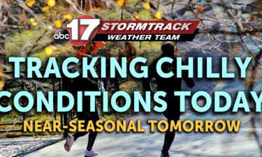
Skip to Content

Daily Forecast

Tracking a hot middle of the week

WEDNESDAY: We’ll pick up a few clouds here and there, but it’ll filter the sunshine at worst. Temperatures look to top out in the low 90’s with a decent southwesterly breeze throughout the day. That will help bump up the humidity, pushing the heat index near the century mark. TONIGHT: Adding on a few more clouds overnight,

Continue Reading

Tracking plenty of sunshine for today

TUESDAY: All of that rain we’ve been tracking since this past weekend has turned into some more fog this morning. That looks to burn off around 9-10 AM this morning with sunshine making a return by this afternoon. It’ll be a very comfortable afternoon with highs only reaching the low to mid 80’s. Enjoy it while

Continue Reading

Tracking some dry weather, finally

TUESDAY: All of that rain we’ve been tracking since this past weekend has turned into some more fog this morning. That looks to burn off around 9-10 AM this morning with sunshine making a return by this afternoon. It’ll be a very comfortable afternoon with highs only reaching the low to mid 80’s. Enjoy it

Continue Reading

Tracking rain pushing out of the area

MONDAY: Showers will be possible throughout the day as this low continues to spin through the area. All of the cloud cover around will keep temperatures pretty comfortable in the mid to upper 70’s. TONIGHT: Rain will come to an end by midnight. Partly cloudy skies will give us a chance to cool off into the low

Continue Reading

Tracking a cool start to a wet week ahead

Tonight: Scattered showers remain with us in Mid-Missouri throughout Sunday evening. We will see cooler than average lows bottoming out at 64.Tomorrow: The low-pressure system located in Northern Missouri will continue to slowly push northeast throughout the duration of Monday leading to more scattered showers enabling us to stay well below the average high of

Continue Reading

Tracking rain to kick off the week

Today: Scattered showers are possible today with no severe weather expected. Skies are cloudy all day and highs are cooler in the mid to upper 70s. Tomorrow: Rain chances continue for Monday with a possible rumble of thunder in the afternoon. Highs stick to the upper 70s. Extended: Clouds and rain exit quickly Monday night

Continue Reading

Tracking strong to severe storms overnight

Tonight: Scattered strong to severe storms have developed along the southwestern part of Central Missouri. The biggest threats with these storms will be flooding, strong winds, large hail, and possible weak tornadoes. As the night continues, these storms will push east. Past 10:30 another round of storms will pass through much of the Northern and

Continue Reading

Tracking strong storms this evening

FRIDAY: A quiet start to the day. A warm front is lifting northward, dragging us back into the muggy air. Highs will push towards 90 with a mix of sun and clouds with humid conditions making things a little uncomfortable. TONIGHT: Storms look to fire along that warm front this evening. They’ll ignite in Iowa and slide

Continue Reading

Hot end to the week, storms possible this weekend

THURSDAY: Some leftover cloud cover looks to be a little slow to clear out this morning. We’ll be able to break it up by this evening, but it’ll hold highs in the low to mid 80’s this afternoon. TONIGHT: Partly cloudy skies will stick around tonight, with overnight lows falling into the upper 60’s. EXTENDED: We’re going to

Continue Reading

Tracking afternoon showers and storms

WEDNESDAY: We’ll be tracking some sunshine to start, but a cold front is on the way this afternoon. Temperatures ahead of that boundary look to top out in the upper 80’s. As the front pushes in it looks to fire up some scattered storms between 5-10 PM. TONIGHT: Those will fizzle shortly after sunset, leaving the rest

Continue Reading
Skip to content