
Columbia Parks and Recreation begins to slowly reopen for sports
Columbia Parks and Recreation began the slow reopening of fields and courts on Monday after COVID-19 halted all play.
Continue Reading Columbia Parks and Recreation began the slow reopening of fields and courts on Monday after COVID-19 halted all play.
Continue Reading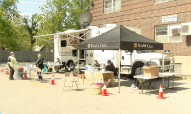
People in Boone County can now access coronavirus testing without a doctor’s note, and those efforts will continue to expand in coming weeks.
Continue Reading
A fire at a Columbia Dollar General store caused an estimated $600,000 in damage Monday, the Columbia Fire Department said.
Continue Reading
MONDAY: Clouds are starting to build in as we track rain moving toward the area. We can expect these clouds to stick around for the remainder of the day as rain begins falling in our southern counties. Highs will be in the upper 50s for the day with those clouds blocking out our sunshine. TONIGHT: Rain becomes
Continue Reading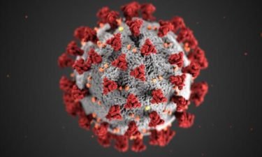
Check back for updates on the COVID-19 pandemic.
Continue Reading
Every Monday, our sports intern Tyler Driesenga will look back at this past week in sports news. Plus – he’ll give us his at-home tip of the week to keep you motivated during these tough times. You can watch his latest tip of the week in the video player above. Without further ado, here’s Tyler
Continue Reading
MONDAY: A chilly start will set the stage for another cool afternoon. Clouds look to return toward midday, and could bring a light shower to folks south of I-70. That cloud cover and winds still out of the northwest will keep temperatures in the mid to upper 50’s. TONIGHT: Rain becomes more widespread in coverage.
Continue Reading
JC Parks youth baseball and softball practices will start Monday after several sports seasons were delayed or canceled due to the COVID-19 pandemic.
Continue Reading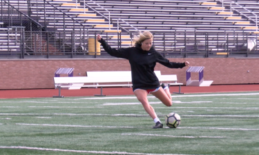
Hickman standout Hannah Larson made history despite losing out on her senior soccer season. ABC 17 Sports Director Andrew Kauffman shares her one of a kind story in the video player above.
Continue Reading
ABC 17 Sports Director Andrew Kauffman unveiled his latest Top 10 list of Andrew’s at-home sports videos on Sunday. You can watch the countdown in the video player above. Andrew asking all of our viewers to send in your best at-home sports videos to news@kmiz.com. He will share the best ones in his 10 p.m.
Continue Reading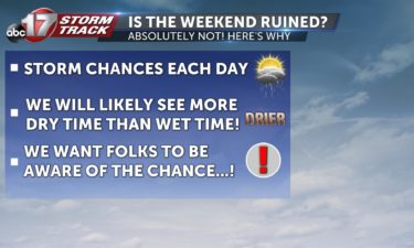
TONIGHT: A frost advisory has been issued for the area until 8:00am tomorrow. Sensitive plants will continue to need extra care into tomorrow morning. Temperatures fall into the mid 30s with rural locations falling to near freezing. Winds will remain out of the northwest at 5-10 mph. MONDAY: After a chilly start, temperatures will attempt to
Continue Reading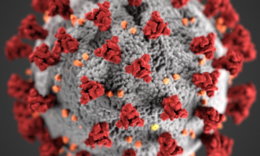
The Columbia/Boone County Health Department is reporting 100 cases of COVID-19 in Boone County.
Continue Reading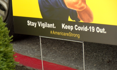
Residents of the Neighborhoods by TigerPlace in Columbia are under quarantine after an employee tested positive for the novel coronavirus.
Continue Reading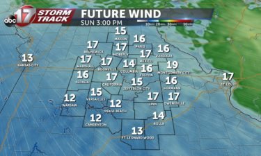
SUNDAY: As we wake up this Sunday morning, the majority of the showers that moved through overnight have cleared out of the area, leaving us dry for the remainder of the day. The wind will be the biggest story today with breezes sustaining at 15-20 mph. Highs will be in the upper 50s and lower 60s.
Continue Reading
Shortly before 10 p.m. Saturday night, a man barricaded himself in a home on North Willowbrook Road in Columbia.
Continue Reading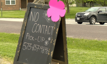
Flower shops across Mid-Missouri had to get innovative to get the rush of customers their flowers for Mother’s Day.
Continue Reading
TONIGHT: A few sprinkles are possible after dark as a cold front passes through. Winds will be gusty up to 30 mph through morning. Temperatures fall into the upper 40s. SUNDAY: We’ll be dry by morning but breezy and chilly conditions will be the main story throughout Mother’s Day. Have the light jacket/wind breaker ready.
Continue Reading The Missouri Department of Health and Senior Services is reporting 9,666 cases of COVID-19.
Continue Reading
The Columbia Farmers Market will be open Saturday from 8 a.m. to noon at the Ag Park off of Ash Street.
Continue Reading
TODAY: Mostly sunny with highs in the low 60s. Clouds will begin building as we move through the afternoon and into the evening. TONIGHT: A small disturbance could cause some spotty showers late tonight and into early tomorrow, but these will be few and far between. Lows will be in the mid 40s. EXTENDED: We’ll
Continue Reading