Climate Matters: Examining how a warming climate can make rainfall more intense
Mid-Missouri typically records just under 12" of rain every spring, but the upcoming spring is trending slightly wetter than normal.
As the population grow in urban areas, local flash flooding continues to be a big concern. Columbia has grown by an estimated nearly 20,000 people since the 2010 census.
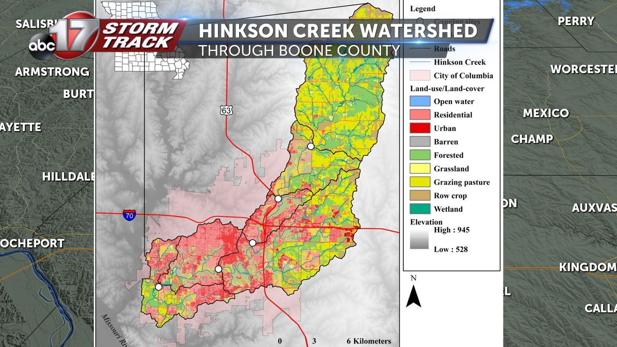
Sprawling neighborhoods can put a strain on watersheds that run through cities, like Hinkson Creek, which stretches 26 miles from east of Hallsville to southwest Columbia where it meets up with Perche Creek to drain into the Missouri River.
When rainfall rates are more intense over a short period of time, water can take awhile to recede, causing dangerous flash flooding.
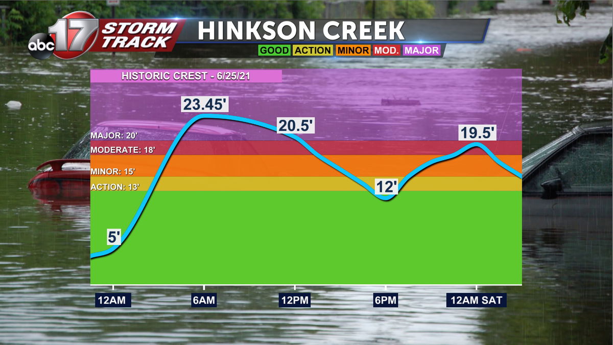
You might remember when parts of Columbia were under high water in late June 2021 after more than 5" of rain fell in less than 24 hours. Hinkson Creek hit a record crest at more than 23 feet.
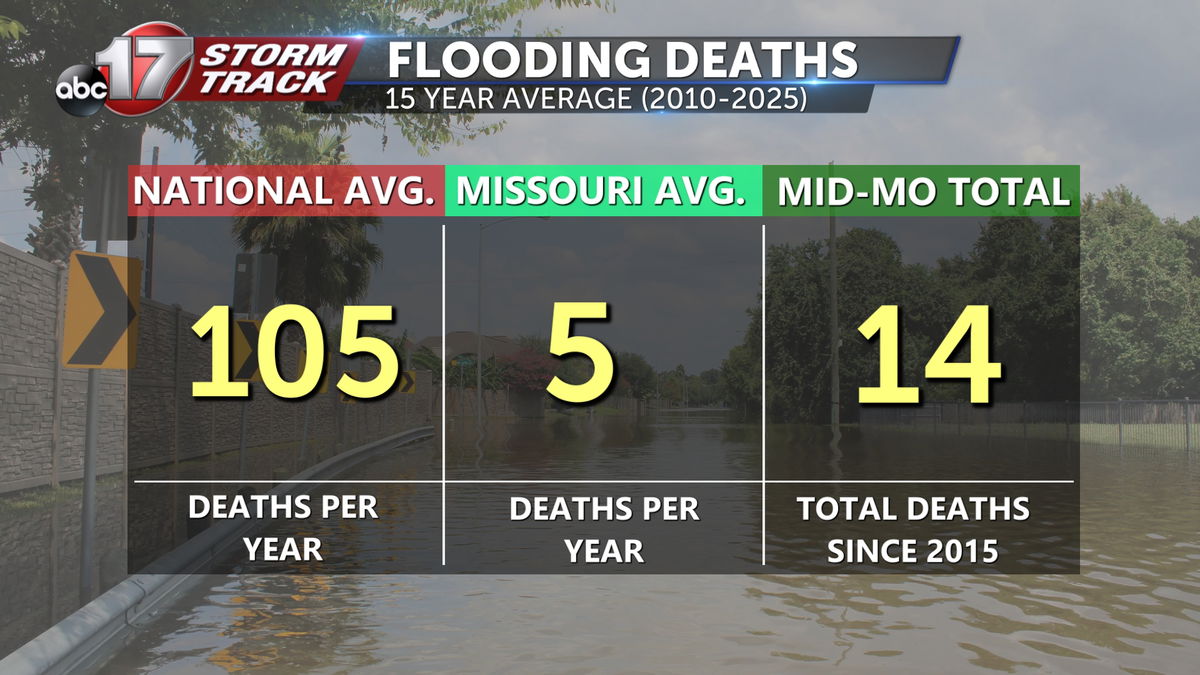
When rapid flash flooding occurs, it can catch us off guard, especially at night. The second leading cause of weather-related deaths is flooding, following extreme heat. A nationwide average of 105 flooding deaths has been recorded in the last 15 years. Missouri averages five deaths per year over that time frame, and 14 deaths have been recorded in Mid-Missouri since 2015. Two of those happened in Boone County just last year.
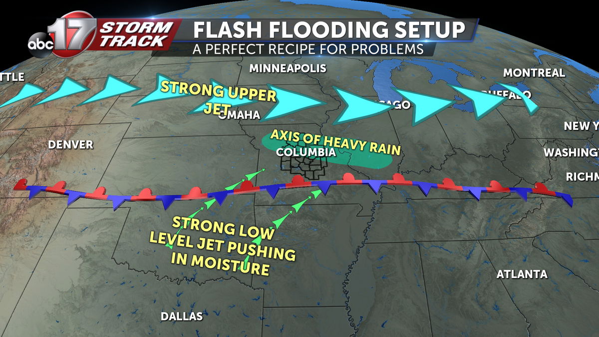
Sometimes all it takes is the perfect setup for flooding like we had in June 2021 with a stubborn front sitting over Mid-Missouri to keep storms popping up over the same areas, over and over. We also had a steady stream of warm, moist Gulf air from the southwest at the same time.
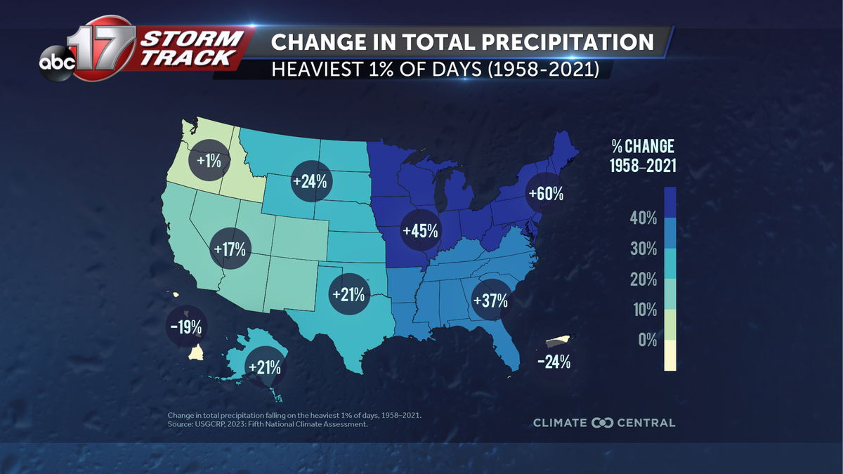
It could be a bit more complicated when you consider the role of climate change. As the global temperature rises, the rainiest days are getting wetter. Since 1958, there's been a 45% increase in rain on the heaviest 1% of days.
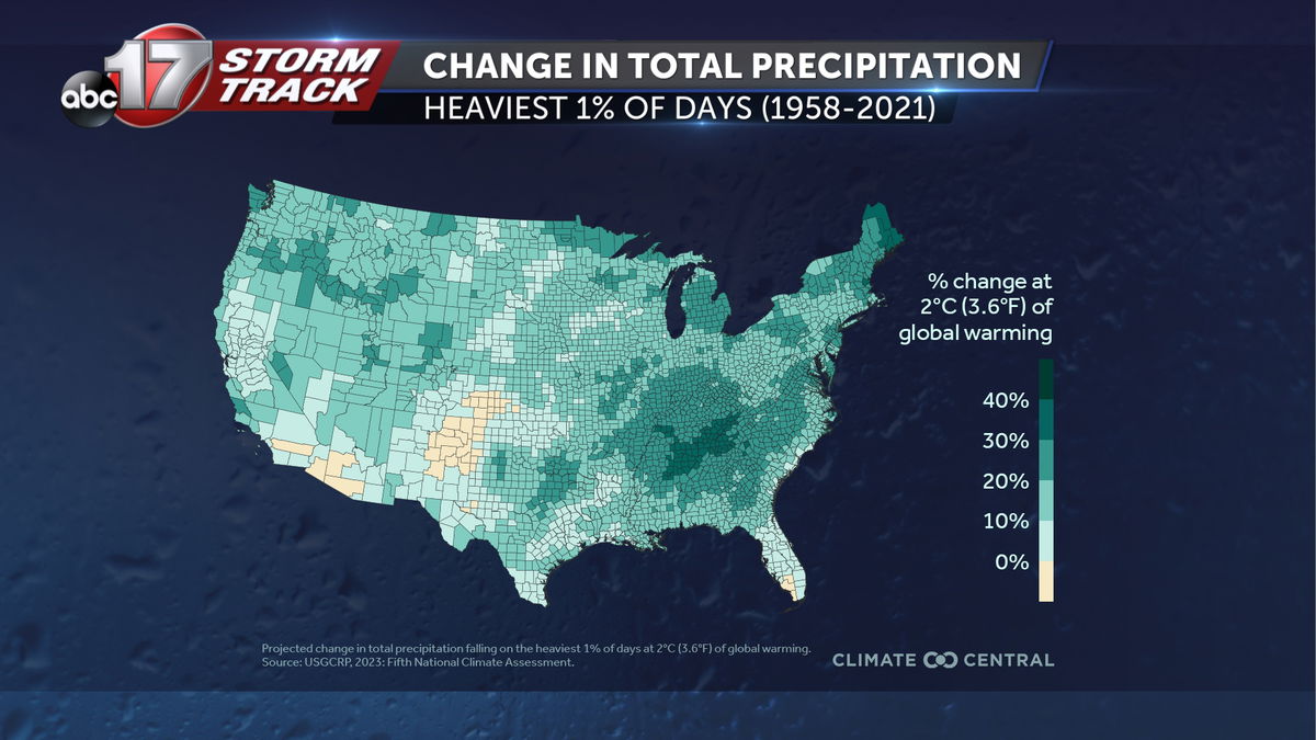
In the future, a less than four degree global temperature increase could lead to a 20-30% jump in rain on the most intense days.
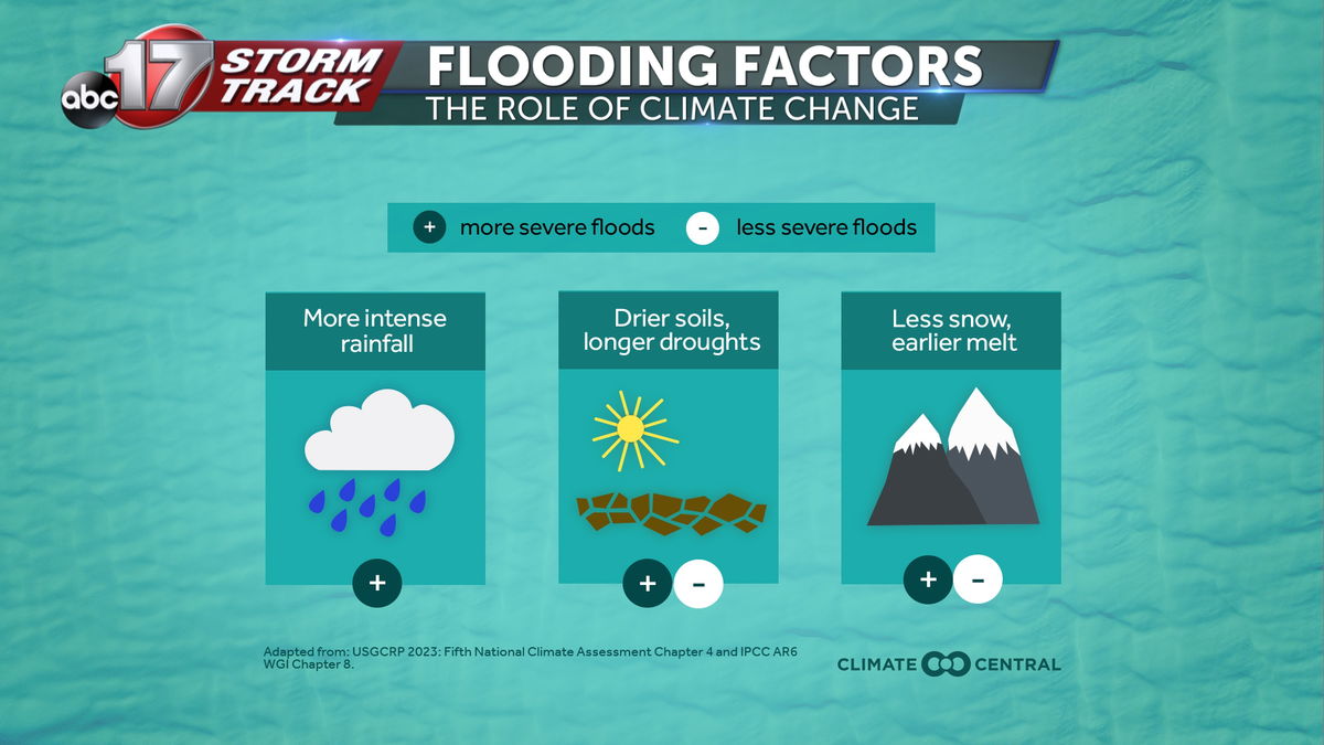
The combination of more intense rain and prolonged drought could make short term inland flooding worse, potentially threatening life and property. However, chances of river flooding are slightly below normal for the upcoming spring, largely due to ongoing drought and lack of snow cover to our north across the Missouri River Basin.
Be sure to watch the ABC 17 Stormtrack Insider at 6:00 next week as we highlight flash flooding safety, and mark your calendar for the long range spring forecast on March 14 at 6:30 on KMIZ.
