Insider Blog: Spring forecast calls for more precipitation, minor flooding on rivers
We're in for a pattern change this spring after coming off a mild winter in Mid-Missouri.
This past season ended up being the third-warmest winter on record in Columbia with an average temperature of 34 degrees. February was noticeably mild coming in at sizth-warmest ever, and tied for least snowiest.
Our winter average snowfall is 15 inches, but we only recorded 4.7 inches between December and the first of March. The most impactful winter event was the stretch leading up to Christmas when we saw about 2 inches of snow and wind chills more than 30 degrees below zero for days in a row, canceling hundreds of flights across the country and impacting several states.
Rain came in below normal, but enough precipitation fell to erase the impressive drought we had all summer into fall.
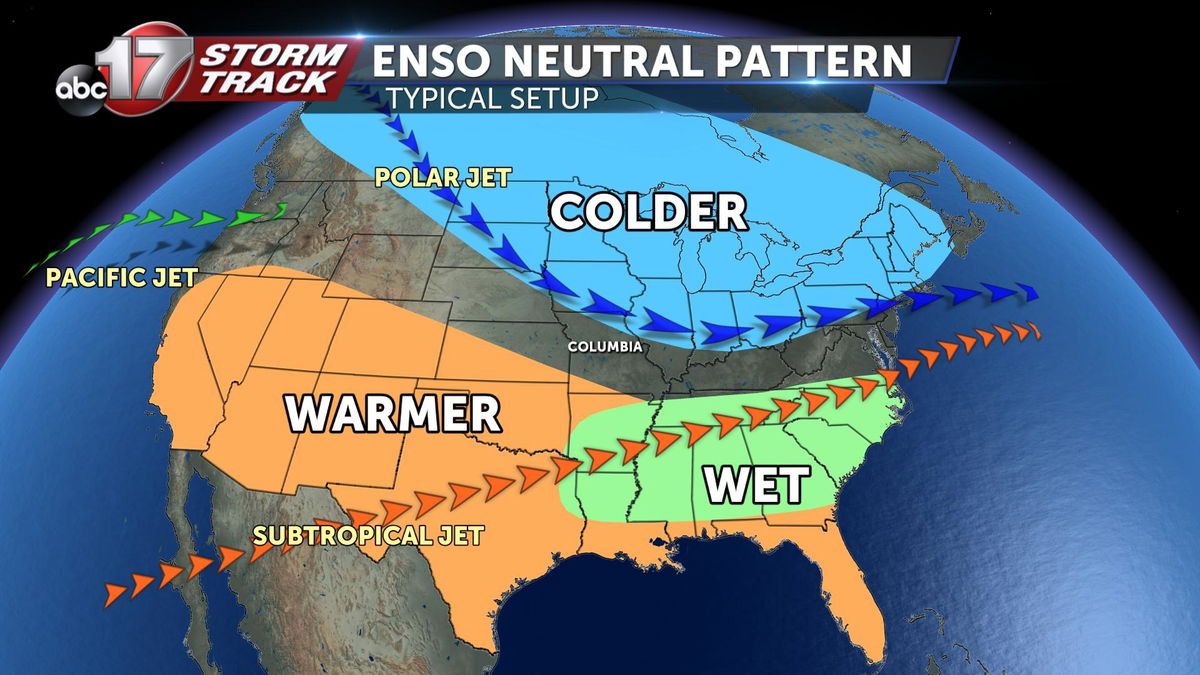
When forecasting months at a time, we look at large-scale patterns such as the El Nino-Southern Oscillation. These patterns tell us whether the ocean temperatures are above or below normal and where the jet streams will set up, a key factor in storm development. After three years in a La Nina pattern, we're expecting sea surface temperatures to warm a bit, allowing for a more neutral pattern heading into spring and summer.
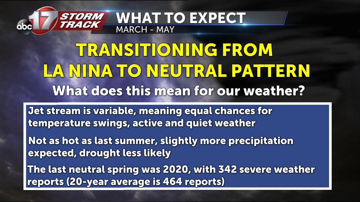
A neutral pattern means our weather could be more variable as the jet stream won't be locked in too far north or south of Mid-Missouri. We'll likely have stretches of quiet weather along with periods of storms and rain. The last neutral spring was in 2020, when we recorded 342 severe weather reports. The 20-year average is 464 wind, hail, and tornado reports.
A typical spring in Mid-Missouri averages about 56 degrees from March through May. Last spring was just slightly above average. Average rainfall comes in at just over 12.5 inches. Last spring we had almost 15 inches of rain, but then followed it with a very dry summer marked by weeks of severe drought.
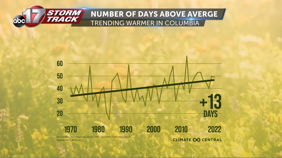
Since 1970, much of the Midwest has seen a temperature increase of at least a few degrees in the spring season. Columbia has warmed 3 degrees in 52 years and averaged 13 more days above average during the three-month period.
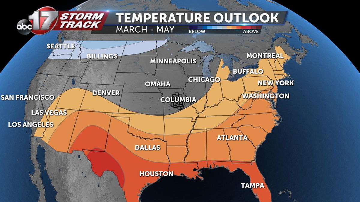
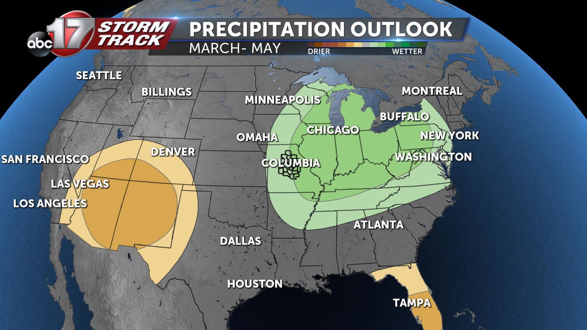
For this spring, I'm tracking near-average temperatures. Cooler-than-average temperatures are expected through much of March, before things begin to warm up. Our typical last freeze falls around April 15. Precipitation is trending above average through May, with an increase in potential severe weather events in April and May.
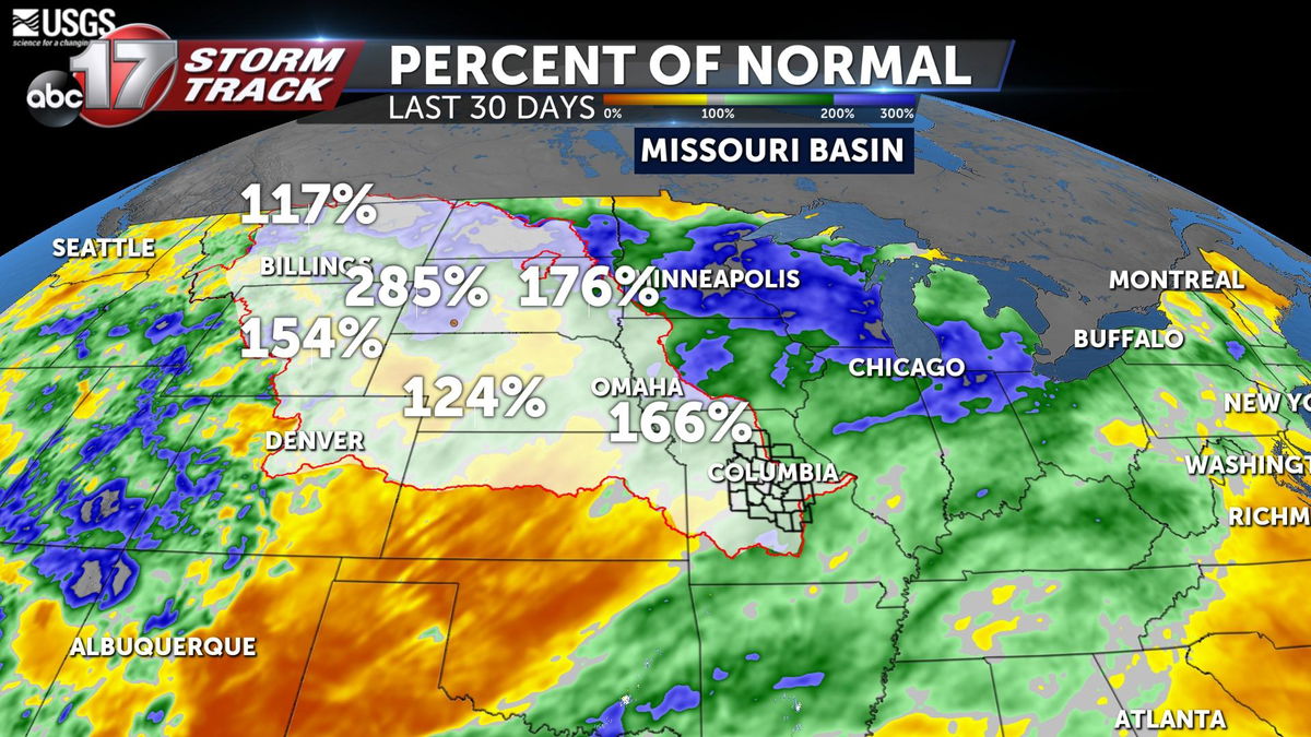
Even though we're coming off a drought, the upper Missouri Basin that flows into the Missouri and Mississippi rivers and their tributaries has received rounds of precipitation including more snowfall this season. The last month has brought rainfall amounts between 150 and 250% higher than normal. Snowpack is looking healthy across Minnesota and the Dakotas, but snow amounts don't look to produce excessive runoff downstream.
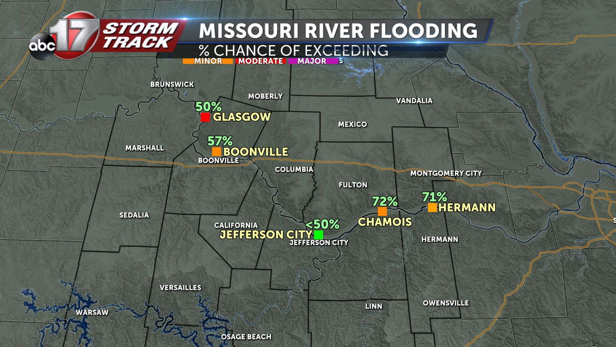
Through May, the upper Plains look to ease drought conditions with no new drought developing in Mid-Missouri. There could be minor flooding on the Missouri River, especially from Chamois to Hermann. Jefferson City has a much lower chance of seeing flooding this spring. Moderate flooding is expected along the Mississippi River from Minnesota to St. Louis.
Near-normal flooding is expected along smaller rivers as snow melts upstream and flows into the smaller tributaries.
Spring tends to be the busiest and most dangerous season when it comes to inconvenient weather in Mid-Missouri. Check out the Insider Blog for ways to prepare and stay safe ahead of wind, hail, tornadoes, flooding, and lightning in the forecast. The ABC 17 Stormtrack Weather app is a great way to stay aware of upcoming severe weather or Weather Alert Days. You can download that for free, here.
