Insider Blog: Weekend system brings thunderstorm chances with some ingredients for severe storms
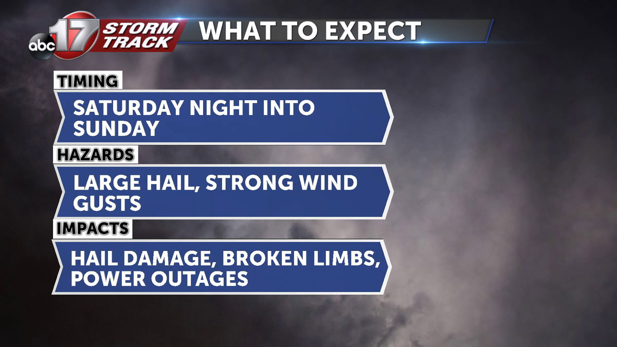
The ABC 17 Stormtrack Weather Team is tracking the likelihood of rain and storms over the weekend, along with the potential for severe weather across the region between late Saturday and Sunday.
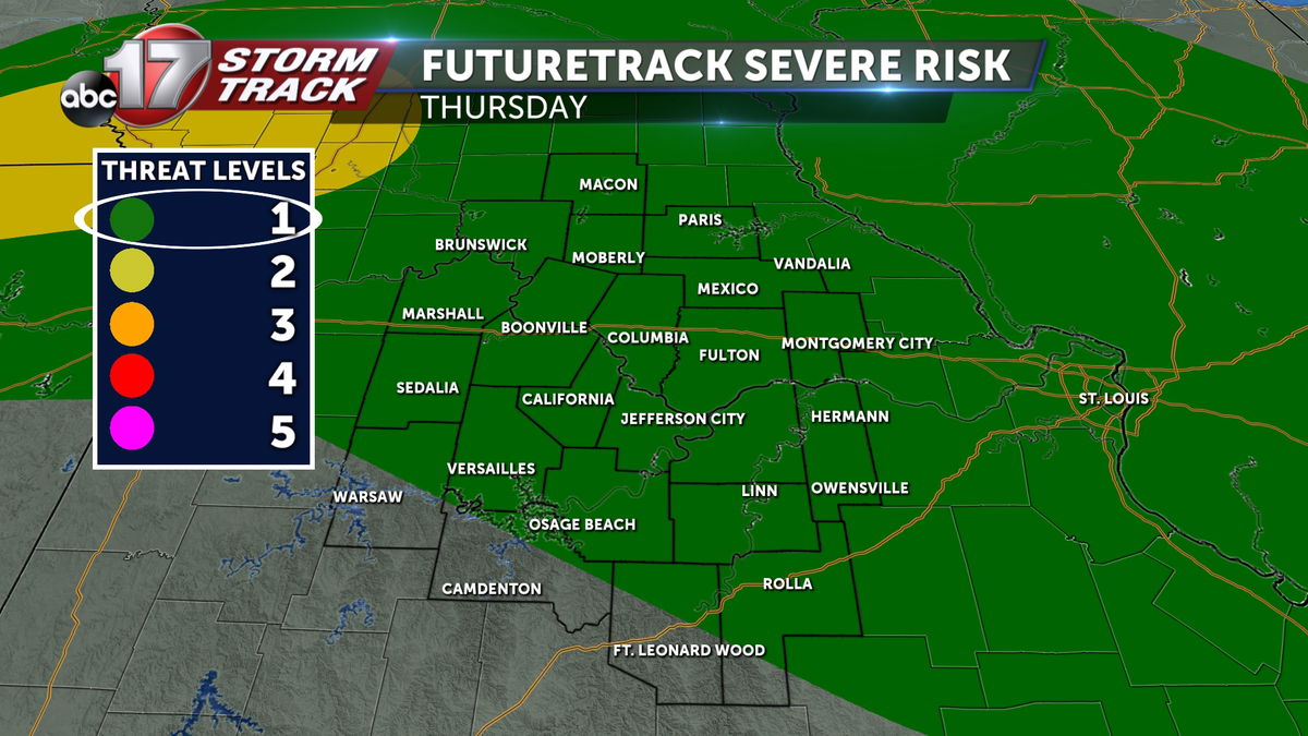
We see a pattern shift toward the end of the week. There will be storm chances tied to a warm front on Thursday. This will bring an isolated risk for hail Thursday morning to midday near the front.
We'll be south of that warm front on Friday, allowing warmer air to settle in to close out the week as highs reach 80 degrees. Friday will be windy with winds sustained between 15-25 mph.
Saturday looks to start off with a few showers in the east and some clouds cluttering the skies, but we'll be tracking a stronger low pressure system that organizes out over the Plains between Friday night and Saturday. Ahead of that, winds will shift to the southwest, pushing dew point temperatures into the upper 50s to low 60s.
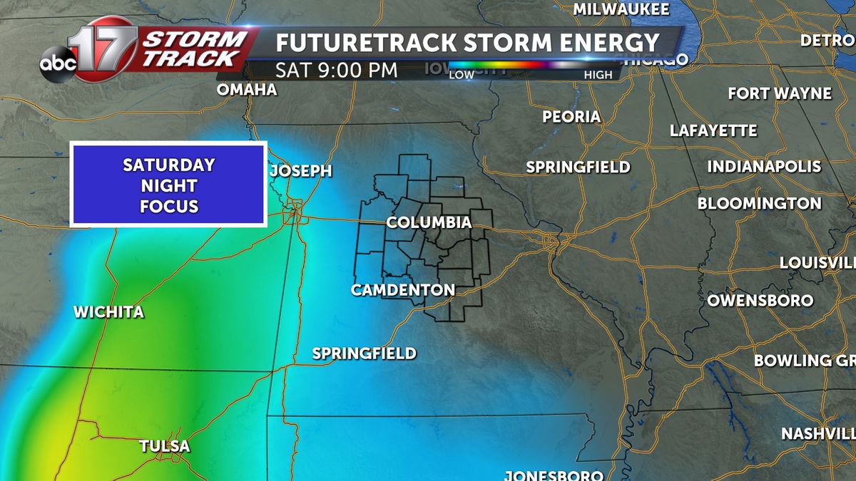
Instability may not increase locally until late in the evening as showers and clouds may keep instability low for much of the day. As the system approaches from the west, however, instability is expected to increase.
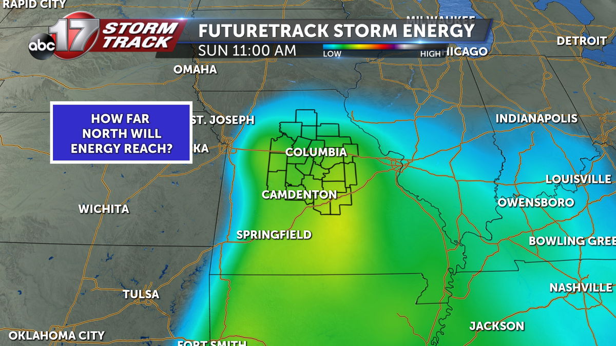
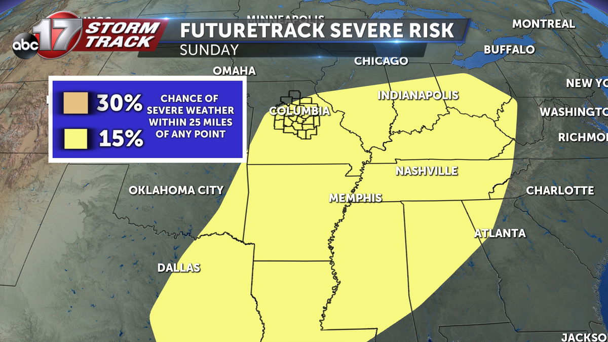
The question here, is how far north will storm energy reach? It may not push as far north as mid-Missouri. The timing of the system may favor less storm energy as well, if it passes during the early morning hours. This is partly why you'll find mid-Missouri right on the western edge of the SPC outlook for Sunday. Increasing confidence in certain forecast features could remove us from Sunday's severe window.
The dynamics of this system could support severe weather with enough wind shear, but the magnitude appears to be on a much lower scale than what we saw with our last regional severe weather episode on March 14.
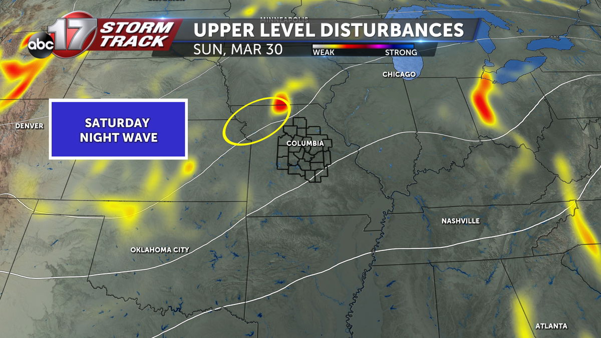
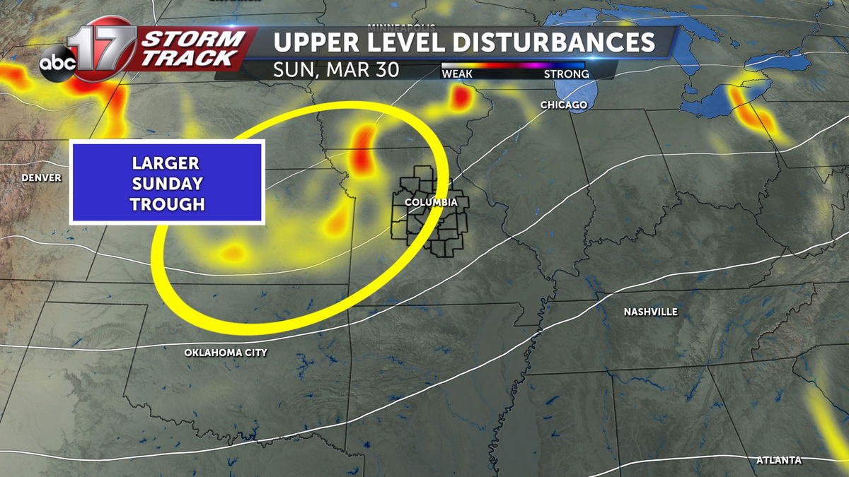
There are two primary waves we're watching. One is a small wave that will may be cast out ahead of the parent trough. This could stir a few chances for storms Saturday night in the north and west. The surface low responsible for our greatest severe threat will be tied more closely to a larger wave coming through on Sunday. Screengrabs below are representative of this, but understand that even these details are shifting with every run of new data. We expect continued shifts to these details.
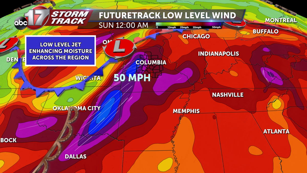
The influence of lower level winds looks to be more promising to our east on Sunday. This also contributes to some uncertainty in our severe threat here on the edge of the SPC outlook for Sunday.
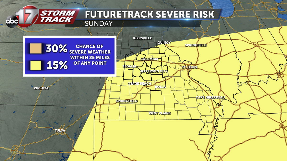
The Storm Prediction Center has Mid-Missouri outlined in a broad 15% risk for severe storms on Sunday. A small shift in timing could take the best ingredients east of us, and a change in system placement or strength could drop the threat south.
If you like details, you have something to think about for now, but it's too early for any further discernment of the weekend's severe threat. Stay with ABC 17 Stormtrack Weather as we continue to monitor the forecast details over the coming days. Make sure you have our weather app to get the latest updates from our team, and alerts when they are issued.
