Insider Blog: Precipitation totals still down on the year despite winter storms
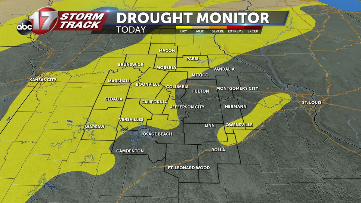
Today's Drought Monitor shows dry conditions spread across much of mid-Missouri.
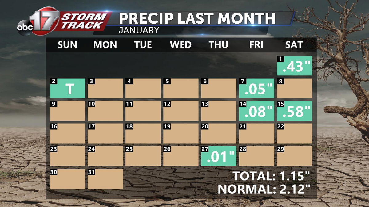
January saw few stretches of wet weather, rather mostly sporadic days of precipitation totaling roughly half what's normal for the month.
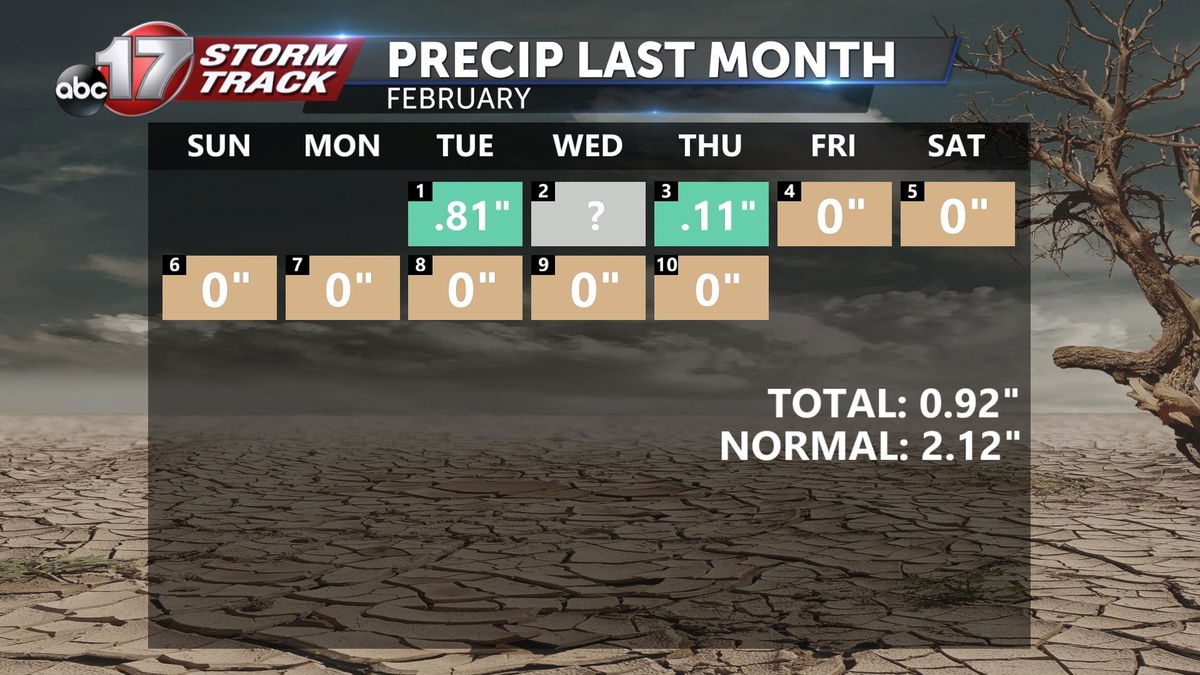
After ending January at a defecit, February started wet. Thanks to a winter storm in the first 3 days, this month is already wetter than normal through the first ten days, but we still have ground to make up through the second half.
You may be wondering, why we're even talking about dry conditions when we have been trekking through melting snow that was once nearly a foot high. While this winter storm has gotten us closer to righting the ship, it's not as much moisture as you may think.
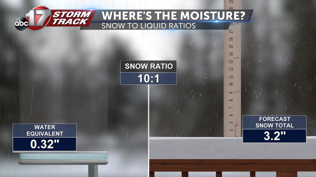
When snow melts to water, the moisture becomes much more consolidated and takes up less space. We use snow to liquid ratios to describe the difference between snow totals and actual moisture content in the snow. Essentially, in a storm like this we may see several inches of snow fall, but still only receive less than half an inch in measurable liquid water. That smaller value is the number that gets added to our precipitation totals.
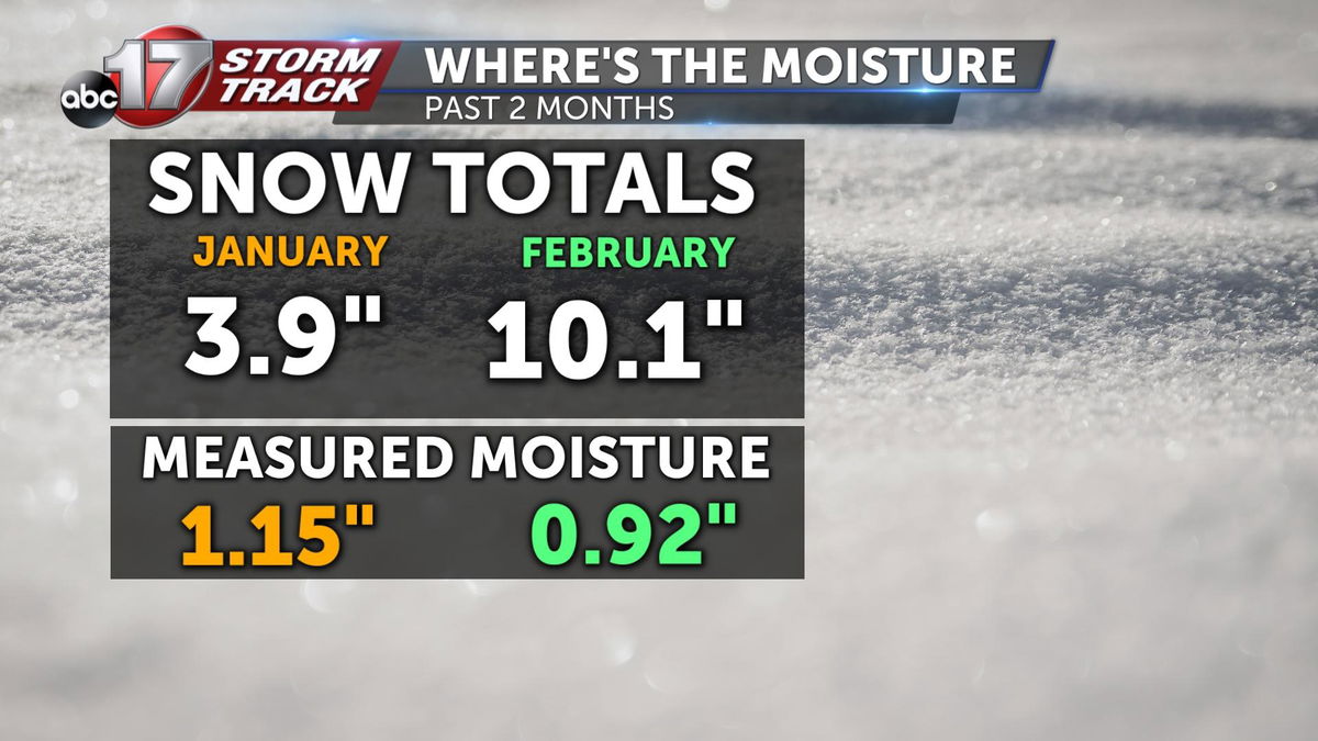
Even though the Columbia Area has recorded 14 inches of snow this year, we've only measured a little over 2 inches in total precipitation, and that includes some rain!
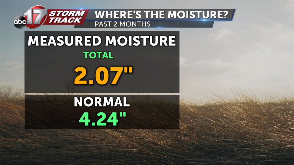
This puts us about 2 inches behind if the month were to end today.
The good news is that we're only halfway through February, and there are chances for significant rainfall in the next seven days.
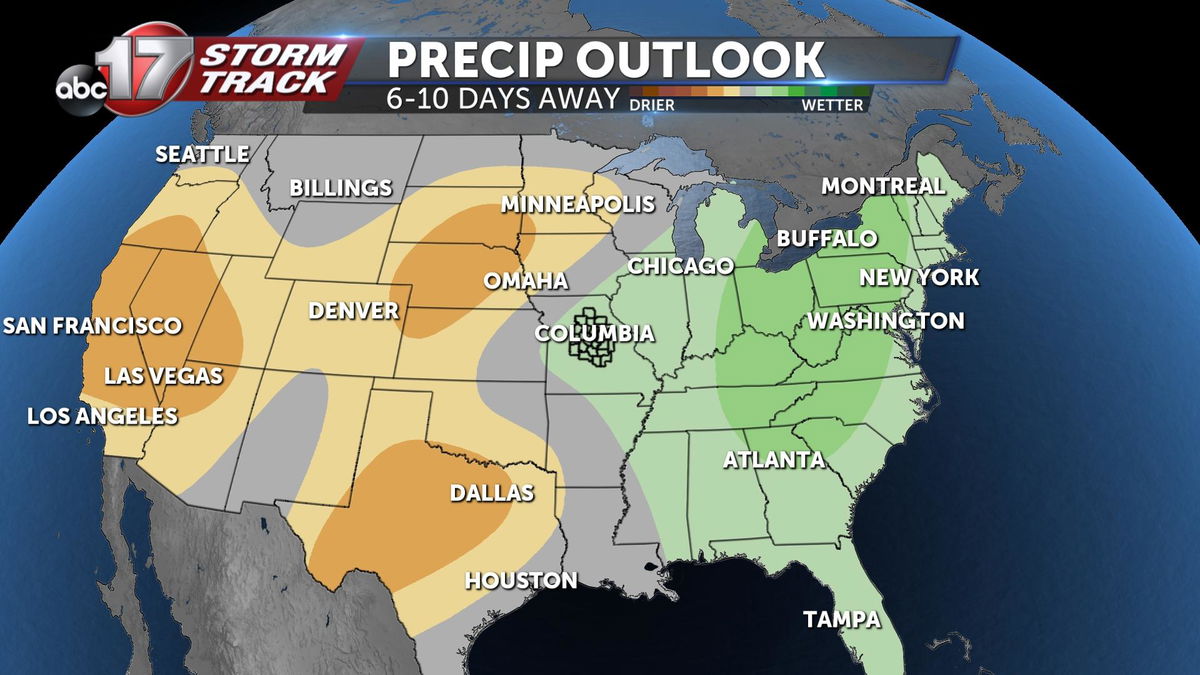
Beyond that, the extended forecast shows a wetter than average expectation through February 21'st.
