WEATHER ALERT DAY: Snow takes over in Mid-Missouri
Watch a live-streamed newscast at 7 a.m. in the player below.
The ABC 17 Stormtrack Weather Team is tracking the latest chance at accumulating snow that could impact Mid-Missouri early this weekend. With a complex situation, we'll have the latest updates as we learn them below:
SATURDAY MORNING UPDATE:
Warm air has held stubbornly overnight but we're finally starting to transition over to some snow. Rain stayed fairly light, which didn't cool off temperatures nearly as much as we anticipated.
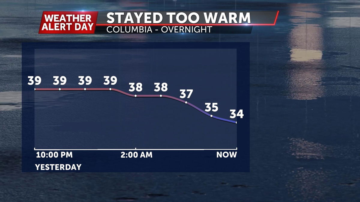
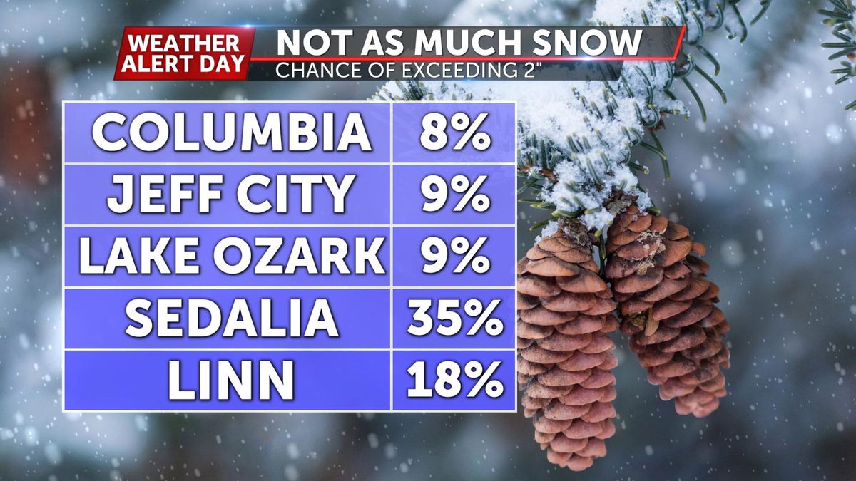
This long of a delay has narrowed our window of accumulating snow, which will limit amounts when this is all said and done.
FRIDAY MORNING UPDATE:
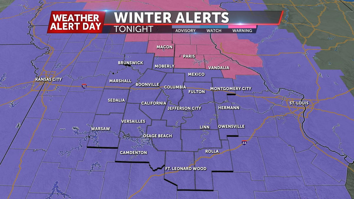
The National Weather Service has issued Winter Weather Advisories for all of Mid-Missouri with treacherous roadways anticipated.
One minor detail raising eyebrows this morning are temperatures. They've come in a bit warmer, which would give us further to go to get back to freezing tonight. If we get into the upper 40's the onset of snow would get pushed back a few hours late tonight, but shouldn't have much of an effect on snow totals.
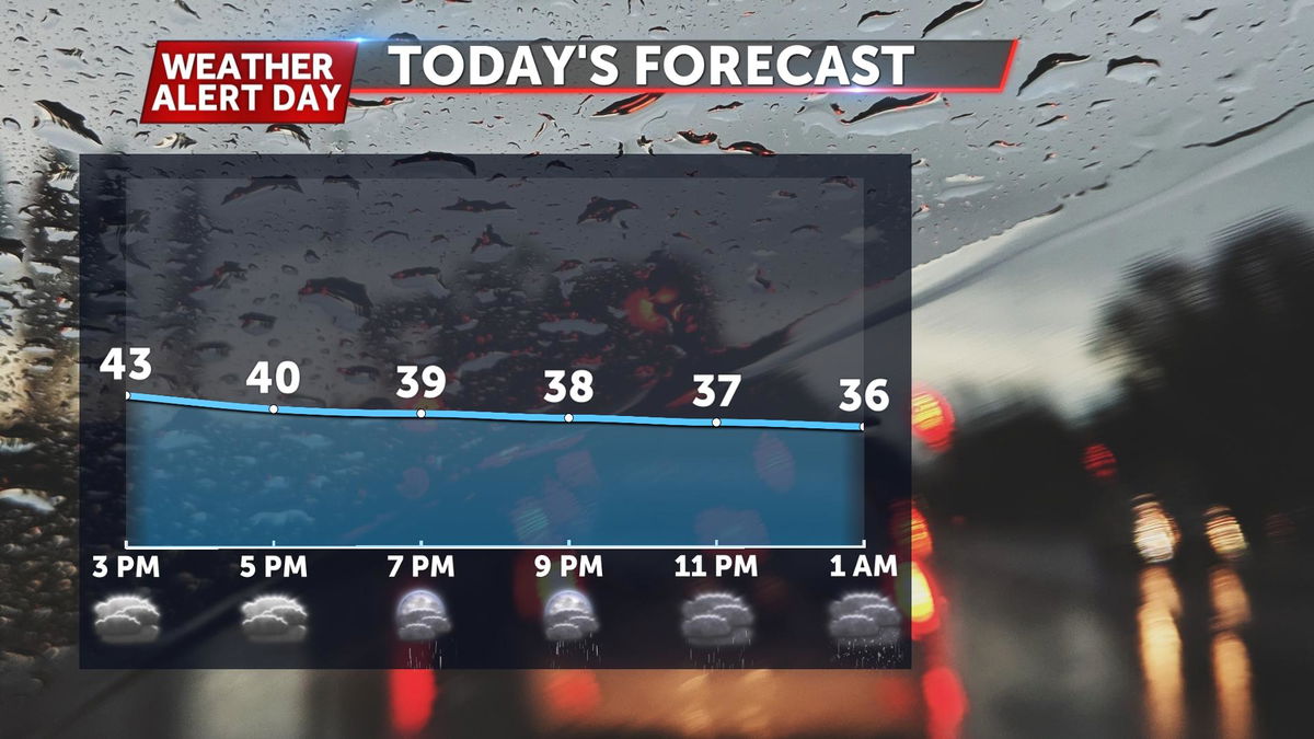
Look for temperatures to fall to around 35° before changing our rain over to snow tonight.
WHAT WE KNOW NOW
THURSDAY MORNING UPDATE
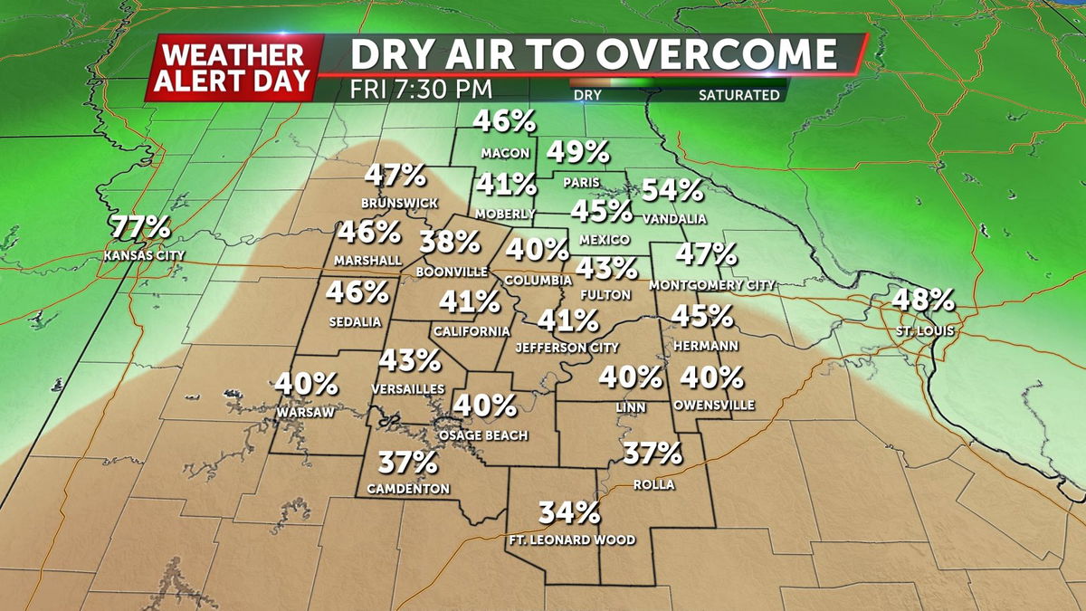
Confidence has increased enough in the track of this system that accumulating snow is now expected areawide. What we'll likely be wrestling with over the next few days will be dry air at the onset of this storm moving in. That should help hold off rain/snow until the evening for most of us Friday.
Setup
An inverted trough is coming together in the Upper Midwest this morning. That will slide south, bringing colder temperatures and plenty of moisture into Mid-Missouri. Precipitation will begin as rain, before transitioning over to snow tonight.
Timeline
Temperatures will top out in the middle 40's on Friday. There is a slight chance we pick up some light showers Friday afternoon but would stay dry before then. The precip will ramp up closer toward midnight, which is when we expect that rain to transition over to snow. Snow will stay the predominant precipitation type for the remainder of the event.
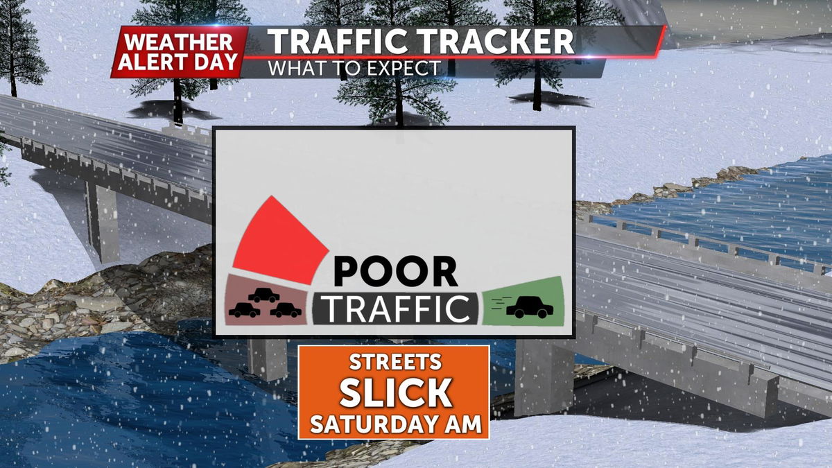
With highs in the low 40's on Friday, anything falling during the afternoon wouldn't be too troubling. Temperatures will cool off after sunset, getting to the freezing mark around midnight. It would be from then until the snow comes to an end sometime Saturday that's the timeframe of concern
WHAT WE'RE TRACKING
When the changeover happens
If we get to snow falling sooner than expected, totals would increase. The opposite would be true if rain were to stick around a bit longer Friday night.
How long into Saturday
This would have an effect on road conditions throughout the day on Saturday. It likely wouldn't add much if anything to snow totals.
What to Expect
Impactful snowfall is a foregone conclusion at this point. Here's how we think it will break down:
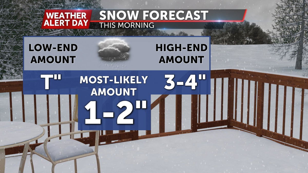
Snow accumulation chances will be greatest to the north, but stretch across our entire region. Forecast totals will be more clear closer to the event. Below is a range of totals that explains what we believe to be most likely areawide, and what could come on the low and high sides.

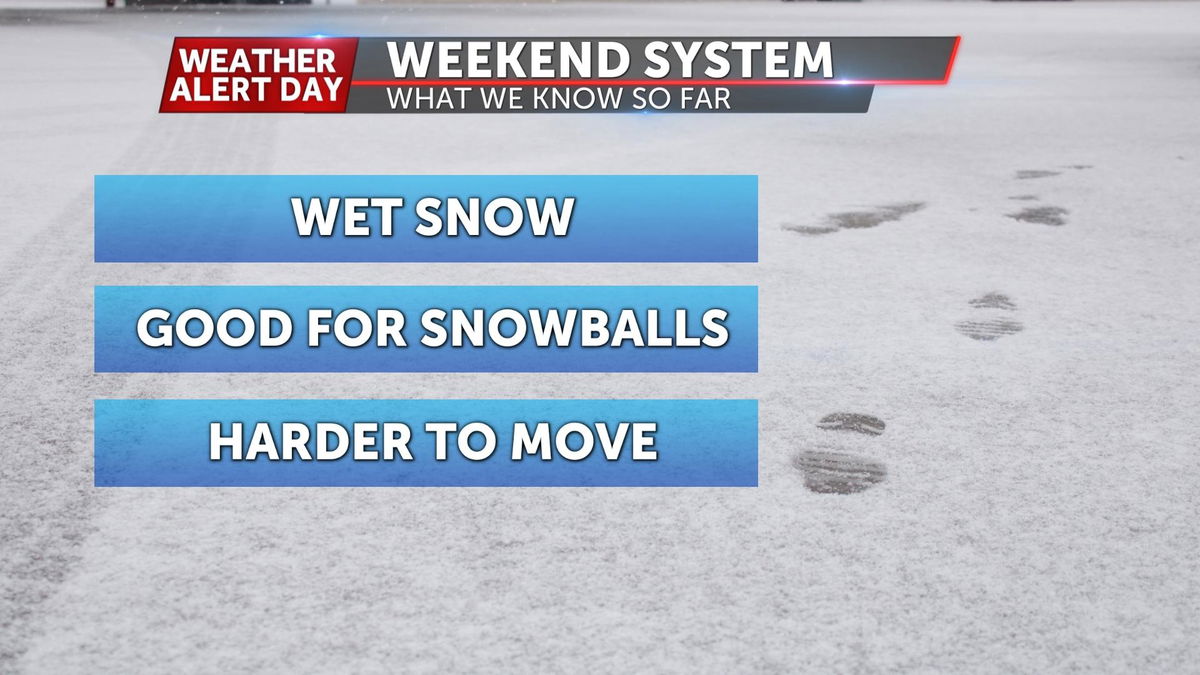
We do expect the snow that falls earlier in the evening to be a wet snow, meaning you should be able to make some pretty good snowballs if that continues. The problem is, this will be tougher to clear than the dry and drifty snow we saw last. Snow should trend drier further into Saturday, as colder air pulls in from the north.