Significant river flooding possible again this spring
Last year was an active weather year for Mid-Missouri, with more than a foot of snow in less than 48 hours in January, destructive tornadoes in May and late spring flooding.
Levees along the Missouri River were damaged or destroyed, and the same areas could be affected by more flooding in the months to come.
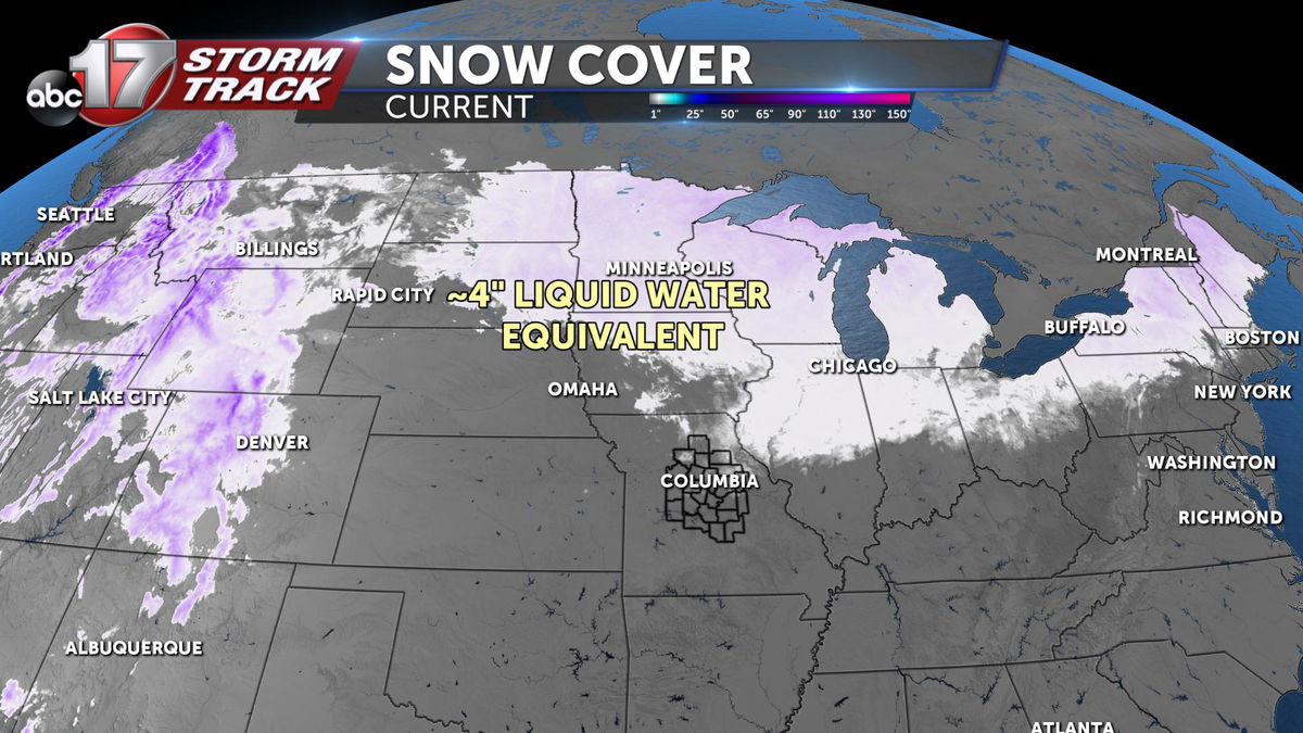
Conditions within the Missouri Basin are similar to what played out last year, with a widespread snowpack along with above-average liquid water content.
In 2019, there were about 3 inches of water equivalent across the upper Midwest, and so far we're at about 4 inches for 2020.
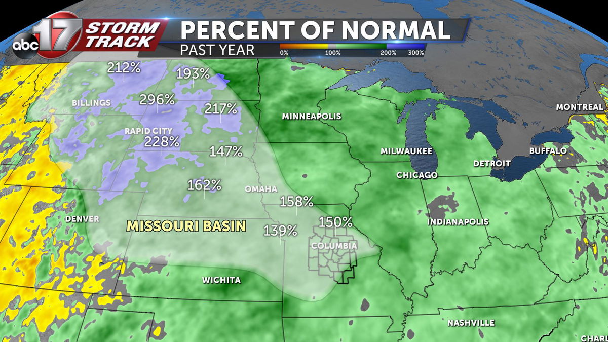
Across the Missouri Basin, precipitation amounts are more than 200 percent higher than normal since last year from Montana through the Dakotas. Even in Mid-Missouri, we're about 100-150 percent higher than average.
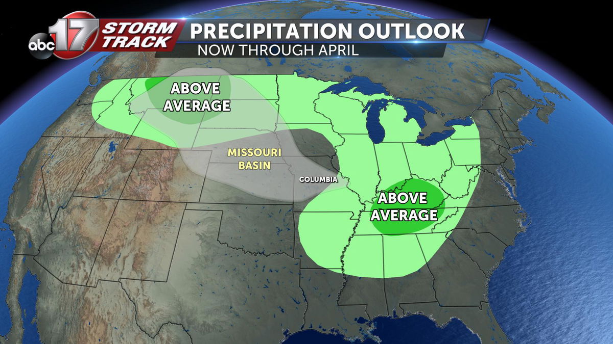
The ABC 17 Stormtrack Weather Team is expecting above-average precipitation through April across the upper Midwest and Plains. Last year, we ran into the problem of rapid snowmelt at the same time as thunderstorms and heavy rain. That scenario could play out again this spring.
Late last spring, every major location along the Missouri River experienced moderate to major flooding. A state of emergency was issued as crests got within feet of records set during the Great Flood of 1993.
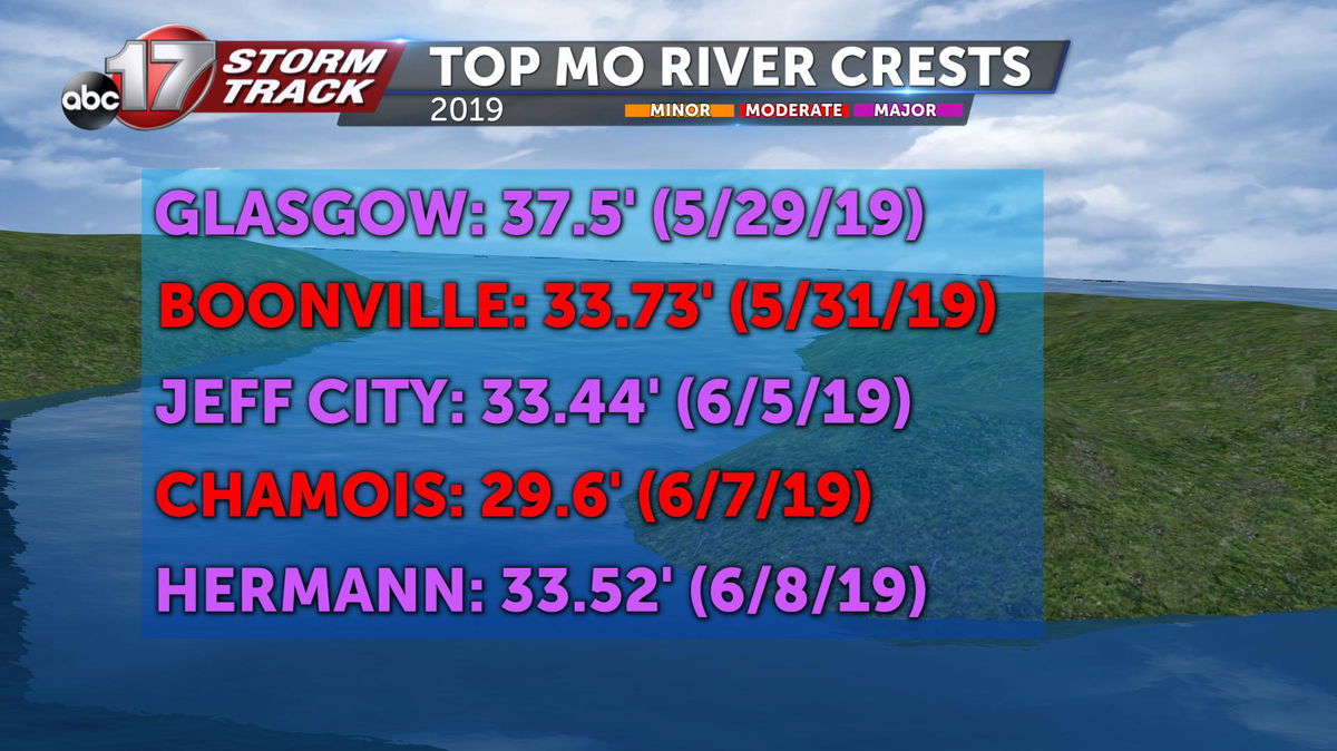
Glasgow, Jefferson City, and Hermann all recorded crests in major flood stage at the end of May through the first week of June. Chamois and Boonville both got into moderate flood stage around the same time.
Conditions are favorable for more flooding this spring, with minor to moderate flooding expected by April.
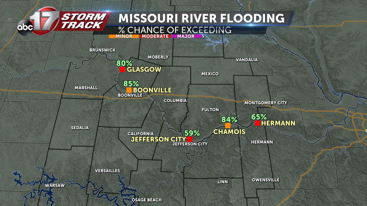
Glasgow is the most concerning, with an 80 percent chance of exceeding moderate flood stage. Jefferson City is also on our radar, with a nearly 60 percent chance of spilling over into moderate flood stage. Hermann has a 65 percent chance of exceeding moderate flood stage, too.
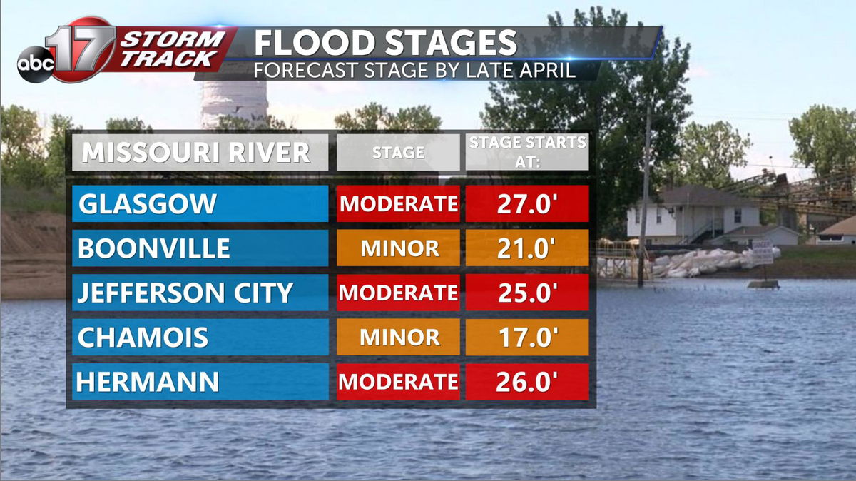
Moderate flood stage for Glasgow is 27 feet, Jefferson City starts at 25 feet and Hermann at 26 feet.
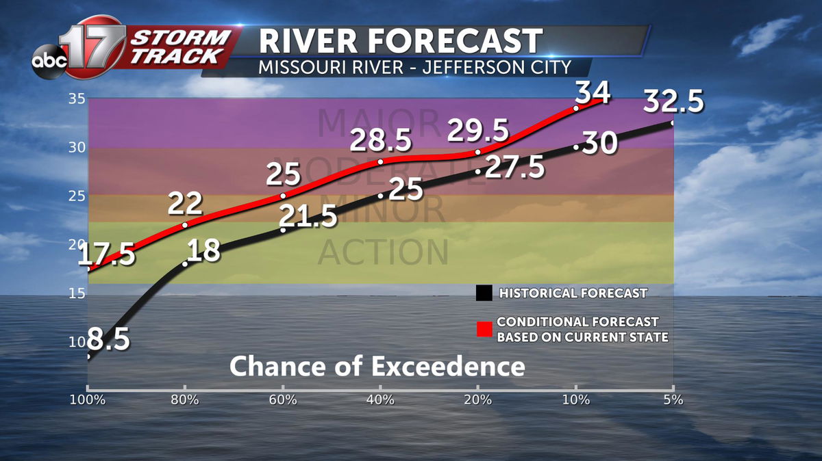
The graph above shows the historical chance of exceeding each flood stage in Jefferson City for the next three months in black, while the red line shows the forecast given the current conditions. By comparing the two lines, you can see our forecast for this year gives us a higher chance of getting into moderate flood stage than usual. The chance of exceeding major flood stage is only slightly higher than normal; just under 20 percent.
The bottom line? Expect more flooding this spring along the Missouri River as the snow begins to melt and spring storms get going in the next month.
