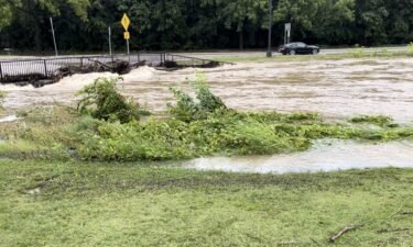
Flooding affects morning Fourth of July festivities in Fulton
Severe flash flooding had multiple roads in Fulton blocked off Thursday morning.
Continue Reading Severe flash flooding had multiple roads in Fulton blocked off Thursday morning.
Continue Reading
Isolated storms have started to develop across the Missouri-Iowa border and have quickly become intense
Continue Reading
TONIGHT: Thursday is an ABC 17 Stormtrack Weather Alert Day for potential severe storms this evening. The first of these storms arrives at 9-10 p.m. for Sedalia, Warsaw, and the Lake area. Storms will then track east to I-44 around midnight, with storms heading out late overnight. Jefferson City and places northward have a lower chance
Continue Reading
The companies insuring against Mother Nature are finding it increasingly harder to do so in a changing climate. Bigger wildfires, stronger hurricanes, and more severe storms all put more strain on the industry protecting our property. But the future looks to hold more disasters that will cost even more money to bounce back from. The
Continue Reading
JEFFERSON CITY, Mo. (KMIZ) The park on Adrian’s Island in Jefferson City will close at 4 p.m. Thursday as the Missouri River continues to rise. Jefferson City Parks and Recreation wrote in a Facebook post Thursday that the rising river was already starting to inundate Deborah Cooper Park. The Missouri River at Jefferson City was
Continue Reading
An alley in downtown Columbia is closed after a partial building collapse on Wednesday afternoon because of heavy rainfall early that morning, according to a news release.
Continue Reading
Around 134 million people in the U.S. are under alerts as an “extremely dangerous and record-breaking” heat wave broils much of the country, according to the National Weather Service.
Continue Reading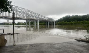
COLUMBIA, Mo. (KMIZ) Flooding remained a concern in Mid-Missouri Thursday morning after rain fell, causing flooding in several areas. According to the MoDOT traveler map, Route ZZ, Route E are closed in Boone County due to flooding. Route A near Moniteau Creek was reported closed due to flooding along with Route P in Cooper County,
Continue Reading
TODAY: Thursday is an ABC17 Stormtrack Weather Alert Day. Storms that have formed before sunrise have created a flooding threat south of I-70 and along HWY 50. Pay attention to flood alerts this morning as this situation will develop quickly. Flooding from heavy and repetitive rains will be our main concern this morning, until storms
Continue Reading
Several rounds of severe weather and heavy rain have put the Missouri Basin to our north in a surplus, leading to downstream flooding along the Missouri River in Mid-Missouri. That upstream rain coupled with flooding from strong storms Tuesday night will cause locations along the Missouri River to reach minor to moderate flood stage over
Continue Reading
TONIGHT: Mostly cloudy with scattered showers early. Showers and storms becoming more widespread overnight into tomorrow morning. 2-3″ rain is likely, with locally higher amounts possible. Watch out for water covered roads. Lows near 70. TOMORROW: Rain clearing by mid-morning with partly cloudy skies. Hot and humid with highs in the upper 80s. Storms developing
Continue Reading
A woman is presumed dead after her vehicle was swept up in Perche Creek floodwaters west of Columbia on Wednesday.
Continue Reading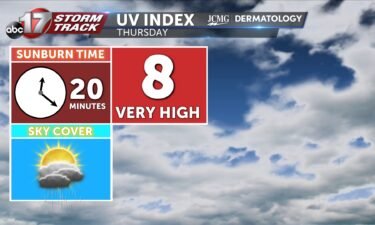
The UV index will be slightly lower tomorrow with morning rain and clouds. Pollen levels remain low.
Continue Reading
This upcoming fall deer and turkey seasons, hunters across many mid-Missouri towns will need to pay extra close attention to changes in regulations brought on by the Missouri Department of Conservation. Boone, Audrain, Howard, Osage, Maries and Saline counties have all been added to the Chronic Waste Disease (CWD) management zones . Starting July 1st, there
Continue Reading
THIS AFTERNOON: Storms are possible again this afternoon toward I-44 and the Lake with the threat of strong winds. Flooding will be a concern from any storms after parts of Mid-MO picked up several inches early Wednesday. TONIGHT: Rain coverage increases tonight keeping the risk of flooding into the early morning. Heavy downpours and lightning
Continue Reading
TODAY: After rain ends around sunrise, we’ll have some dry time. Skies may allow a few peaks of sunshine through an otherwise mostly cloudy sky before we become overcast again this afternoon. TONIGHT: A cold front, the one that brough last night’s storms, will settle near I-44. Showers and storms will return along the front,
Continue Reading
TONIGHT: Increasing clouds with showers and storms likely. Some could be strong with gusty winds, especially north of I-70. Rainfall amounts between 1-2″ possible. Lows in the lower 70s. TOMORROW: Spotty showers early, followed by mostly cloudy skies. Highs in the upper 80s with a heat index in the mid-90s. A few strong storms with
Continue Reading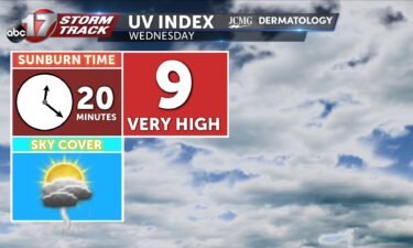
Wednesday’s UV index will be high despite morning clouds and a few showers. Pollen levels remain low through the weekend.
Continue Reading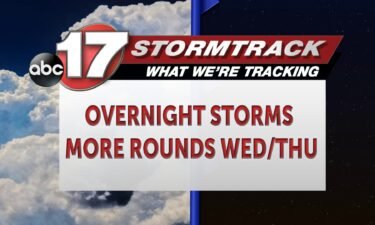
TODAY: Tuesday will be notably warmer than Monday. Temperatures reach into the 90s, with enough humidity to have us feeling like low triple digits in the afternoon. TONIGHT: Storms return from the north along a cold front after 8 p.m. near Brunswick and Macon. At this point, we’ll have a chance for strong to severe
Continue Reading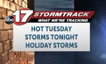
TODAY: Tuesday will be notably warmer than Monday. Temperatures reach into the 90s, with enough humidity to have us feeling like low triple digits in the afternoon. TONIGHT: Storms return from the north along a cold front after 7 p.m. near Brunswick and Macon. At this point, we’ll have a chance for strong to severe
Continue Reading