
Public works monitoring conditions ahead of expected winter weather
The Columbia Department of Public Works is getting ready for winter weather moving in New Year’s Eve.
Continue Reading The Columbia Department of Public Works is getting ready for winter weather moving in New Year’s Eve.
Continue Reading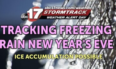
TONIGHT: Mostly cloudy with lows in the low 20s. TOMORROW: Partly to mostly cloudy and chilly with highs in the mid-30s. EXTENDED: A Weather Alert Day is in effect for New Year’s Eve into New Year’s Day as we’ll be tracking the threat for icy conditions. Another low pressure system tracking in from the south
Continue Reading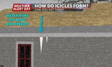
If you’ve ever broken an icicle off of a car, railing, or even roof of a building then you may want to rethink doing it again. For icicles to form, liquid water needs to be present first; whether that comes as rain or as snow that has melted and then will flow off the exterior
Continue Reading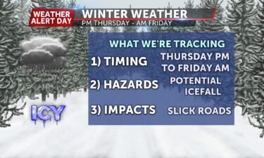
TODAY: Some light flakes may continue to fall throughout the afternoon but dry air will push that out by this evening. Temperatures will stick to just above freezing for most of the afternoon and lows tonight will dip into the mid-20s. THURSDAY: New Year’s Eve will start off chilly but clear as temps hang right around freezing.
Continue Reading
WEDNESDAY MORNING UPDATE: We’ve been holding on to rain this morning but the colder air is sneaking back in. Temperatures are expected to fall back to about the freezing mark by 8-9 AM and give us another shot at some flakes. Still not expecting many problems on the roads, with light accumulations. Wet roads will
Continue Reading
WEDNESDAY: Rain continues to fall this morning but will start to mix in some more wintry weather. That rain will transition to sleet and snow toward 8-9 AM before all snow takes over by midday. Dry air will kick most of the moisture southeast of us by 3 PM. With such a short window and
Continue Reading
COLUMBIA, Mo. (KMIZ) The MoDOT travelers map shows a few counties in Missouri experiencing covered roads Wednesday morning. According to MoDOT, Sullivan county, and Putnam county are reporting covered roads over most of the area. Some counties are seeing partly covered roads, including Macon, Gentry, Buchanan, Knox, and Clark.Audrain, Randolph, Monroe, and Marion Counties are
Continue Reading
TONIGHT: Mostly cloudy with rain moving in late. Showers continue overnight. Low near 38. TOMORROW: Rain through mid-morning, moving south during the day. Cold air moves in by mid-afternoon, allowing rain to briefly change over to snow south of Highway 50. A dusting of snow will be possible, with precipitation shifting south toward I-44 for
Continue Reading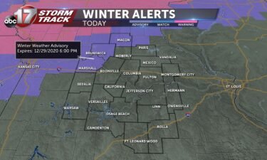
TUESDAY: A wintry mix is expected to move in this morning. Will start out as snow before changing over to a mix of sleet and freezing rain into the early afternoon hours. Limited impacts expected for most of us, but our extreme northwestern counties should expect some slick roads this afternoon. Tempeatures will struggle to warm
Continue Reading
Temperatures remained below freezing shortly before noon Tuesday, causing state travel authorities to warn of slippery roads in central Missouri.
Continue Reading
TUESDAY: A wintry mix is expected to move in this morning. Will start out as snow before changing over to a mix of sleet and freezing rain into the early afternoon hours. Limited impacts expected for most of us, but our extreme northwestern counties should expect some slick roads this afternoon. Tempeatures will struggle to
Continue Reading
TONIGHT: Mostly cloudy with lows in the upper 20s. TOMORROW: Temperatures start off near freezing with precipitation moving in by mid-morning. A wintry mix is possible along and north of I-70 through mid-afternoon, allowing for some slick spots through late afternoon. Temperatures warm up by evening, changing precipitation over to rain as gusty south winds
Continue Reading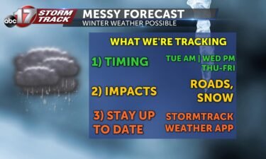
MONDAY: Noticeably cooler today with highs stuck in the upper 30’s after waking up in the 20’s. We’ll be tracking some sunshine later today so that will help a bit. TONIGHT: Mostly cloudy skies move in, keeping temperatures in the mid to upper 20’s. EXTENDED: Tuesday is the start of what could be a few rounds of wintry weather we’re tracking.
Continue Reading
MONDAY: Noticeably cooler today with highs stuck in the upper 30’s after waking up in the 20’s. We’ll be tracking some sunshine later today so that will help a bit. TONIGHT: Mostly cloudy skies move in, keeping temperatures in the mid to upper 20’s. EXTENDED: Tuesday is the start of what could be a few rounds of wintry weather
Continue Reading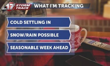
TONIGHT: Temperatures will be much cooler than last night with lows falling into the mid 20s. MONDAY: Temperatures tomorrow will start out in the upper 20s for the morning and reach the upper 30s. EXTENDED: Another system will begin moving in on Tuesday and could bring a wintry mix with it. This will transition to rain on
Continue Reading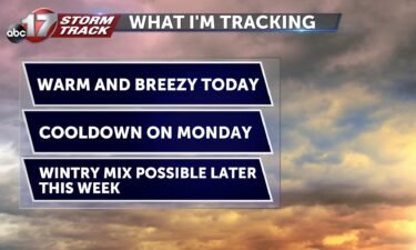
TODAY: Winds will pick up today from the south. This will continue to bring warm conditions as highs approach the mid-50s this afternoon. MONDAY: A front will pass through Sunday night that brings seasonal conditions back to the area. Temperatures tomorrow will start out in the upper 20s for the morning and reach the upper 30s. EXTENDED:
Continue Reading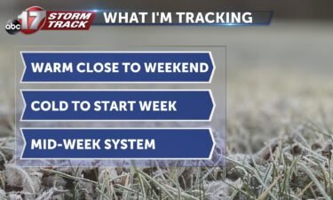
TONIGHT: Clouds increase a bit overnight. That along with a southerly breeze will keep us warmer than nights past. Lows will fall into the low to mid 30’s. TOMORROW: Winds pick up Sunday, which will help carry temperatures a few degrees further. We’ll manage to make it into the low to mid 50’s closing out the
Continue Reading
SATURDAY: After another chilly start, temperatures pick up the pace this afternoon. We’ll top out in the upper 40’s to low 50’s with a healthy dose of sunshine and a southwesterly breeze. TONIGHT: Clouds increase a bit overnight. That along with a southerly breeze will keep us warmer than nights past. Lows will fall into
Continue Reading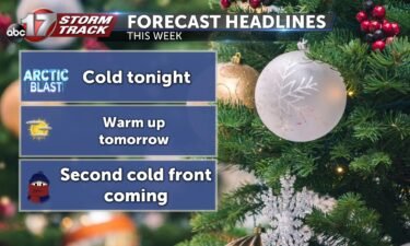
TONIGHT: Mostly clear and cold with lows in the low 20s. TOMORROW: We get a break from the cold air as our arctic air mass moves east, leaving us with southwest winds and mild temperatures for the weekend. We can expect temperatures to warm into the upper 40s. EXTENDED: Sunday will be warm as well
Continue Reading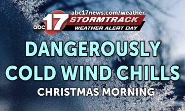
The ABC 17 Stormtrack Weather Team has issued a Weather Alert Day for Friday morning for the threat of dangerously cold wind chills on Christmas Day. Temperatures have dropped like a rock behind the front that moved through yesterday. Arctic air dropping south from Canada sticks around through tomorrow afternoon before exiting east and winds
Continue Reading