Weather Alert Day: Severe storms bring strong winds, possible tornado Monday night
UPDATES:
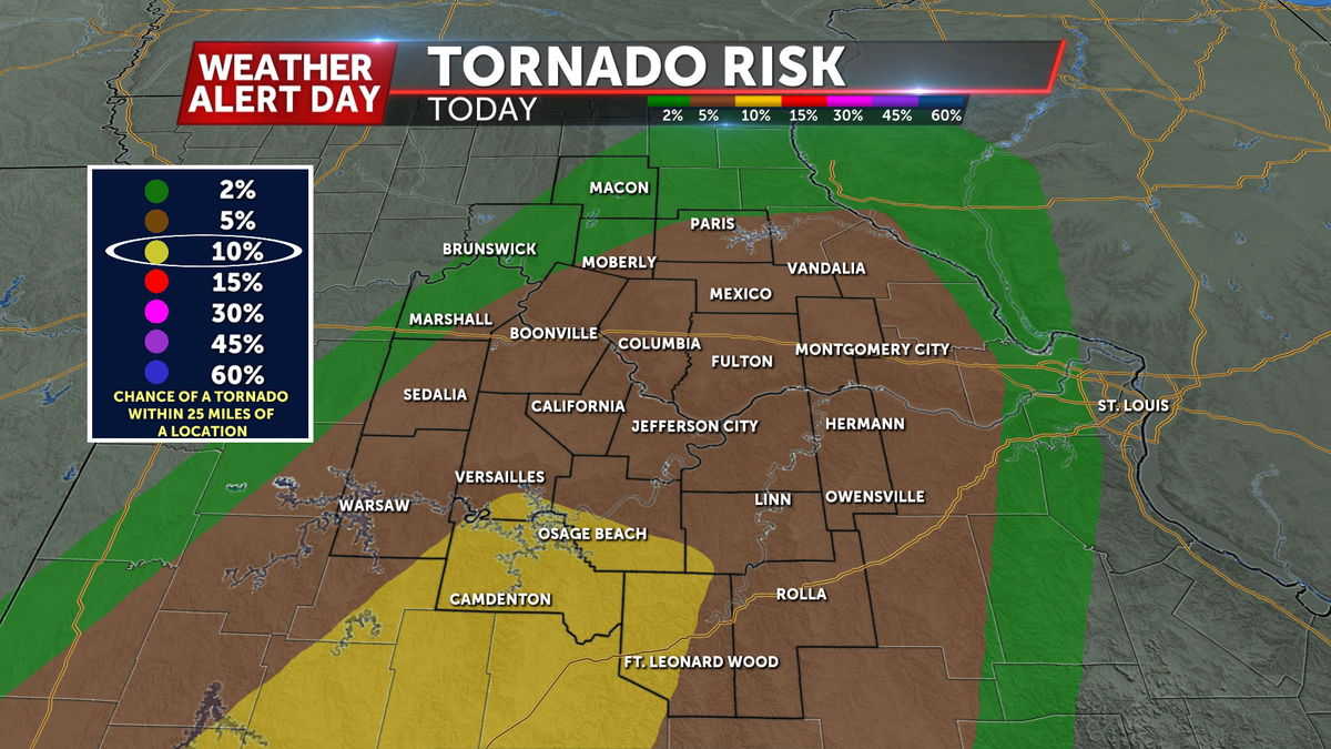
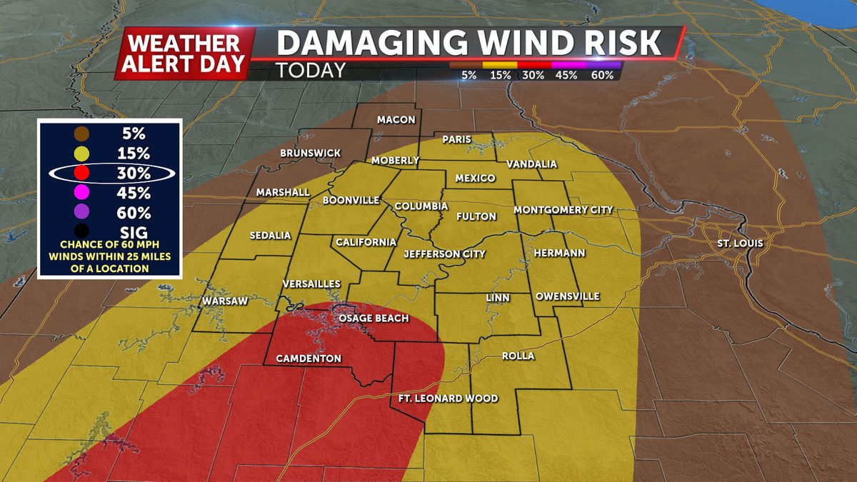
As of this afternoon, our risk for wind and tornadoes has increased for some, as confidence increases in the presence of low level instability (storm energy) with the northward progression of the surface low. Still, plenty of wind and shear will be present with this system, so any storms could quickly become organized and strong.


This increased threat is mainly south of HWY 50, but timing largely remains the same.
BLOG:
An ABC 17 Stormtrack Weather Alert Day has been issued from 4 p.m. Monday afternoon to midnight for the threat of severe storms. These storms will carry a high wind risk and could produce a tornado.


SETUP

Rain showers have already spread across Mid-Missouri on Sunday as southerly winds push in warmer temperatures and moisture. Low-level winds will intensify into Monday, increasing instability and shear over the area. Supercells are expected to blossom in this unstable environment across Central and Southern Missouri and congeal into a line into Monday night. With the wind setup and forecast storm direction, tornado potential is a concern.
FUTURETRACK
Several rounds of storms will precede the severe risk on Monday evening which will impact how strong storms can get. Storms are expected to be ongoing in the morning becoming isolated throughout the day. If the atmosphere can recharge enough energy, isolated severe storms will fire up after 4 p.m. Monday and come together into a heavy line of storms into the evening. It will take until nearly midnight for the severe risk to exit east.
IMPACTS
Initially isolated supercells that fire up Monday afternoon will risk producing a tornado as they have less competition from storms around. When activity grows into a heavy line, downpours and 60 mph winds will be the main concern, though a tornado will still be possible. Hail will not likely be large with these storms but flash flooding may become a problem by Monday night after several rounds of heavy storms.


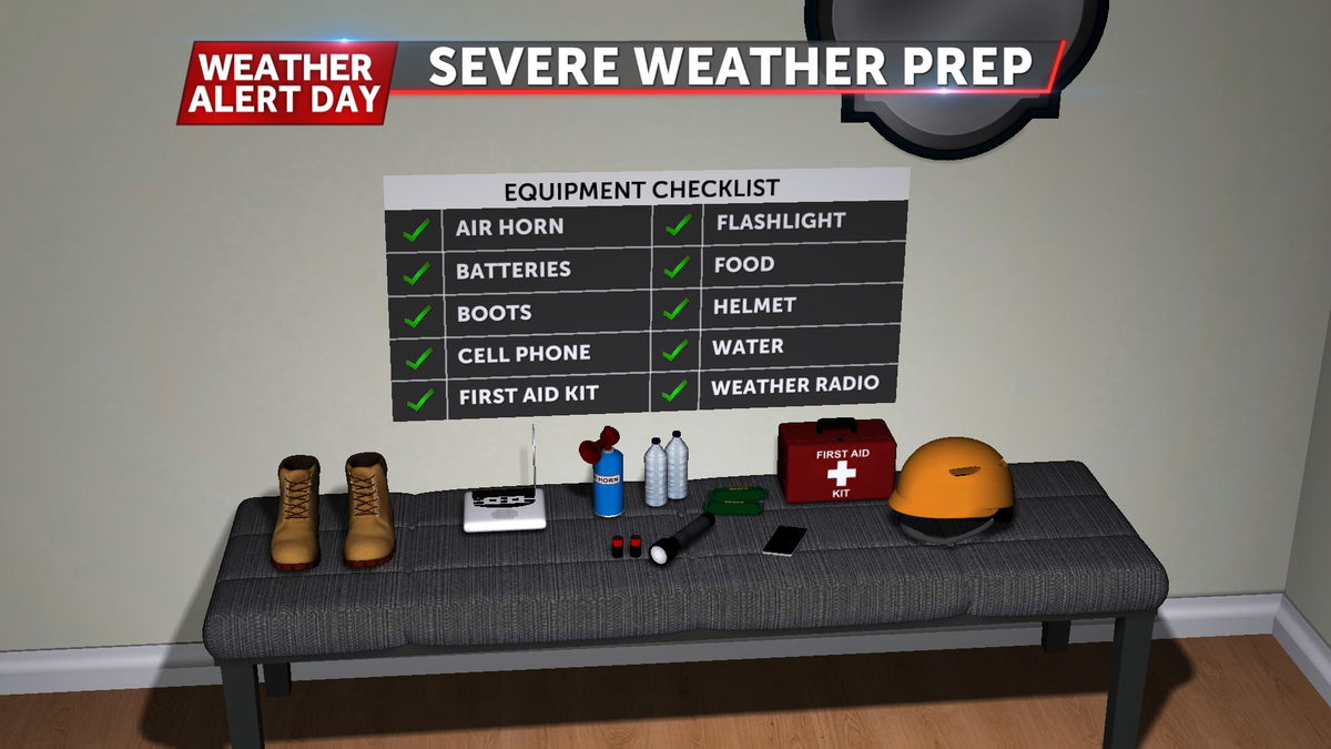
If heading out early this week, be sure you have first aid gear and extra supplies in your car. Have a plan ahead of the storms and know your safe place in your home with tornadoes in the forecast. A lower level interior room with no windows is safest, and you should have a NOAA weather radio to stay informed when other technology may fail.
