Insider Blog: Flash flood warnings in effect as rounds of rain continue
The cold front responsible for severe weather this week has stalled to our south, and we'll continue to see several waves of rain and storms through early Sunday.
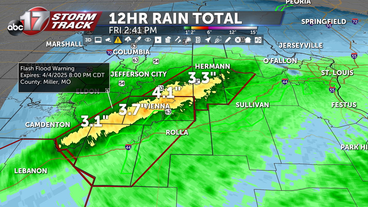
Flash Flood Warnings are in effect for Phelps, Pulaski, Miller, and Maries counties until 8:00 p.m., and parts of Osage and Gasconade as up to 4" of rain has fallen with more on the way.
The flash flooding threat will continue into tonight as low level winds continue to increase along the front, especially along and south of I-44.
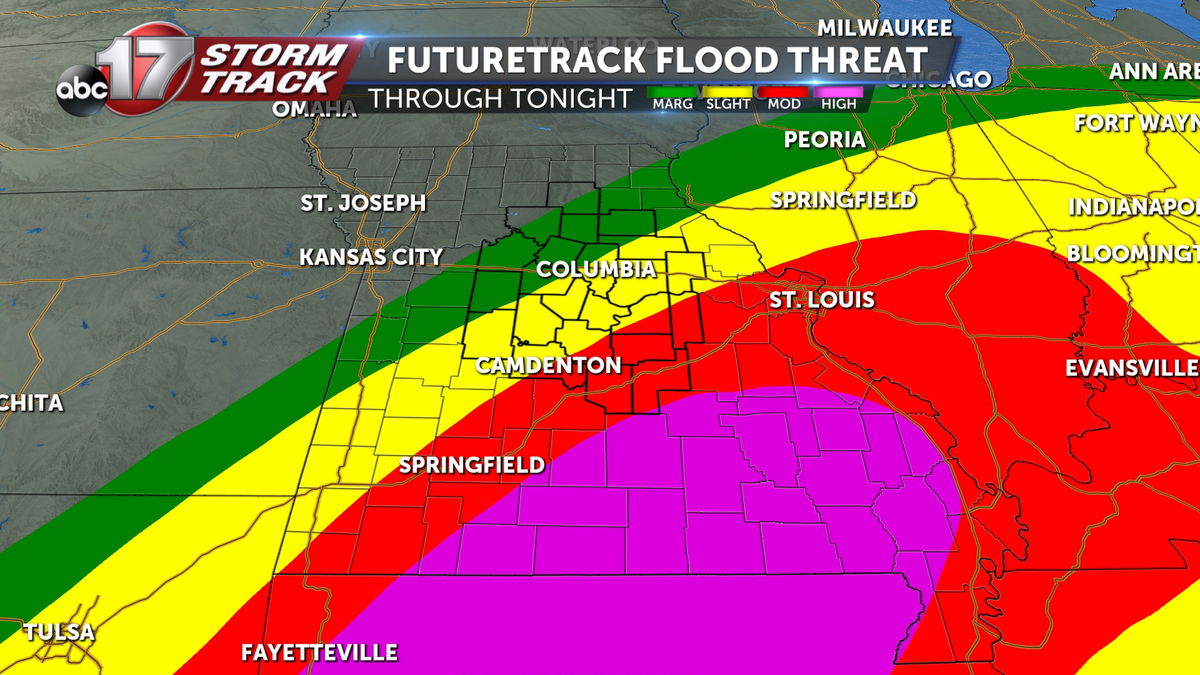
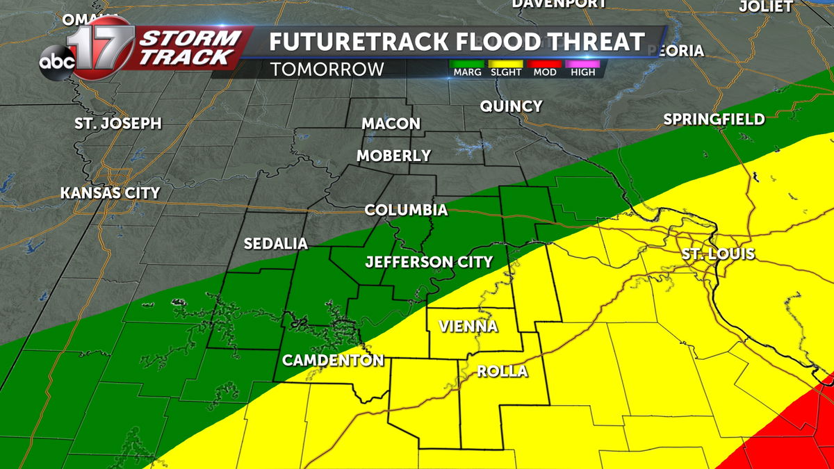
Waves of rain will continue through Sunday morning, with breaks in between. Low level winds could increase moisture along the boundary, leading to potentially dangerous flooding across southern Missouri into the Ohio Valley as rainfall totals could get near a foot over the next three days.
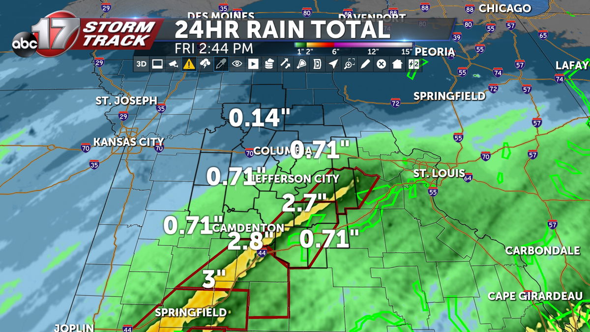
A Flood Watch is in effect for Phelps and Pulaski counties and farther south through Saturday night as rainfall totals in this area could exceed 5".
Farther north, we can still expect measurable rain, but amounts will be lower. 1-2" is likely for areas north of I-70, 2-3" for Columbia and Jefferson City, and 4-5"+ along I-44.
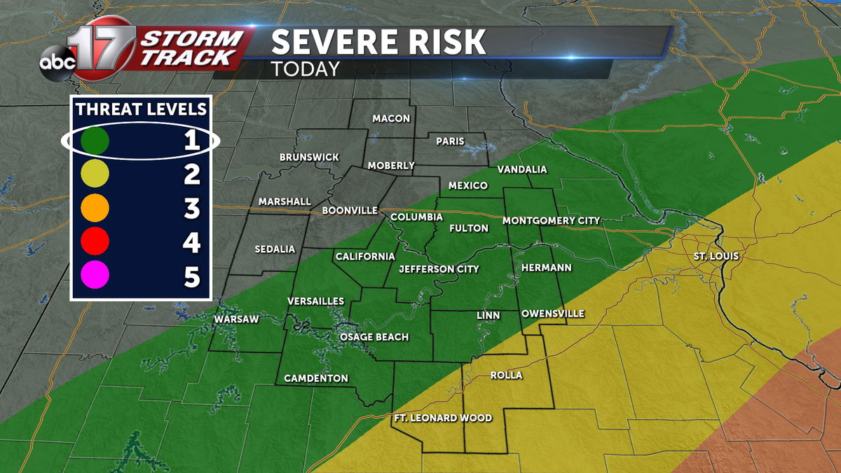
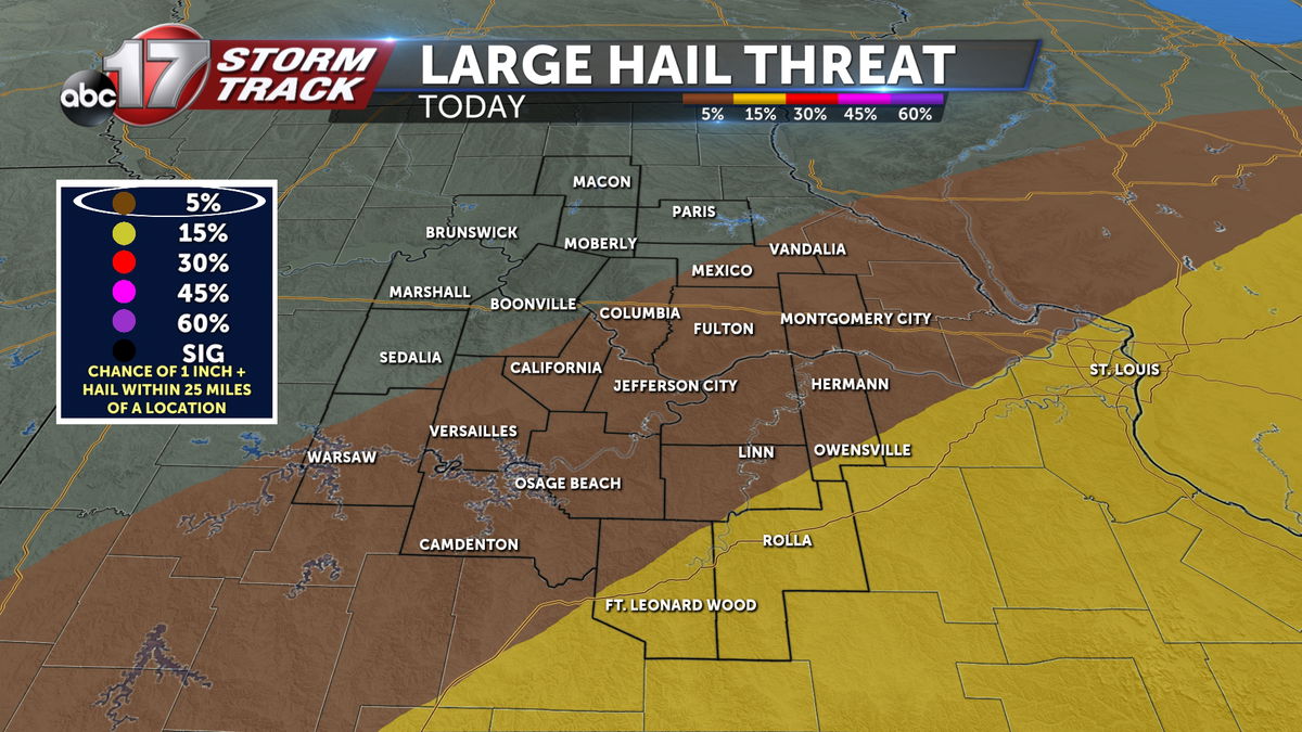
A few strong storms are possible on Friday afternoon and evening as the front could lift slightly farther north into Mid-Missouri, drawing in more instability along and south of the boundary. The main concern would be 1" hail with those elevated storms. A level 1 out of 5 severe weather risk is already outlining areas along and south of I-70 for this threat.
Significant river rises on major rivers in Mid-Missouri aren't expected, but smaller tributaries may see rises by the end of the weekend. The Moreau River near Jefferson City is expected to go into minor flood stage by Saturday.