WEATHER ALERT DAY: Strong winds beginning to ease Wednesday night
Strong winds have started to die down a bit as deep low pressure continues to work its way out of Mid-Missouri and track northeast into the Great Lakes region.
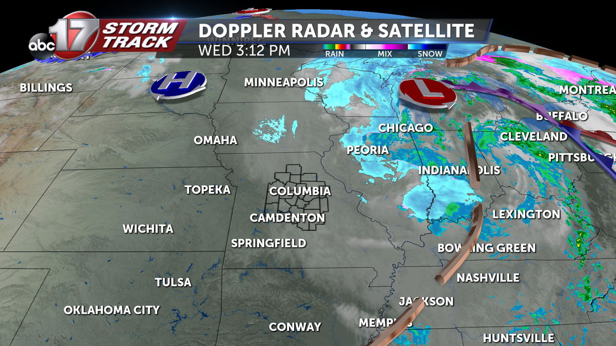
There were some slick spots on roads this morning after light snowfall accumulation, but road impacts aren't expected into the evening commute.
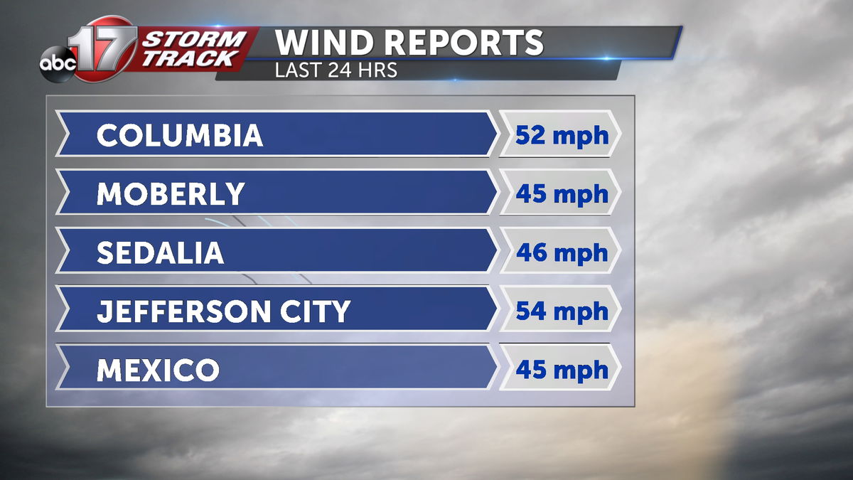
Winds gusted past 50 mph at the Columbia and Jefferson City airports early Wednesday, with power outages mainly confined to the Kansas City and St. Louis areas this evening.
TIMING:
This ABC17 Stormtrack Weather Alert Day lasts through 6 p.m. Wednesday.
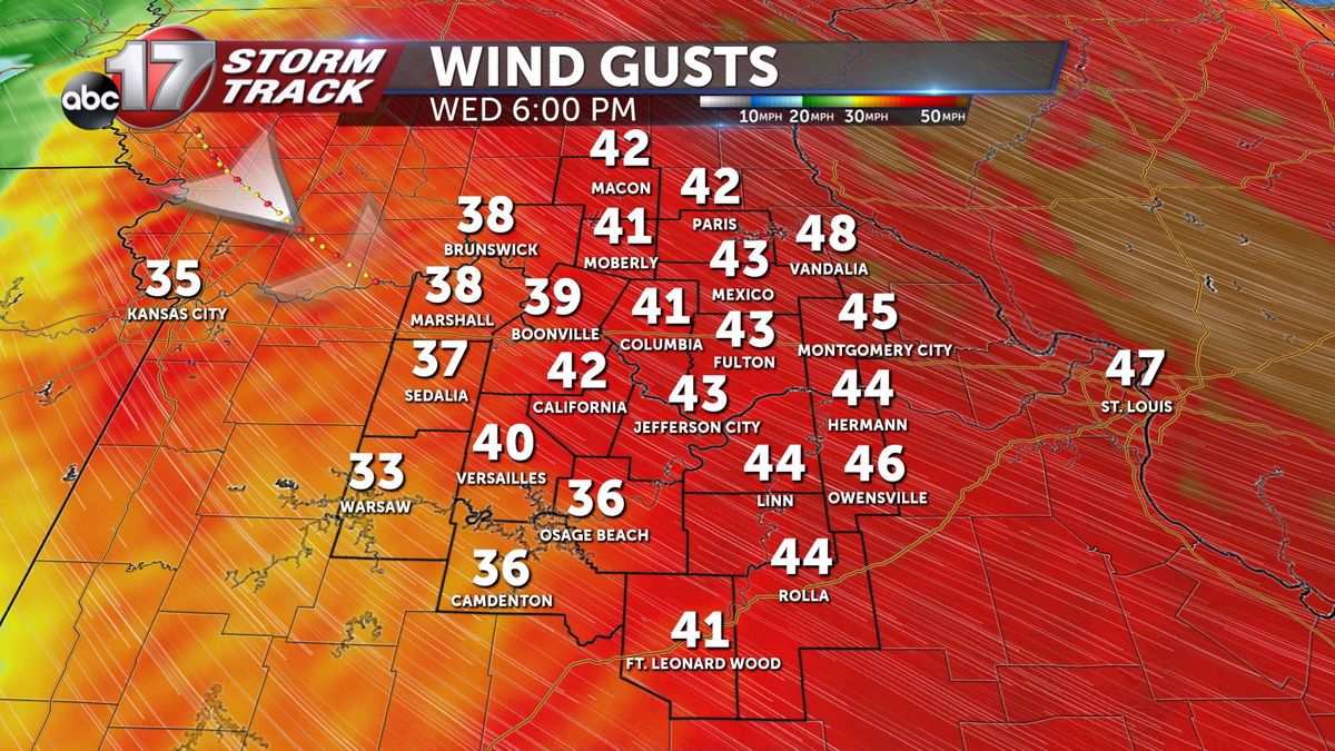
These will be non-thunderstorm winds, primarily driven by the pressure gradient of this intense low pressure system, so they will move at the speed of the low itself. Winds will be gusty all day, but will gradually weaken through the afternoon, leaving us with gusts falling to 30-40 mph after 6 p.m.
HAZARDS & IMPACTS:
These non-thunderstorm winds will potentially reach Severe Thunderstorm Warning criteria (58 mph) in short bursts. This is why we are issuing an ABC17 Stormtrack Weather Alert Day, as this is expected to create at least isolated damage to trees, power lines, and other structures.
Few have already reported gusts over severe criteria, locally. Near Malta Bend in Saline county, a mesonet station recorded a 58 mph gust. Several incidents of tree damage have also been reported. Downed trees and wires were reported on Kahrs road in Smithton. Power poles and tree branches were reported broken near Moberly. So far our highest reported snowfall total was near Thompson, in Audrain county.
